Property Record
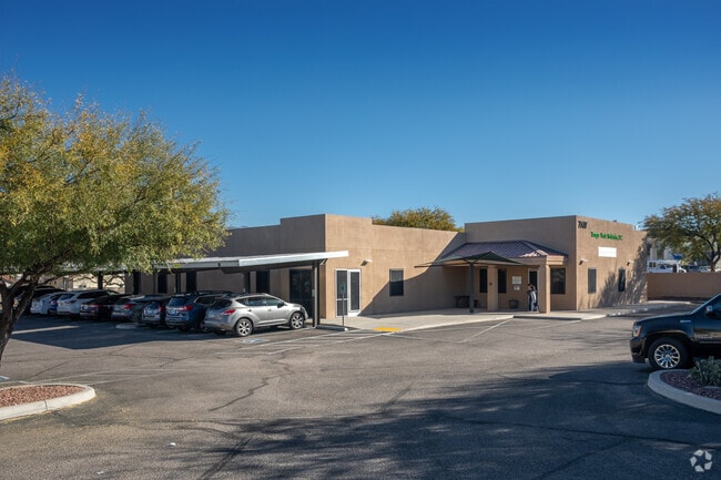
7507 E Tanque Verde Rd, Tucson, AZ 85715


Property Detail
7507 E Tanque Verde Rd
114-46-9500
BEST MAILING LISTS PHASE II BLOCK B
Medicalbuilding
Pima
O3
Arizona
B and X Area of moderate flood hazard, usually the area between the limits of the 100-year and 500-year floods.
220
2025
0.77 AC
2026
East Tucson
004031
Tucson
7,238 SF
Tucson, AZ
NEARBY LISTINGS FOR SALE OR LEASE
DEMOGRAPHICS near 7507 E Tanque Verde Rd
1 mile
3 mile
5 mile
2025 Total Population
10,236
86,011
227,609
2030 Population
10,419
88,099
232,715
Pop Growth 2025-2030
+ 1.79%
+ 2.43%
+ 2.24%
Average Age
46
45
43
2025 Total Households
5,062
42,119
104,642
HH Growth 2025-2030
+ 1.86%
+ 2.55%
+ 2.41%
Median Household Inc
$79,239
$65,138
$65,460
Avg Household Size
2.00
2.00
2.10
2025 Avg HH Vehicles
2.00
2.00
2.00
Median Home Value
$388,449
$361,719
$345,185
Median Year Built
1984
1978
1977
Nearby Places
Map Layers
Map Styles
 Street
 Aerial
Layers
 Traffic
 Biking
Places
Listings with unknown addresses are not visible on the map
- Restaurants
- Banks
- Shops
- Fitness
- Groceries
PUBLIC TRANSPORTATION
COMMUTER RAIL
Drive
Walk
Distance
21 min
9.7 mi
AIRPORT
Tucson International
Drive
Walk
Distance
Tucson International
27 min
15.0 mi
SALE & LEASE HISTORY
LISTING DATE
SALE/LEASE

Sep 23, 2016
For Sale
Dec 18, 2019
For Lease
Nearby Properties
Address
Land Use
TOTAL SIZE
Lot Size
Zoning
Address
Land Use
TOTAL SIZE
Lot Size
Zoning
1,089,840 SF
45.56 AC
Address
Land Use
TOTAL SIZE
Lot Size
Zoning
53,431 SF
9.98 AC
Address
Land Use
TOTAL SIZE
Lot Size
Zoning
684,356 SF
19.65 AC
PAD13
Address
Land Use
TOTAL SIZE
Lot Size
Zoning
96,125 SF
15.38 AC
SR
Address
Land Use
TOTAL SIZE
Lot Size
Zoning
473,573 SF
22.65 AC
C3
Address
Land Use
TOTAL SIZE
Lot Size
Zoning
308,730 SF
10.15 AC
Address
Land Use
TOTAL SIZE
Lot Size
Zoning
504,584 SF
18.17 AC
O3
Address
Land Use
TOTAL SIZE
Lot Size
Zoning
427,088 SF
19.78 AC
R3
Address
Land Use
TOTAL SIZE
Lot Size
Zoning
310,878 SF
29.30 AC
TR
Address
Land Use
TOTAL SIZE
Lot Size
Zoning
256,775 SF
6.69 AC
C1
Address
Land Use
TOTAL SIZE
Lot Size
Zoning
364,128 SF
11.55 AC
O3
Address
Land Use
TOTAL SIZE
Lot Size
Zoning
109,335 SF
7.83 AC
PAD13
Address
Land Use
TOTAL SIZE
Lot Size
Zoning
1,804 SF
8.29 AC
R3
Address
Land Use
TOTAL SIZE
Lot Size
Zoning
230,640 SF
11.99 AC
Address
Land Use
TOTAL SIZE
Lot Size
Zoning
276,903 SF
37.62 AC
RX1
Address
Land Use
TOTAL SIZE
Lot Size
Zoning
240,585 SF
18.16 AC
R2
Address
Land Use
TOTAL SIZE
Lot Size
Zoning
162,473 SF
6.08 AC
C3
Address
Land Use
TOTAL SIZE
Lot Size
Zoning
264,788 SF
12.63 AC
R3
Address
Land Use
TOTAL SIZE
Lot Size
Zoning
74,815 SF
5.05 AC
Address
Land Use
TOTAL SIZE
Lot Size
Zoning
162,630 SF
15.14 AC
Address
Land Use
TOTAL SIZE
Lot Size
Zoning
180,149 SF
17.48 AC
PAD3
Address
Land Use
TOTAL SIZE
Lot Size
Zoning
288,749 SF
21.55 AC
CR2
Address
Land Use
TOTAL SIZE
Lot Size
Zoning
286,164 SF
5.80 AC
C3
Address
Land Use
TOTAL SIZE
Lot Size
Zoning
238,953 SF
14.13 AC
CB1
Address
Land Use
TOTAL SIZE
Lot Size
Zoning
118,655 SF
8.74 AC
C1
Address
Land Use
TOTAL SIZE
Lot Size
Zoning
240,309 SF
14.71 AC
CB1
Address
Land Use
TOTAL SIZE
Lot Size
Zoning
268,026 SF
16 AC
R3
Address
Land Use
TOTAL SIZE
Lot Size
Zoning
160,678 SF
16.12 AC
Address
Land Use
TOTAL SIZE
Lot Size
Zoning
171,301 SF
6.36 AC
C3
Address
Land Use
TOTAL SIZE
Lot Size
Zoning
146,302 SF
27.52 AC
CR1
The World's #1 Commercial Real Estate Marketplace
Connect with us
© 2026 CoStar Group
The information above has been obtained from sources believed reliable. While we do not doubt its accuracy we have not verified it and make no guarantee, warranty or representation about it. It is your responsibility to independently confirm its accuracy and completeness. Any projections, opinions, assumptions, or estimates used are for example only and do not represent the current or future performance of the property. The value of this transaction to you depends on tax and other factors which should be evaluated by your tax, financial, and legal advisors. You and your advisors should conduct a careful, independent investigation of the property to determine to your satisfaction the suitability of the property for your needs.