Property Record
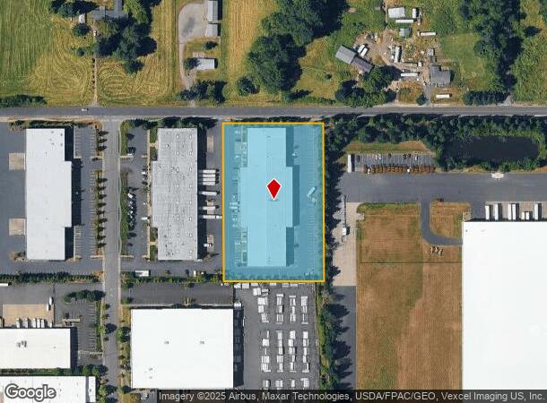
7509 S 5Th St, Ridgefield, WA 98642

NEARBY LISTINGS FOR SALE OR LEASE
-
-
View all Ridgefield listings for lease on LoopNet.com
Property Detail
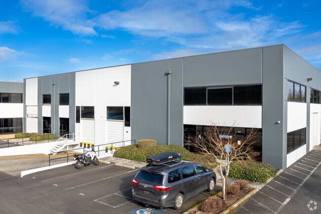
7509 S 5Th St
986027-521
Union Ridge Commerce Park Condo
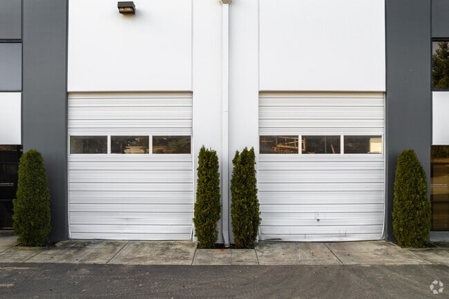
Warehouse
UNION RIDGE COMMERCE PARK 700096 UNIT 3 FOR ASSESSOR USE ONLY UNION RIDGE COMMERCE PARK 700096 UNIT 3
X
Clark
53015C1020G
Washington
2025
0.11 AC
2025
Clark County Outlying
040303
Portland
3,300 SF
Portland-Vancouver-Hillsboro, OR-WA
DEMOGRAPHICS near 7509 S 5Th St
1 Mile
3 Mile
5 Mile
2024 Total Population
1,517
16,924
35,766
2029 Population
1,714
19,009
39,378
Pop Growth 2024-2029
+ 12.99%
+ 12.32%
+ 10.10%
Average Age
43
39
41
2024 Total Households
515
5,679
12,345
HH Growth 2024-2029
+ 13.20%
+ 12.50%
+ 10.15%
Median Household Inc
$105,186
$104,069
$103,386
Avg Household Size
2.90
3.00
2.90
2024 Avg HH Vehicles
2.00
2.00
2.00
Median Home Value
$744,755
$623,143
$617,260
Median Year Built
2010
2010
2001
Nearby Places
Map Layers
Map Styles
 Street
 Aerial
- Restaurants
- Banks
- Shops
- Fitness
- Groceries
PUBLIC TRANSPORTATION
AIRPORT
Portland International
DRIVE
WALK
Distance
Portland International
32 min
22.8 mi
Freight Ports
Port of Vancouver
DRIVE
WALK
Distance
Port of Vancouver
24 min
15.9 mi
SALE & LEASE HISTORY
LISTING DATE
SALE/LEASE

Aug 31, 2017
For Lease
Apr 19, 2017
For Lease
Nearby Properties
Address
Land Use
TOTAL SIZE
Lot Size
Zoning
Address
Land Use
TOTAL SIZE
Lot Size
Zoning
741,237 SF
42.05 AC
E
Address
Land Use
TOTAL SIZE
Lot Size
Zoning
299,106 SF
16.63 AC
RMD-16
Address
Land Use
TOTAL SIZE
Lot Size
Zoning
665,040 SF
57.82 AC
E
Address
Land Use
TOTAL SIZE
Lot Size
Zoning
468,420 SF
38.81 AC
E
Address
Land Use
TOTAL SIZE
Lot Size
Zoning
145,300 SF
31.34 AC
PF
Address
Land Use
TOTAL SIZE
Lot Size
Zoning
99,600 SF
4.38 AC
CCB
Address
Land Use
TOTAL SIZE
Lot Size
Zoning
343,528 SF
32.10 AC
PF
Address
Land Use
TOTAL SIZE
Lot Size
Zoning
113,250 SF
20.40 AC
E
Address
Land Use
TOTAL SIZE
Lot Size
Zoning
153,436 SF
17.03 AC
CRB
Address
Land Use
TOTAL SIZE
Lot Size
Zoning
76,536 SF
2.64 AC
RMD-16
Address
Land Use
TOTAL SIZE
Lot Size
Zoning
117,494 SF
9.08 AC
E
Address
Land Use
TOTAL SIZE
Lot Size
Zoning
181,560 SF
9 AC
E
Address
Land Use
TOTAL SIZE
Lot Size
Zoning
170,500 SF
16.83 AC
E
Address
Land Use
TOTAL SIZE
Lot Size
Zoning
112,220 SF
6.44 AC
E
Address
Land Use
TOTAL SIZE
Lot Size
Zoning
108,939 SF
6.32 AC
E
Address
Land Use
TOTAL SIZE
Lot Size
Zoning
49,840 SF
9.76 AC
CRB
Address
Land Use
TOTAL SIZE
Lot Size
Zoning
141,500 SF
11.71 AC
E
Address
Land Use
TOTAL SIZE
Lot Size
Zoning
74,640 SF
11.40 AC
E
Address
Land Use
TOTAL SIZE
Lot Size
Zoning
77,620 SF
7.95 AC
E
Address
Land Use
TOTAL SIZE
Lot Size
Zoning
83,660 SF
5.72 AC
E
Address
Land Use
TOTAL SIZE
Lot Size
Zoning
129,977 SF
6.02 AC
E
Address
Land Use
TOTAL SIZE
Lot Size
Zoning
52,000 SF
5.67 AC
E
Address
Land Use
TOTAL SIZE
Lot Size
Zoning
37,500 SF
10.90 AC
E
Address
Land Use
TOTAL SIZE
Lot Size
Zoning
52,853 SF
4.55 AC
CCB
Address
Land Use
TOTAL SIZE
Lot Size
Zoning
52,937 SF
3.93 AC
E
Address
Land Use
TOTAL SIZE
Lot Size
Zoning
50,260 SF
3.38 AC
E
Address
Land Use
TOTAL SIZE
Lot Size
Zoning
71,200 SF
3.91 AC
E
Address
Land Use
TOTAL SIZE
Lot Size
Zoning
93,646 SF
5.09 AC
E
Address
Land Use
TOTAL SIZE
Lot Size
Zoning
53,059 SF
7.37 AC
E
The World's #1 Commercial Real Estate Marketplace
Connect with us
© 2025 CoStar Group
The information above has been obtained from sources believed reliable. While we do not doubt its accuracy we have not verified it and make no guarantee, warranty or representation about it. It is your responsibility to independently confirm its accuracy and completeness. Any projections, opinions, assumptions, or estimates used are for example only and do not represent the current or future performance of the property. The value of this transaction to you depends on tax and other factors which should be evaluated by your tax, financial, and legal advisors. You and your advisors should conduct a careful, independent investigation of the property to determine to your satisfaction the suitability of the property for your needs.