Property Record
750H Viaduct Rd, Chickasaw, AL 36611

Property Detail
750H Viaduct Rd
Mobile, AL
LOT 1 PORT OF CHICKASAW NORTH ADDITION MBK 125/50
22-09-44-0-006-006
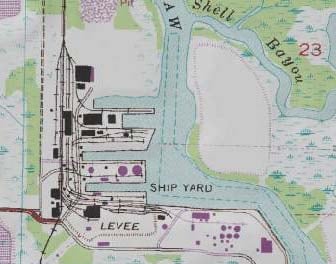
MOBILE
Officebuilding
Alabama
AE The base floodplain where base flood elevations are provided. AE Zones are now used on new format FIRMs instead of A1-A30 Zones.
1
2025
29.52 AC
2025
Northeast Mobile
003800
Mobile
816 SF
NEARBY LISTINGS FOR SALE OR LEASE
DEMOGRAPHICS near 750H Viaduct Rd
1 mile
3 mile
5 mile
2025 Total Population
346
17,628
53,293
2030 Population
354
17,983
54,321
Pop Growth 2025-2030
+ 2.31%
+ 2.01%
+ 1.93%
Average Age
42
40
41
2025 Total Households
146
6,978
21,066
HH Growth 2025-2030
+ 2.05%
+ 2.08%
+ 2.00%
Median Household Inc
$38,571
$33,992
$36,944
Avg Household Size
2.40
2.40
2.40
2025 Avg HH Vehicles
1.00
2.00
2.00
Median Home Value
$154,545
$90,278
$94,615
Median Year Built
1961
1965
1967
Nearby Places
Map Layers
Map Styles
 Street
 Aerial
Transit
 Traffic
 Biking
Places
Listings with unknown addresses are not visible on the map
- Restaurants
- Banks
- Shops
- Fitness
- Groceries
PUBLIC TRANSPORTATION
AIRPORT
Mobile International
Drive
Walk
Distance
Mobile International
24 min
12.4 mi
Mobile Regional
Drive
Walk
Distance
Mobile Regional
36 min
18.0 mi
Freight Ports
Port of Mobile
Drive
Walk
Distance
Port of Mobile
14 min
7.2 mi
SALE & LEASE HISTORY
LISTING DATE
SALE/LEASE

Sep 25, 2016
For Lease
Jul 19, 2023
For Lease
Nearby Properties
Address
Land Use
TOTAL SIZE
Lot Size
Zoning
Address
Land Use
TOTAL SIZE
Lot Size
Zoning
9,100 SF
34.07 AC
Address
Land Use
TOTAL SIZE
Lot Size
Zoning
602,638 SF
85.74 AC
Address
Land Use
TOTAL SIZE
Lot Size
Zoning
153,780 SF
Address
Land Use
TOTAL SIZE
Lot Size
Zoning
200,370 SF
47.96 AC
Address
Land Use
TOTAL SIZE
Lot Size
Zoning
7,505 SF
27.76 AC
Address
Land Use
TOTAL SIZE
Lot Size
Zoning
187,257 SF
33.10 AC
Address
Land Use
TOTAL SIZE
Lot Size
Zoning
5,000 SF
13.33 AC
Address
Land Use
TOTAL SIZE
Lot Size
Zoning
21,700 SF
6.98 AC
Address
Land Use
TOTAL SIZE
Lot Size
Zoning
197,471 SF
15.90 AC
Address
Land Use
TOTAL SIZE
Lot Size
Zoning
5,553 SF
40.77 AC
Address
Land Use
TOTAL SIZE
Lot Size
Zoning
97,443 SF
98.83 AC
Address
Land Use
TOTAL SIZE
Lot Size
Zoning
131,516 SF
15 AC
Address
Land Use
TOTAL SIZE
Lot Size
Zoning
262,071 SF
32.03 AC
Address
Land Use
TOTAL SIZE
Lot Size
Zoning
3,188 SF
10.16 AC
Address
Land Use
TOTAL SIZE
Lot Size
Zoning
294,193 SF
7.06 AC
Address
Land Use
TOTAL SIZE
Lot Size
Zoning
18,818 SF
6.21 AC
Address
Land Use
TOTAL SIZE
Lot Size
Zoning
66,025 SF
9.70 AC
Address
Land Use
TOTAL SIZE
Lot Size
Zoning
128,250 SF
13.83 AC
Address
Land Use
TOTAL SIZE
Lot Size
Zoning
143,623 SF
11.94 AC
Address
Land Use
TOTAL SIZE
Lot Size
Zoning
101,578 SF
32 AC
Address
Land Use
TOTAL SIZE
Lot Size
Zoning
58,789 SF
17 AC
Address
Land Use
TOTAL SIZE
Lot Size
Zoning
5,384 SF
18 AC
Address
Land Use
TOTAL SIZE
Lot Size
Zoning
107,965 SF
8.14 AC
Address
Land Use
TOTAL SIZE
Lot Size
Zoning
58,624 SF
8.30 AC
Address
Land Use
TOTAL SIZE
Lot Size
Zoning
122,776 SF
14.32 AC
Address
Land Use
TOTAL SIZE
Lot Size
Zoning
31,420 SF
3.54 AC
Address
Land Use
TOTAL SIZE
Lot Size
Zoning
200,000 SF
Address
Land Use
TOTAL SIZE
Lot Size
Zoning
200,472 SF
9.18 AC
Address
Land Use
TOTAL SIZE
Lot Size
Zoning
59,400 SF
16.72 AC
Address
Land Use
TOTAL SIZE
Lot Size
Zoning
47,998 SF
11 AC
The World's #1 Commercial Real Estate Marketplace
Connect with us
© 2026 CoStar Group
The information above has been obtained from sources believed reliable. While we do not doubt its accuracy we have not verified it and make no guarantee, warranty or representation about it. It is your responsibility to independently confirm its accuracy and completeness. Any projections, opinions, assumptions, or estimates used are for example only and do not represent the current or future performance of the property. The value of this transaction to you depends on tax and other factors which should be evaluated by your tax, financial, and legal advisors. You and your advisors should conduct a careful, independent investigation of the property to determine to your satisfaction the suitability of the property for your needs.