Property Record
751 E Main St, Waconia, MN 55387


Save to a Folder
{{folder.Name}}
{{folder.ListingIds.length}} Properties
{{folder.ListingIds.length}} Property
Create a New Folder
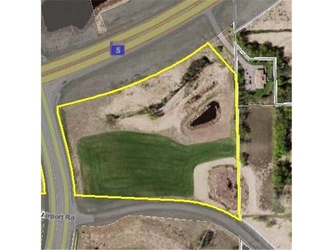
Property Detail
751 E Main St
Minneapolis-St. Paul-Bloomington, MN-WI
TRACT 1. THAT PART OF THE SOUTHWEST QUARTER OF THE NORTHEAST QUARTER AND THE NORTHWEST QUA
75.0242900
CARVER
Marshland
Minnesota
B and X Area of moderate flood hazard, usually the area between the limits of the 100-year and 500-year floods.
25.38 AC
0
Carver County Outlying
2026
Minneapolis/St Paul
090302
NEARBY LISTINGS FOR SALE OR LEASE
DEMOGRAPHICS near 751 E Main St
1 mile
3 mile
5 mile
2025 Total Population
4,609
15,933
26,394
2030 Population
4,830
16,732
27,484
Pop Growth 2025-2030
+ 4.79%
+ 5.01%
+ 4.13%
Average Age
40
40
39
2025 Total Households
1,691
5,701
9,139
HH Growth 2025-2030
+ 4.97%
+ 5.30%
+ 4.38%
Median Household Inc
$95,929
$120,702
$132,248
Avg Household Size
2.70
2.70
2.80
2025 Avg HH Vehicles
2.00
2.00
2.00
Median Home Value
$437,123
$448,346
$465,198
Median Year Built
1993
2000
2001
Nearby Places
Map Layers
Map Styles
 Street
 Aerial
Layers
 Traffic
 Biking
Places
Listings with unknown addresses are not visible on the map
- Restaurants
- Banks
- Shops
- Fitness
- Groceries
PUBLIC TRANSPORTATION
AIRPORT
Minneapolis-St Paul International/Wold-Chamberlain
Drive
Walk
Distance
Minneapolis-St Paul International/Wold-Chamberlain
45 min
30.4 mi
Freight Ports
Port Milwaukee
Drive
Walk
Distance
Port Milwaukee
413 min
367.5 mi
SALE & LEASE HISTORY
LISTING DATE
SALE/LEASE

Sep 24, 2016
For Sale
May 28, 2021
For Sale
Mar 22, 2019
For Sale
Nearby Properties
Address
Land Use
TOTAL SIZE
Lot Size
Zoning
Address
Land Use
TOTAL SIZE
Lot Size
Zoning
218,348 SF
12.89 AC
Address
Land Use
TOTAL SIZE
Lot Size
Zoning
50,530 SF
14.99 AC
Address
Land Use
TOTAL SIZE
Lot Size
Zoning
200,083 SF
58.28 AC
Address
Land Use
TOTAL SIZE
Lot Size
Zoning
10.72 AC
Address
Land Use
TOTAL SIZE
Lot Size
Zoning
23,645 SF
0.62 AC
Address
Land Use
TOTAL SIZE
Lot Size
Zoning
55,559 SF
55.16 AC
Address
Land Use
TOTAL SIZE
Lot Size
Zoning
7.68 AC
Address
Land Use
TOTAL SIZE
Lot Size
Zoning
10.79 AC
Address
Land Use
TOTAL SIZE
Lot Size
Zoning
62,580 SF
10.19 AC
Address
Land Use
TOTAL SIZE
Lot Size
Zoning
24,051 SF
4.17 AC
Address
Land Use
TOTAL SIZE
Lot Size
Zoning
16,876 SF
2.30 AC
Address
Land Use
TOTAL SIZE
Lot Size
Zoning
6,392 SF
8.52 AC
Address
Land Use
TOTAL SIZE
Lot Size
Zoning
4.09 AC
Address
Land Use
TOTAL SIZE
Lot Size
Zoning
16,598 SF
1.90 AC
Address
Land Use
TOTAL SIZE
Lot Size
Zoning
20,513 SF
1.26 AC
Address
Land Use
TOTAL SIZE
Lot Size
Zoning
38,376 SF
1.61 AC
Address
Land Use
TOTAL SIZE
Lot Size
Zoning
7,599 SF
0.78 AC
Address
Land Use
TOTAL SIZE
Lot Size
Zoning
132,018 SF
17.38 AC
Address
Land Use
TOTAL SIZE
Lot Size
Zoning
3.13 AC
Address
Land Use
TOTAL SIZE
Lot Size
Zoning
77,895 SF
11.45 AC
Address
Land Use
TOTAL SIZE
Lot Size
Zoning
41,970 SF
3.67 AC
Address
Land Use
TOTAL SIZE
Lot Size
Zoning
40,410 SF
3.82 AC
Address
Land Use
TOTAL SIZE
Lot Size
Zoning
16.62 AC
Address
Land Use
TOTAL SIZE
Lot Size
Zoning
2.68 AC
Address
Land Use
TOTAL SIZE
Lot Size
Zoning
9,450 SF
4.44 AC
Address
Land Use
TOTAL SIZE
Lot Size
Zoning
5.29 AC
Address
Land Use
TOTAL SIZE
Lot Size
Zoning
20,336 SF
3.43 AC
Address
Land Use
TOTAL SIZE
Lot Size
Zoning
10,188 SF
4.48 AC
Address
Land Use
TOTAL SIZE
Lot Size
Zoning
4.38 AC
Address
Land Use
TOTAL SIZE
Lot Size
Zoning
73,840 SF
3.85 AC
The World's #1 Commercial Real Estate Marketplace
Connect with us
© 2026 CoStar Group
The information above has been obtained from sources believed reliable. While we do not doubt its accuracy we have not verified it and make no guarantee, warranty or representation about it. It is your responsibility to independently confirm its accuracy and completeness. Any projections, opinions, assumptions, or estimates used are for example only and do not represent the current or future performance of the property. The value of this transaction to you depends on tax and other factors which should be evaluated by your tax, financial, and legal advisors. You and your advisors should conduct a careful, independent investigation of the property to determine to your satisfaction the suitability of the property for your needs.