Property Record
751 Lemoyne Rd, Northwood, OH 43619


NEARBY LISTINGS FOR SALE OR LEASE
Property Detail
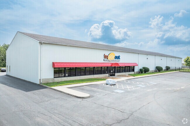
751 Lemoyne Rd
M50-812-340323020001
S379.09 N1626.78 W574.53 WSW
Storebuilding
Wood
X
Ohio
39173C0051D
5 AC
2023
Perrysburg/Northwood
2024
Toledo
020100
Toledo, OH
31,300 SF
DEMOGRAPHICS near 751 Lemoyne Rd
1 Mile
3 Mile
5 Mile
2024 Total Population
2,048
28,699
82,064
2029 Population
2,078
28,496
82,350
Pop Growth 2024-2029
+ 1.46%
(0.71%)
+ 0.35%
Average Age
43
42
39
2024 Total Households
822
12,134
34,207
HH Growth 2024-2029
+ 1.46%
(0.73%)
+ 0.27%
Median Household Inc
$69,970
$55,545
$45,648
Avg Household Size
2.40
2.30
2.30
2024 Avg HH Vehicles
2.00
2.00
2.00
Median Home Value
$169,942
$146,273
$124,404
Median Year Built
1974
1964
1959
Nearby Places
Map Layers
Map Styles
 Street
 Aerial
- Restaurants
- Banks
- Shops
- Fitness
- Groceries
PUBLIC TRANSPORTATION
COMMUTER RAIL
DRIVE
WALK
Distance
11 min
6.0 mi
AIRPORT
Eugene F Kranz Toledo Express
DRIVE
WALK
Distance
Eugene F Kranz Toledo Express
44 min
25.1 mi
Freight Ports
DRIVE
WALK
Distance
16 min
6.8 mi
Nearby Properties
Address
Land Use
TOTAL SIZE
Lot Size
Zoning
Address
Land Use
TOTAL SIZE
Lot Size
Zoning
605,609 SF
9.66 AC
40-C4
Address
Land Use
TOTAL SIZE
Lot Size
Zoning
313,004 SF
44.54 AC
40-C2
Address
Land Use
TOTAL SIZE
Lot Size
Zoning
136,090 SF
4 AC
Address
Land Use
TOTAL SIZE
Lot Size
Zoning
127,658 SF
9.01 AC
40-C4
Address
Land Use
TOTAL SIZE
Lot Size
Zoning
73,802 SF
22.50 AC
40-R1
Address
Land Use
TOTAL SIZE
Lot Size
Zoning
214,312 SF
35.35 AC
40-C5
Address
Land Use
TOTAL SIZE
Lot Size
Zoning
349,799 SF
51.86 AC
Address
Land Use
TOTAL SIZE
Lot Size
Zoning
102,535 SF
20 AC
40-R2
Address
Land Use
TOTAL SIZE
Lot Size
Zoning
228,251 SF
43.08 AC
10-RD6
Address
Land Use
TOTAL SIZE
Lot Size
Zoning
100,531 SF
3.07 AC
Address
Land Use
TOTAL SIZE
Lot Size
Zoning
34 AC
40-C5
Address
Land Use
TOTAL SIZE
Lot Size
Zoning
230,074 SF
142.89 AC
40-M2
Address
Land Use
TOTAL SIZE
Lot Size
Zoning
181,347 SF
14.12 AC
40-R4
Address
Land Use
TOTAL SIZE
Lot Size
Zoning
65,683 SF
5.02 AC
10-MX
Address
Land Use
TOTAL SIZE
Lot Size
Zoning
117,094 SF
28.04 AC
40-R2
Address
Land Use
TOTAL SIZE
Lot Size
Zoning
331,416 SF
30.56 AC
Address
Land Use
TOTAL SIZE
Lot Size
Zoning
199,768 SF
16.15 AC
40-C2
Address
Land Use
TOTAL SIZE
Lot Size
Zoning
77,079 SF
3.87 AC
40-R3
Address
Land Use
TOTAL SIZE
Lot Size
Zoning
229,500 SF
9.97 AC
Address
Land Use
TOTAL SIZE
Lot Size
Zoning
91,261 SF
5.47 AC
40-C2
Address
Land Use
TOTAL SIZE
Lot Size
Zoning
180,900 SF
5 AC
Address
Land Use
TOTAL SIZE
Lot Size
Zoning
106,525 SF
18.90 AC
Address
Land Use
TOTAL SIZE
Lot Size
Zoning
58,281 SF
2.60 AC
40-C2
Address
Land Use
TOTAL SIZE
Lot Size
Zoning
46,267 SF
3.22 AC
40-R3
Address
Land Use
TOTAL SIZE
Lot Size
Zoning
124,380 SF
9.39 AC
Address
Land Use
TOTAL SIZE
Lot Size
Zoning
69,259 SF
13.65 AC
40-R2
Address
Land Use
TOTAL SIZE
Lot Size
Zoning
44.33 AC
40-C2
Address
Land Use
TOTAL SIZE
Lot Size
Zoning
93,191 SF
11.13 AC
40-C4
Address
Land Use
TOTAL SIZE
Lot Size
Zoning
104,012 SF
7.14 AC
40-R3
Address
Land Use
TOTAL SIZE
Lot Size
Zoning
66,701 SF
4 AC
40-R3
The World's #1 Commercial Real Estate Marketplace
Connect with us
© 2026 CoStar Group
The information above has been obtained from sources believed reliable. While we do not doubt its accuracy we have not verified it and make no guarantee, warranty or representation about it. It is your responsibility to independently confirm its accuracy and completeness. Any projections, opinions, assumptions, or estimates used are for example only and do not represent the current or future performance of the property. The value of this transaction to you depends on tax and other factors which should be evaluated by your tax, financial, and legal advisors. You and your advisors should conduct a careful, independent investigation of the property to determine to your satisfaction the suitability of the property for your needs.