Property Record
751 Madrone Rd, Glen Ellen, CA 95442

Property Detail
751 Madrone Rd
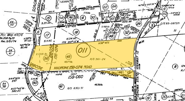
056-011-056
98 FM 056-011-055 & PT RD OR 97075508
Winery
SONOMA
AE The base floodplain where base flood elevations are provided. AE Zones are now used on new format FIRMs instead of A1-A30 Zones.
California
2025
13.81 AC
2025
Sonoma/Wine Country
150502
North Bay/Santa Rosa
10,324 SF
Santa Rosa-Petaluma, CA
NEARBY LISTINGS FOR SALE OR LEASE
-
-
View all Glen Ellen listings for sale on LoopNet.com
DEMOGRAPHICS near 751 Madrone Rd
1 mile
3 mile
5 mile
2025 Total Population
1,484
17,048
31,805
2030 Population
1,440
16,921
31,786
Pop Growth 2025-2030
(2.96%)
(0.74%)
(0.06%)
Average Age
45
43
46
2025 Total Households
599
6,503
13,311
HH Growth 2025-2030
(3.01%)
(0.88%)
(0.02%)
Median Household Inc
$110,169
$110,304
$110,355
Avg Household Size
2.40
2.50
2.30
2025 Avg HH Vehicles
2.00
2.00
2.00
Median Home Value
$906,397
$825,461
$887,005
Median Year Built
1974
1976
1976
Nearby Places
Map Layers
Map Styles
 Street
 Aerial
Layers
 Traffic
 Biking
Places
Listings with unknown addresses are not visible on the map
- Restaurants
- Banks
- Shops
- Fitness
- Groceries
PUBLIC TRANSPORTATION
AIRPORT
Charles M Schulz - Sonoma County
Drive
Walk
Distance
Charles M Schulz - Sonoma County
40 min
25.3 mi
Freight Ports
Port of Richmond
Drive
Walk
Distance
Port of Richmond
62 min
42.2 mi
Nearby Properties
Address
Land Use
TOTAL SIZE
Lot Size
Zoning
Address
Land Use
TOTAL SIZE
Lot Size
Zoning
54,592 SF
6 AC
K
Address
Land Use
TOTAL SIZE
Lot Size
Zoning
7,886 SF
1.70 AC
R11UA
Address
Land Use
TOTAL SIZE
Lot Size
Zoning
19,818 SF
22.19 AC
Address
Land Use
TOTAL SIZE
Lot Size
Zoning
11,605 SF
183.62 AC
Address
Land Use
TOTAL SIZE
Lot Size
Zoning
2,944 SF
64.66 AC
Address
Land Use
TOTAL SIZE
Lot Size
Zoning
36,530 SF
0.51 AC
Address
Land Use
TOTAL SIZE
Lot Size
Zoning
189,112 SF
5.87 AC
R320UA
Address
Land Use
TOTAL SIZE
Lot Size
Zoning
2,652 SF
120.17 AC
LIA100
Address
Land Use
TOTAL SIZE
Lot Size
Zoning
8,232 SF
2.02 AC
R11UA
Address
Land Use
TOTAL SIZE
Lot Size
Zoning
88,048 SF
5 AC
Address
Land Use
TOTAL SIZE
Lot Size
Zoning
1,166 SF
89.68 AC
Address
Land Use
TOTAL SIZE
Lot Size
Zoning
10,510 SF
19.56 AC
Address
Land Use
TOTAL SIZE
Lot Size
Zoning
5,958 SF
73.62 AC
RRD100
Address
Land Use
TOTAL SIZE
Lot Size
Zoning
13,020 SF
80.12 AC
DA60
Address
Land Use
TOTAL SIZE
Lot Size
Zoning
3,014 SF
64.85 AC
Address
Land Use
TOTAL SIZE
Lot Size
Zoning
4,518 SF
47.95 AC
Address
Land Use
TOTAL SIZE
Lot Size
Zoning
2,062 SF
103.71 AC
DA40
Address
Land Use
TOTAL SIZE
Lot Size
Zoning
5,070 SF
11.86 AC
Address
Land Use
TOTAL SIZE
Lot Size
Zoning
4,800 SF
112.33 AC
Address
Land Use
TOTAL SIZE
Lot Size
Zoning
7,972 SF
25.52 AC
Address
Land Use
TOTAL SIZE
Lot Size
Zoning
3,428 SF
0.76 AC
Address
Land Use
TOTAL SIZE
Lot Size
Zoning
23,800 SF
2.74 AC
Address
Land Use
TOTAL SIZE
Lot Size
Zoning
4,141 SF
36.74 AC
DA20
Address
Land Use
TOTAL SIZE
Lot Size
Zoning
6,837 SF
40 AC
LIA100
Address
Land Use
TOTAL SIZE
Lot Size
Zoning
6,687 SF
20 AC
Address
Land Use
TOTAL SIZE
Lot Size
Zoning
17,136 SF
2 AC
R14UA
Address
Land Use
TOTAL SIZE
Lot Size
Zoning
125.94 AC
LIAB7FRZN
Address
Land Use
TOTAL SIZE
Lot Size
Zoning
9,635 SF
144.53 AC
SP
Address
Land Use
TOTAL SIZE
Lot Size
Zoning
11,369 SF
6.70 AC
The World's #1 Commercial Real Estate Marketplace
Connect with us
© 2026 CoStar Group
The information above has been obtained from sources believed reliable. While we do not doubt its accuracy we have not verified it and make no guarantee, warranty or representation about it. It is your responsibility to independently confirm its accuracy and completeness. Any projections, opinions, assumptions, or estimates used are for example only and do not represent the current or future performance of the property. The value of this transaction to you depends on tax and other factors which should be evaluated by your tax, financial, and legal advisors. You and your advisors should conduct a careful, independent investigation of the property to determine to your satisfaction the suitability of the property for your needs.