Property Record
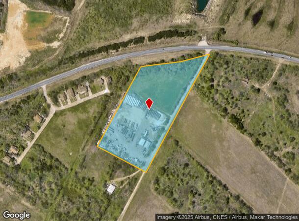
7511 Dee Gabriel Collins Rd, Austin, TX 78744


NEARBY LISTINGS FOR SALE OR LEASE
Property Detail
7511 Dee Gabriel Collins Rd
Austin-Round Rock-San Marcos, TX
Collins Walter Place
297373
LOT 1 * LESS N .005AC COLLINS WALTER PLACE
Farms
Travis
X
Texas
48453C0612K
1
2024
6.66 AC
2025
Southeast
002413
Austin
DEMOGRAPHICS near 7511 Dee Gabriel Collins Rd
1 Mile
3 Mile
5 Mile
2024 Total Population
891
39,934
172,205
2029 Population
969
43,541
187,775
Pop Growth 2024-2029
+ 8.75%
+ 9.03%
+ 9.04%
Average Age
35
35
34
2024 Total Households
330
12,488
67,317
HH Growth 2024-2029
+ 9.39%
+ 9.91%
+ 9.93%
Median Household Inc
$139,329
$77,329
$61,195
Avg Household Size
2.70
3.10
2.40
2024 Avg HH Vehicles
2.00
2.00
2.00
Median Home Value
$463,235
$265,584
$299,983
Median Year Built
2011
2004
1999
Nearby Places
Map Layers
Map Styles
 Street
 Aerial
- Restaurants
- Banks
- Shops
- Fitness
- Groceries
PUBLIC TRANSPORTATION
AIRPORT
Austin-Bergstrom International
DRIVE
WALK
Distance
Austin-Bergstrom International
15 min
6.0 mi
SALE & LEASE HISTORY
LISTING DATE
SALE/LEASE

Sep 15, 2023
For Lease
Nearby Properties
Address
Land Use
TOTAL SIZE
Lot Size
Zoning
Address
Land Use
TOTAL SIZE
Lot Size
Zoning
942.08 AC
Address
Land Use
TOTAL SIZE
Lot Size
Zoning
454,740 SF
27.77 AC
Address
Land Use
TOTAL SIZE
Lot Size
Zoning
255,483 SF
35 AC
Address
Land Use
TOTAL SIZE
Lot Size
Zoning
335,913 SF
13.83 AC
Address
Land Use
TOTAL SIZE
Lot Size
Zoning
390,384 SF
34.08 AC
Address
Land Use
TOTAL SIZE
Lot Size
Zoning
287,925 SF
9.92 AC
Address
Land Use
TOTAL SIZE
Lot Size
Zoning
288,174 SF
18.91 AC
Address
Land Use
TOTAL SIZE
Lot Size
Zoning
262,576 SF
15.68 AC
Address
Land Use
TOTAL SIZE
Lot Size
Zoning
422,500 SF
30.52 AC
Address
Land Use
TOTAL SIZE
Lot Size
Zoning
323,360 SF
20.93 AC
Address
Land Use
TOTAL SIZE
Lot Size
Zoning
368,244 SF
93.34 AC
Address
Land Use
TOTAL SIZE
Lot Size
Zoning
353,770 SF
23.97 AC
Address
Land Use
TOTAL SIZE
Lot Size
Zoning
326,400 SF
26.12 AC
Address
Land Use
TOTAL SIZE
Lot Size
Zoning
345,600 SF
49.73 AC
Address
Land Use
TOTAL SIZE
Lot Size
Zoning
350,171 SF
26.64 AC
Address
Land Use
TOTAL SIZE
Lot Size
Zoning
351,255 SF
12.45 AC
Address
Land Use
TOTAL SIZE
Lot Size
Zoning
257,600 SF
26.83 AC
Address
Land Use
TOTAL SIZE
Lot Size
Zoning
237,600 SF
17.79 AC
Address
Land Use
TOTAL SIZE
Lot Size
Zoning
249,216 SF
20.19 AC
Address
Land Use
TOTAL SIZE
Lot Size
Zoning
166,770 SF
13.51 AC
Address
Land Use
TOTAL SIZE
Lot Size
Zoning
267,300 SF
17.53 AC
Address
Land Use
TOTAL SIZE
Lot Size
Zoning
172,800 SF
22.82 AC
Address
Land Use
TOTAL SIZE
Lot Size
Zoning
264,765 SF
23.37 AC
Address
Land Use
TOTAL SIZE
Lot Size
Zoning
177,375 SF
26.20 AC
Address
Land Use
TOTAL SIZE
Lot Size
Zoning
267,024 SF
25.97 AC
Address
Land Use
TOTAL SIZE
Lot Size
Zoning
167,500 SF
14.03 AC
Address
Land Use
TOTAL SIZE
Lot Size
Zoning
392,710 SF
97 AC
Address
Land Use
TOTAL SIZE
Lot Size
Zoning
204,741 SF
18.90 AC
Address
Land Use
TOTAL SIZE
Lot Size
Zoning
229,997 SF
18.63 AC
Address
Land Use
TOTAL SIZE
Lot Size
Zoning
206,299 SF
12.19 AC
The World's #1 Commercial Real Estate Marketplace
Connect with us
© 2026 CoStar Group
The information above has been obtained from sources believed reliable. While we do not doubt its accuracy we have not verified it and make no guarantee, warranty or representation about it. It is your responsibility to independently confirm its accuracy and completeness. Any projections, opinions, assumptions, or estimates used are for example only and do not represent the current or future performance of the property. The value of this transaction to you depends on tax and other factors which should be evaluated by your tax, financial, and legal advisors. You and your advisors should conduct a careful, independent investigation of the property to determine to your satisfaction the suitability of the property for your needs.