Property Record
7515 Wynlea St, Houston, TX 77061

NEARBY LISTINGS FOR SALE OR LEASE
Property Detail
7515 Wynlea St
0402390000068
Abst 27 J R Harris
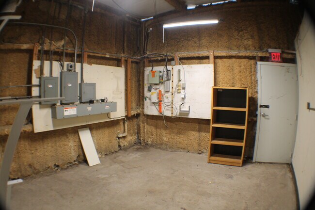
Warehouse
TRS 29E & 29E-1 ABST 27 J R HARRIS
X
Harris
48201C0895N
Texas
2024
0.54 AC
2025
South Hwy 35
333501
Houston
9,870 SF
Houston-Pasadena-The Woodlands, TX
DEMOGRAPHICS near 7515 Wynlea St
1 Mile
3 Mile
5 Mile
2024 Total Population
14,663
105,010
315,178
2029 Population
15,187
108,023
323,960
Pop Growth 2024-2029
+ 3.57%
+ 2.87%
+ 2.79%
Average Age
35
36
36
2024 Total Households
5,459
34,743
103,798
HH Growth 2024-2029
+ 3.74%
+ 2.91%
+ 2.84%
Median Household Inc
$34,999
$42,954
$44,583
Avg Household Size
2.60
2.90
2.90
2024 Avg HH Vehicles
2.00
2.00
2.00
Median Home Value
$180,619
$147,119
$147,553
Median Year Built
1972
1969
1969
Nearby Places
Map Layers
Map Styles
 Street
 Aerial
- Restaurants
- Banks
- Shops
- Fitness
- Groceries
PUBLIC TRANSPORTATION
AIRPORT
William P Hobby
DRIVE
WALK
Distance
William P Hobby
10 min
3.2 mi
George Bush Intcntl/Houston
DRIVE
WALK
Distance
George Bush Intcntl/Houston
40 min
30.2 mi
Freight Ports
Port of Houston
DRIVE
WALK
Distance
Port of Houston
16 min
7.8 mi
SALE & LEASE HISTORY
LISTING DATE
SALE/LEASE

Jun 09, 2018
For Lease
Apr 08, 2024
For Lease
Nearby Properties
Address
Land Use
TOTAL SIZE
Lot Size
Zoning
Address
Land Use
TOTAL SIZE
Lot Size
Zoning
403,242 SF
46.18 AC
Address
Land Use
TOTAL SIZE
Lot Size
Zoning
690,590 SF
31.88 AC
Address
Land Use
TOTAL SIZE
Lot Size
Zoning
389,108 SF
37.39 AC
Address
Land Use
TOTAL SIZE
Lot Size
Zoning
556,568 SF
20 AC
Address
Land Use
TOTAL SIZE
Lot Size
Zoning
260,972 SF
23.45 AC
Address
Land Use
TOTAL SIZE
Lot Size
Zoning
188,110 SF
2.22 AC
Address
Land Use
TOTAL SIZE
Lot Size
Zoning
196,000 SF
29.42 AC
Address
Land Use
TOTAL SIZE
Lot Size
Zoning
239,458 SF
15.57 AC
Address
Land Use
TOTAL SIZE
Lot Size
Zoning
210,476 SF
9.60 AC
Address
Land Use
TOTAL SIZE
Lot Size
Zoning
291,181 SF
11.07 AC
Address
Land Use
TOTAL SIZE
Lot Size
Zoning
391,576 SF
19.94 AC
Address
Land Use
TOTAL SIZE
Lot Size
Zoning
308,748 SF
11.34 AC
Address
Land Use
TOTAL SIZE
Lot Size
Zoning
353,676 SF
19.86 AC
Address
Land Use
TOTAL SIZE
Lot Size
Zoning
284,290 SF
20 AC
Address
Land Use
TOTAL SIZE
Lot Size
Zoning
433,760 SF
52.70 AC
Address
Land Use
TOTAL SIZE
Lot Size
Zoning
113,688 SF
4 AC
Address
Land Use
TOTAL SIZE
Lot Size
Zoning
164,515 SF
Address
Land Use
TOTAL SIZE
Lot Size
Zoning
257,481 SF
9.28 AC
Address
Land Use
TOTAL SIZE
Lot Size
Zoning
228,900 SF
3.85 AC
Address
Land Use
TOTAL SIZE
Lot Size
Zoning
152,276 SF
6.83 AC
Address
Land Use
TOTAL SIZE
Lot Size
Zoning
165,880 SF
19.20 AC
Address
Land Use
TOTAL SIZE
Lot Size
Zoning
244,134 SF
9.44 AC
Address
Land Use
TOTAL SIZE
Lot Size
Zoning
85,323 SF
37.81 AC
Address
Land Use
TOTAL SIZE
Lot Size
Zoning
235,982 SF
9.19 AC
Address
Land Use
TOTAL SIZE
Lot Size
Zoning
418,210 SF
21.42 AC
Address
Land Use
TOTAL SIZE
Lot Size
Zoning
241,219 SF
8.92 AC
Address
Land Use
TOTAL SIZE
Lot Size
Zoning
155,657 SF
3.59 AC
Address
Land Use
TOTAL SIZE
Lot Size
Zoning
71,340 SF
47.16 AC
Address
Land Use
TOTAL SIZE
Lot Size
Zoning
215,004 SF
7.76 AC
Address
Land Use
TOTAL SIZE
Lot Size
Zoning
213,064 SF
7.29 AC
The World's #1 Commercial Real Estate Marketplace
Connect with us
© 2026 CoStar Group
The information above has been obtained from sources believed reliable. While we do not doubt its accuracy we have not verified it and make no guarantee, warranty or representation about it. It is your responsibility to independently confirm its accuracy and completeness. Any projections, opinions, assumptions, or estimates used are for example only and do not represent the current or future performance of the property. The value of this transaction to you depends on tax and other factors which should be evaluated by your tax, financial, and legal advisors. You and your advisors should conduct a careful, independent investigation of the property to determine to your satisfaction the suitability of the property for your needs.