Property Record
7516 Yukon Dr, Bismarck, ND 58503


NEARBY LISTINGS FOR SALE OR LEASE
-
-
View all Bismarck listings for sale on LoopNet.com
Property Detail
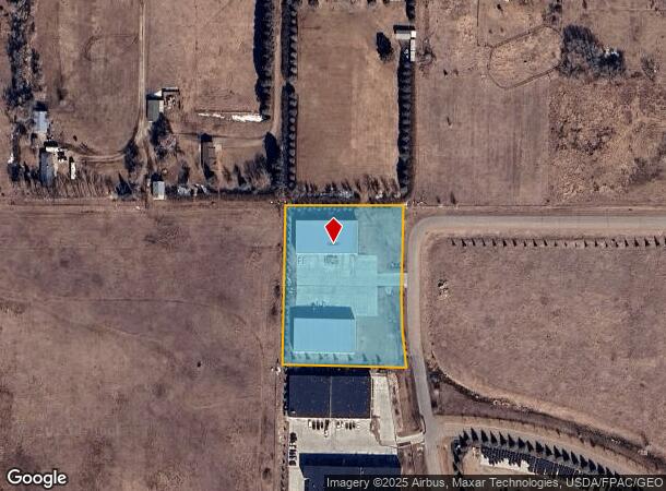
7516 Yukon Dr
Bismarck, ND
State Street Office Park
31-139-80-0Y-02-030
TWN: 139 RNG: 80 SUB: 31139800Y BLK: 02 STATE STREET OFFICE PARK BLOCK 02 LOT 3 665490
Realpropertynec
Burleigh
X
North Dakota
38015C0595E
3-66549
2024
2.63 AC
2024
Bismarck
011105
Other Market Areas
12,000 SF
DEMOGRAPHICS near 7516 Yukon Dr
1 Mile
3 Mile
5 Mile
2024 Total Population
597
15,380
51,527
2029 Population
616
15,886
53,158
Pop Growth 2024-2029
+ 3.18%
+ 3.29%
+ 3.17%
Average Age
36
39
41
2024 Total Households
186
5,756
21,118
HH Growth 2024-2029
+ 3.23%
+ 3.27%
+ 3.14%
Median Household Inc
$131,707
$99,907
$77,204
Avg Household Size
3.00
2.60
2.40
2024 Avg HH Vehicles
3.00
2.00
2.00
Median Home Value
$385,134
$363,773
$300,086
Median Year Built
2007
2010
1996
Nearby Places
Map Layers
Map Styles
 Street
 Aerial
- Restaurants
- Banks
- Shops
- Fitness
- Groceries
PUBLIC TRANSPORTATION
AIRPORT
Bismarck Municipal
DRIVE
WALK
Distance
Bismarck Municipal
24 min
10.4 mi
Freight Ports
Port Milwaukee
DRIVE
WALK
Distance
Port Milwaukee
827 min
767.6 mi
Nearby Properties
Address
Land Use
TOTAL SIZE
Lot Size
Zoning
Address
Land Use
TOTAL SIZE
Lot Size
Zoning
28.06 AC
CG
Address
Land Use
TOTAL SIZE
Lot Size
Zoning
27.48 AC
CG
Address
Land Use
TOTAL SIZE
Lot Size
Zoning
31,202 SF
9.05 AC
RM30
Address
Land Use
TOTAL SIZE
Lot Size
Zoning
20.87 AC
CG
Address
Land Use
TOTAL SIZE
Lot Size
Zoning
65,001 SF
9.88 AC
RT
Address
Land Use
TOTAL SIZE
Lot Size
Zoning
38,275 SF
10.53 AC
RM30
Address
Land Use
TOTAL SIZE
Lot Size
Zoning
39,771 SF
9.65 AC
CG
Address
Land Use
TOTAL SIZE
Lot Size
Zoning
27,639 SF
4.28 AC
RT
Address
Land Use
TOTAL SIZE
Lot Size
Zoning
7.83 AC
RM20
Address
Land Use
TOTAL SIZE
Lot Size
Zoning
74,564 SF
6.67 AC
RT
Address
Land Use
TOTAL SIZE
Lot Size
Zoning
8,685 SF
12.51 AC
CG
Address
Land Use
TOTAL SIZE
Lot Size
Zoning
40,647 SF
2.67 AC
PUD
Address
Land Use
TOTAL SIZE
Lot Size
Zoning
25,831 SF
17.10 AC
CG
Address
Land Use
TOTAL SIZE
Lot Size
Zoning
3.90 AC
RM30
Address
Land Use
TOTAL SIZE
Lot Size
Zoning
7,560 SF
4.39 AC
PUD
Address
Land Use
TOTAL SIZE
Lot Size
Zoning
27,639 SF
4.28 AC
RT
Address
Land Use
TOTAL SIZE
Lot Size
Zoning
60,510 SF
7.48 AC
CG
Address
Land Use
TOTAL SIZE
Lot Size
Zoning
40,280 SF
4.17 AC
CG
Address
Land Use
TOTAL SIZE
Lot Size
Zoning
5,658 SF
7.28 AC
CG
Address
Land Use
TOTAL SIZE
Lot Size
Zoning
10,920 SF
19.88 AC
Address
Land Use
TOTAL SIZE
Lot Size
Zoning
10,788 SF
14.22 AC
CG
Address
Land Use
TOTAL SIZE
Lot Size
Zoning
23,227 SF
12 AC
Address
Land Use
TOTAL SIZE
Lot Size
Zoning
30,816 SF
3.19 AC
CA
Address
Land Use
TOTAL SIZE
Lot Size
Zoning
54,000 SF
4.14 AC
CG
Address
Land Use
TOTAL SIZE
Lot Size
Zoning
53.35 AC
RMH
Address
Land Use
TOTAL SIZE
Lot Size
Zoning
98,471 SF
5.02 AC
RM15
Address
Land Use
TOTAL SIZE
Lot Size
Zoning
53.47 AC
RMH
Address
Land Use
TOTAL SIZE
Lot Size
Zoning
69,470 SF
4.79 AC
CG
Address
Land Use
TOTAL SIZE
Lot Size
Zoning
10,500 SF
9.14 AC
Address
Land Use
TOTAL SIZE
Lot Size
Zoning
30,384 SF
2 AC
CG
The World's #1 Commercial Real Estate Marketplace
Connect with us
© 2025 CoStar Group
The information above has been obtained from sources believed reliable. While we do not doubt its accuracy we have not verified it and make no guarantee, warranty or representation about it. It is your responsibility to independently confirm its accuracy and completeness. Any projections, opinions, assumptions, or estimates used are for example only and do not represent the current or future performance of the property. The value of this transaction to you depends on tax and other factors which should be evaluated by your tax, financial, and legal advisors. You and your advisors should conduct a careful, independent investigation of the property to determine to your satisfaction the suitability of the property for your needs.