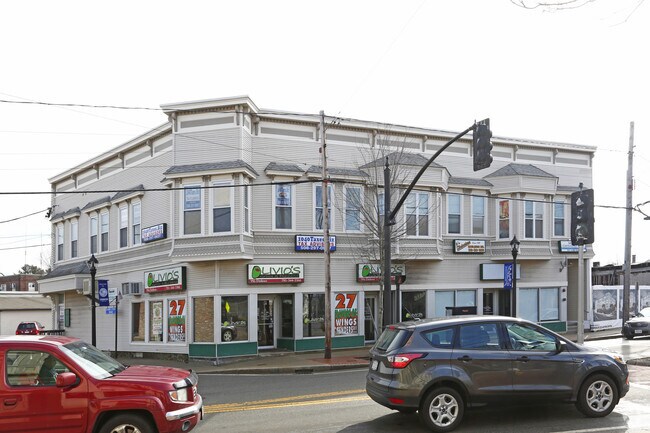
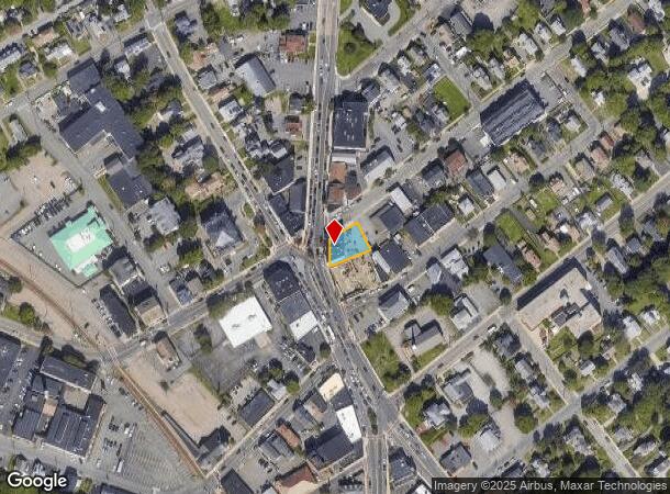
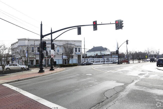
Property Record
752 Washington St, Stoughton, MA 02072
NEARBY LISTINGS FOR SALE OR LEASE
Property Detail
752 Washington St
STOU-000054-000284
Tall Oaks Drive
Storebuilding
Norfolk
X
Massachusetts
25021C0213F
0.17 AC
2025
Route 24
2025
Boston
456102
Boston-Cambridge-Newton, MA-NH
6,389 SF
DEMOGRAPHICS near 752 Washington St
1 Mile
3 Mile
5 Mile
2024 Total Population
11,325
48,245
157,564
2029 Population
11,168
47,819
155,993
Pop Growth 2024-2029
(1.39%)
(0.88%)
(1.00%)
Average Age
41
42
41
2024 Total Households
4,294
18,687
57,186
HH Growth 2024-2029
(1.49%)
(0.95%)
(1.02%)
Median Household Inc
$87,802
$98,208
$95,235
Avg Household Size
2.60
2.50
2.60
2024 Avg HH Vehicles
2.00
2.00
2.00
Median Home Value
$430,432
$477,426
$470,297
Median Year Built
1959
1970
1965
Nearby Places
Map Layers
Map Styles
 Street
 Aerial
- Restaurants
- Banks
- Shops
- Fitness
- Groceries
PUBLIC TRANSPORTATION
TRANSIT/SUBWAY
Stoughton (Providence/Stoughton Line - Massachusetts Bay Transportation Authority Commuter Rail (Purple Line))
DRIVE
WALK
Distance
Stoughton (Providence/Stoughton Line - Massachusetts Bay Transportation Authority Commuter Rail (Purple Line))
1 min
4 min
0.2 mi
COMMUTER RAIL
Stoughton (Providence/Stoughton Line - Massachusetts Bay Transportation Authority Commuter Rail (Purple Line))
DRIVE
WALK
Distance
Stoughton (Providence/Stoughton Line - Massachusetts Bay Transportation Authority Commuter Rail (Purple Line))
1 min
4 min
0.2 mi
Canton Center (Providence/Stoughton Line - Massachusetts Bay Transportation Authority Commuter Rail (Purple Line))
DRIVE
WALK
Distance
Canton Center (Providence/Stoughton Line - Massachusetts Bay Transportation Authority Commuter Rail (Purple Line))
8 min
3.8 mi
AIRPORT
General Edward Lawrence Logan International
DRIVE
WALK
Distance
General Edward Lawrence Logan International
35 min
19.9 mi
Rhode Island Tf Green International
DRIVE
WALK
Distance
Rhode Island Tf Green International
62 min
39.8 mi
Freight Ports
Port of Boston
DRIVE
WALK
Distance
Port of Boston
33 min
17.8 mi
SALE & LEASE HISTORY
LISTING DATE
SALE/LEASE

Sep 25, 2016
For Lease
Aug 15, 2017
For Lease
Aug 15, 2017
For Lease
Nearby Properties
Address
Land Use
TOTAL SIZE
Lot Size
Zoning
Address
Land Use
TOTAL SIZE
Lot Size
Zoning
1,292 SF
36.06 AC
C5
Address
Land Use
TOTAL SIZE
Lot Size
Zoning
543,189 SF
22.90 AC
6
Address
Land Use
TOTAL SIZE
Lot Size
Zoning
403,163 SF
24.58 AC
I
Address
Land Use
TOTAL SIZE
Lot Size
Zoning
417,014 SF
10 AC
6
Address
Land Use
TOTAL SIZE
Lot Size
Zoning
56,088 SF
23.94 AC
I
Address
Land Use
TOTAL SIZE
Lot Size
Zoning
214,600 SF
20.30 AC
RU
Address
Land Use
TOTAL SIZE
Lot Size
Zoning
7.27 AC
GB
Address
Land Use
TOTAL SIZE
Lot Size
Zoning
12.24 AC
I
Address
Land Use
TOTAL SIZE
Lot Size
Zoning
70,216 SF
6.86 AC
7
Address
Land Use
TOTAL SIZE
Lot Size
Zoning
298,820 SF
19.65 AC
6
Address
Land Use
TOTAL SIZE
Lot Size
Zoning
34.45 AC
HB
Address
Land Use
TOTAL SIZE
Lot Size
Zoning
289,562 SF
13.59 AC
Address
Land Use
TOTAL SIZE
Lot Size
Zoning
253,912 SF
10.33 AC
R3
Address
Land Use
TOTAL SIZE
Lot Size
Zoning
133,125 SF
16.13 AC
7
Address
Land Use
TOTAL SIZE
Lot Size
Zoning
128,760 SF
19.51 AC
6
Address
Land Use
TOTAL SIZE
Lot Size
Zoning
285,036 SF
20.45 AC
R3
Address
Land Use
TOTAL SIZE
Lot Size
Zoning
94,356 SF
10 AC
6
Address
Land Use
TOTAL SIZE
Lot Size
Zoning
121,424 SF
11.11 AC
HB
Address
Land Use
TOTAL SIZE
Lot Size
Zoning
130,080 SF
2.82 AC
R3
Address
Land Use
TOTAL SIZE
Lot Size
Zoning
133,108 SF
4.48 AC
R3
Address
Land Use
TOTAL SIZE
Lot Size
Zoning
93,330 SF
13.90 AC
6
Address
Land Use
TOTAL SIZE
Lot Size
Zoning
102,480 SF
12.30 AC
6
Address
Land Use
TOTAL SIZE
Lot Size
Zoning
168,224 SF
11.83 AC
6
Address
Land Use
TOTAL SIZE
Lot Size
Zoning
190,000 SF
11.42 AC
Address
Land Use
TOTAL SIZE
Lot Size
Zoning
87,655 SF
3.39 AC
GB
Address
Land Use
TOTAL SIZE
Lot Size
Zoning
118,207 SF
10.90 AC
NB
Address
Land Use
TOTAL SIZE
Lot Size
Zoning
109,800 SF
12.60 AC
6
Address
Land Use
TOTAL SIZE
Lot Size
Zoning
101,098 SF
6.50 AC
6
Address
Land Use
TOTAL SIZE
Lot Size
Zoning
80,315 SF
9.31 AC
6
Address
Land Use
TOTAL SIZE
Lot Size
Zoning
126,035 SF
2.71 AC
R3
The World's #1 Commercial Real Estate Marketplace
Connect with us
© 2025 CoStar Group
The information above has been obtained from sources believed reliable. While we do not doubt its accuracy we have not verified it and make no guarantee, warranty or representation about it. It is your responsibility to independently confirm its accuracy and completeness. Any projections, opinions, assumptions, or estimates used are for example only and do not represent the current or future performance of the property. The value of this transaction to you depends on tax and other factors which should be evaluated by your tax, financial, and legal advisors. You and your advisors should conduct a careful, independent investigation of the property to determine to your satisfaction the suitability of the property for your needs.