Property Record
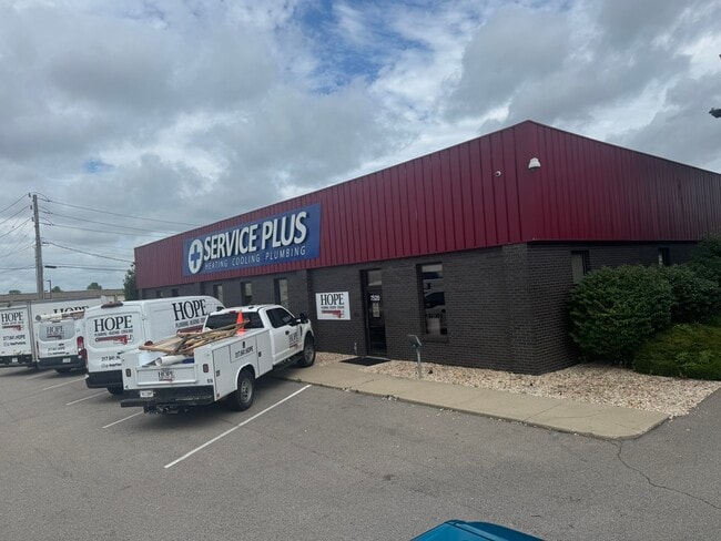
7520 E 88Th Pl, Indianapolis, IN 46256


Current Lease Availabilities
Property Detail
7520 E 88Th Pl
49-02-14-111-003.000-400
NE1/4 SE1/4 S14 T17 R4 BEG 1086.75FT S & 651FT WOF NE COR W 57FT NW 223FT NW 119.71FT NE 138.30FTE 140.62FT S 397.2FT TO BEG 1.097AC
Industrialgeneral
Marion
ZO01
Indiana
B and X Area of moderate flood hazard, usually the area between the limits of the 100-year and 500-year floods.
1.10 AC
2024
Castleton
2025
Indianapolis
330103
Indianapolis-Carmel-Greenwood, IN
7,120 SF
NEARBY LISTINGS FOR SALE OR LEASE
DEMOGRAPHICS near 7520 E 88Th Pl
1 mile
3 mile
5 mile
2025 Total Population
5,925
57,837
157,323
2030 Population
5,934
59,504
162,053
Pop Growth 2025-2030
+ 0.15%
+ 2.88%
+ 3.01%
Average Age
41
40
40
2025 Total Households
3,070
26,545
66,527
HH Growth 2025-2030
+ 0.23%
+ 2.83%
+ 2.97%
Median Household Inc
$63,135
$82,015
$97,164
Avg Household Size
1.80
2.10
2.30
2025 Avg HH Vehicles
1.00
2.00
2.00
Median Home Value
$240,761
$316,539
$359,829
Median Year Built
1985
1988
1989
Nearby Places
Map Layers
Map Styles
 Street
 Aerial
Layers
 Traffic
 Biking
Places
Listings with unknown addresses are not visible on the map
- Restaurants
- Banks
- Shops
- Fitness
- Groceries
PUBLIC TRANSPORTATION
AIRPORT
Indianapolis International
Drive
Walk
Distance
Indianapolis International
48 min
28.2 mi
Nearby Properties
Address
Land Use
TOTAL SIZE
Lot Size
Zoning
Address
Land Use
TOTAL SIZE
Lot Size
Zoning
366,825 SF
26.60 AC
ZO01
Address
Land Use
TOTAL SIZE
Lot Size
Zoning
16,704 SF
109.83 AC
ZO01
Address
Land Use
TOTAL SIZE
Lot Size
Zoning
8,551 SF
45.92 AC
ZO01
Address
Land Use
TOTAL SIZE
Lot Size
Zoning
22,081 SF
27.39 AC
ZO01
Address
Land Use
TOTAL SIZE
Lot Size
Zoning
4,246 SF
89.83 AC
ZO01
Address
Land Use
TOTAL SIZE
Lot Size
Zoning
683,795 SF
25.53 AC
Address
Land Use
TOTAL SIZE
Lot Size
Zoning
10,911 SF
11.56 AC
ZO01
Address
Land Use
TOTAL SIZE
Lot Size
Zoning
21,742 SF
39.35 AC
ZO01
Address
Land Use
TOTAL SIZE
Lot Size
Zoning
426,839 SF
97.65 AC
Address
Land Use
TOTAL SIZE
Lot Size
Zoning
555,234 SF
36.07 AC
Address
Land Use
TOTAL SIZE
Lot Size
Zoning
325,194 SF
8.07 AC
Address
Land Use
TOTAL SIZE
Lot Size
Zoning
372,138 SF
20.71 AC
Address
Land Use
TOTAL SIZE
Lot Size
Zoning
328,241 SF
91.83 AC
Address
Land Use
TOTAL SIZE
Lot Size
Zoning
5,314 SF
13.92 AC
ZO01
Address
Land Use
TOTAL SIZE
Lot Size
Zoning
363,408 SF
30.78 AC
Address
Land Use
TOTAL SIZE
Lot Size
Zoning
6,229 SF
36.20 AC
ZO01
Address
Land Use
TOTAL SIZE
Lot Size
Zoning
6,252 SF
52.04 AC
ZO01
Address
Land Use
TOTAL SIZE
Lot Size
Zoning
125.31 AC
Address
Land Use
TOTAL SIZE
Lot Size
Zoning
3,053 SF
10.33 AC
ZO01
Address
Land Use
TOTAL SIZE
Lot Size
Zoning
178,991 SF
0.90 AC
Address
Land Use
TOTAL SIZE
Lot Size
Zoning
6,366 SF
19.32 AC
ZO01
Address
Land Use
TOTAL SIZE
Lot Size
Zoning
24,192 SF
5.93 AC
Address
Land Use
TOTAL SIZE
Lot Size
Zoning
140,987 SF
14 AC
Address
Land Use
TOTAL SIZE
Lot Size
Zoning
308,854 SF
13.64 AC
Address
Land Use
TOTAL SIZE
Lot Size
Zoning
289,664 SF
35.22 AC
Address
Land Use
TOTAL SIZE
Lot Size
Zoning
229,633 SF
78.75 AC
Address
Land Use
TOTAL SIZE
Lot Size
Zoning
91,717 SF
37.30 AC
Address
Land Use
TOTAL SIZE
Lot Size
Zoning
23,452 SF
14.94 AC
ZO01
Address
Land Use
TOTAL SIZE
Lot Size
Zoning
151,823 SF
57.55 AC
ZO01
Address
Land Use
TOTAL SIZE
Lot Size
Zoning
167,734 SF
3.69 AC
The World's #1 Commercial Real Estate Marketplace
Connect with us
© 2026 CoStar Group
The information above has been obtained from sources believed reliable. While we do not doubt its accuracy we have not verified it and make no guarantee, warranty or representation about it. It is your responsibility to independently confirm its accuracy and completeness. Any projections, opinions, assumptions, or estimates used are for example only and do not represent the current or future performance of the property. The value of this transaction to you depends on tax and other factors which should be evaluated by your tax, financial, and legal advisors. You and your advisors should conduct a careful, independent investigation of the property to determine to your satisfaction the suitability of the property for your needs.