Property Record
7520 Standish Pl, Derwood, MD 20855
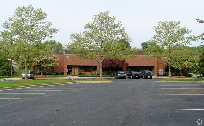
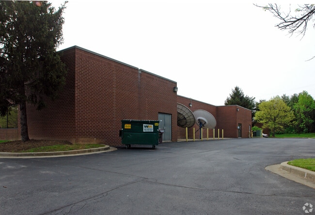

Property Detail
7520 Standish Pl
04-02415162
LU 2 METRO PARK LAN
Privatepreserveopenspacevacantlandforestlandconservation
Montgomery
IM2.5
Maryland
B and X Area of moderate flood hazard, usually the area between the limits of the 100-year and 500-year floods.
5.07 AC
2025
North Rockville
2025
Washington, DC
701211
Washington-Arlington-Alexandria, DC-VA-MD-WV
111,643 SF
NEARBY LISTINGS FOR SALE OR LEASE
DEMOGRAPHICS near 7520 Standish Pl
1 mile
3 mile
5 mile
2025 Total Population
11,239
104,654
323,582
2030 Population
11,407
108,160
333,266
Pop Growth 2025-2030
+ 1.49%
+ 3.35%
+ 2.99%
Average Age
41
41
41
2025 Total Households
4,296
40,321
121,262
HH Growth 2025-2030
+ 1.37%
+ 3.44%
+ 3.06%
Median Household Inc
$110,914
$119,700
$119,057
Avg Household Size
2.60
2.50
2.60
2025 Avg HH Vehicles
2.00
2.00
2.00
Median Home Value
$643,199
$654,324
$642,752
Median Year Built
1987
1984
1983
Nearby Places
Map Layers
Map Styles
 Street
 Aerial
Layers
 Traffic
 Biking
Places
Listings with unknown addresses are not visible on the map
- Restaurants
- Banks
- Shops
- Fitness
- Groceries
PUBLIC TRANSPORTATION
COMMUTER RAIL
Rockville (BRUNSWICK - WASHINGTON - Maryland Area Regional Commuter Trains (The MARC), Brunswick Line - Maryland Area Regional Commuter Trains (The MARC))
Drive
Walk
Distance
Rockville (BRUNSWICK - WASHINGTON - Maryland Area Regional Commuter Trains (The MARC), Brunswick Line - Maryland Area Regional Commuter Trains (The MARC))
6 min
2.6 mi
Washington Grove Marc Eb (BRUNSWICK - WASHINGTON - Maryland Transit Administration)
Drive
Walk
Distance
Washington Grove Marc Eb (BRUNSWICK - WASHINGTON - Maryland Transit Administration)
7 min
2.9 mi
AIRPORT
Ronald Reagan Washington Ntl
Drive
Walk
Distance
Ronald Reagan Washington Ntl
44 min
24.2 mi
Washington Dulles International
Drive
Walk
Distance
Washington Dulles International
49 min
30.5 mi
Baltimore/Washington International Thurgood Marshall
Drive
Walk
Distance
Baltimore/Washington International Thurgood Marshall
51 min
37.0 mi
Freight Ports
Port of Baltimore
Drive
Walk
Distance
Port of Baltimore
55 min
39.8 mi
Nearby Properties
Address
Land Use
TOTAL SIZE
Lot Size
Zoning
Address
Land Use
TOTAL SIZE
Lot Size
Zoning
987,382 SF
5 AC
MXTD
Address
Land Use
TOTAL SIZE
Lot Size
Zoning
635,057 SF
28.09 AC
CRT0.
Address
Land Use
TOTAL SIZE
Lot Size
Zoning
713,627 SF
38.49 AC
LSC1.
Address
Land Use
TOTAL SIZE
Lot Size
Zoning
1,136,684 SF
84.61 AC
R200
Address
Land Use
TOTAL SIZE
Lot Size
Zoning
668,337 SF
10.39 AC
LSC1.
Address
Land Use
TOTAL SIZE
Lot Size
Zoning
533,012 SF
18.08 AC
LSC1.
Address
Land Use
TOTAL SIZE
Lot Size
Zoning
488,864 SF
18.17 AC
CRT0.
Address
Land Use
TOTAL SIZE
Lot Size
Zoning
978,527 SF
11.54 AC
03
Address
Land Use
TOTAL SIZE
Lot Size
Zoning
693,823 SF
5.30 AC
CR2.0
Address
Land Use
TOTAL SIZE
Lot Size
Zoning
431,178 SF
40.97 AC
RA
Address
Land Use
TOTAL SIZE
Lot Size
Zoning
461,295 SF
45.71 AC
LSC2.
Address
Land Use
TOTAL SIZE
Lot Size
Zoning
450,000 SF
8.53 AC
MXD
Address
Land Use
TOTAL SIZE
Lot Size
Zoning
298,300 SF
7.69 AC
CR1.0
Address
Land Use
TOTAL SIZE
Lot Size
Zoning
353,867 SF
RS
Address
Land Use
TOTAL SIZE
Lot Size
Zoning
185,000 SF
2.60 AC
EOF
Address
Land Use
TOTAL SIZE
Lot Size
Zoning
633,793 SF
31.03 AC
RE
Address
Land Use
TOTAL SIZE
Lot Size
Zoning
434,440 SF
5.09 AC
CR1.5
Address
Land Use
TOTAL SIZE
Lot Size
Zoning
407,130 SF
4.62 AC
CRT1.
Address
Land Use
TOTAL SIZE
Lot Size
Zoning
363,750 SF
21.16 AC
R60
Address
Land Use
TOTAL SIZE
Lot Size
Zoning
370,422 SF
13.87 AC
CRT1.
Address
Land Use
TOTAL SIZE
Lot Size
Zoning
302,484 SF
4.99 AC
MXD
Address
Land Use
TOTAL SIZE
Lot Size
Zoning
85,381 SF
5.86 AC
MXD
Address
Land Use
TOTAL SIZE
Lot Size
Zoning
315,000 SF
4.70 AC
CR1.5
Address
Land Use
TOTAL SIZE
Lot Size
Zoning
363,000 SF
4.37 AC
MXTD
Address
Land Use
TOTAL SIZE
Lot Size
Zoning
899,156 SF
6.05 AC
CD
Address
Land Use
TOTAL SIZE
Lot Size
Zoning
1.64 AC
MXD
Address
Land Use
TOTAL SIZE
Lot Size
Zoning
405,742 SF
14.48 AC
R30
Address
Land Use
TOTAL SIZE
Lot Size
Zoning
243,000 SF
2.10 AC
PD-KS
Address
Land Use
TOTAL SIZE
Lot Size
Zoning
170,689 SF
9.98 AC
LSC1.
Address
Land Use
TOTAL SIZE
Lot Size
Zoning
385,641 SF
2.65 AC
MXD
The World's #1 Commercial Real Estate Marketplace
Connect with us
© 2026 CoStar Group
The information above has been obtained from sources believed reliable. While we do not doubt its accuracy we have not verified it and make no guarantee, warranty or representation about it. It is your responsibility to independently confirm its accuracy and completeness. Any projections, opinions, assumptions, or estimates used are for example only and do not represent the current or future performance of the property. The value of this transaction to you depends on tax and other factors which should be evaluated by your tax, financial, and legal advisors. You and your advisors should conduct a careful, independent investigation of the property to determine to your satisfaction the suitability of the property for your needs.