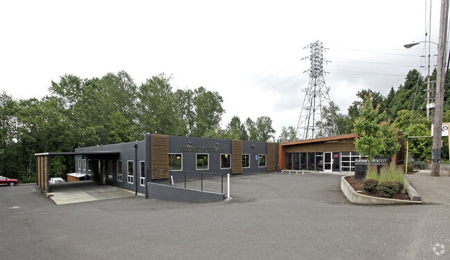
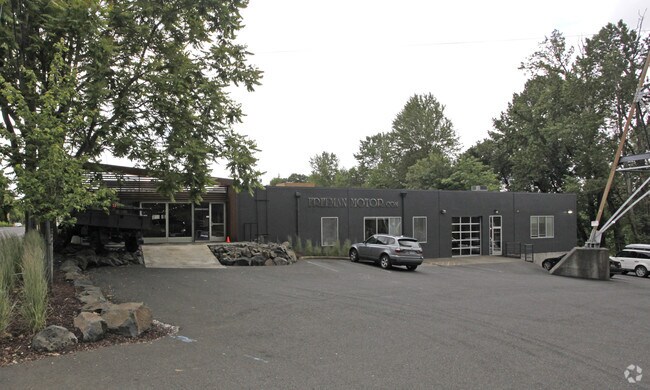
Property Record
7524 S Macadam Ave, Portland, OR 97219


Property Detail
7524 S Macadam Ave
R330308
SECTION 22 1S 1E, TL 4500 0.91 ACRES
Commercialnec
Multnomah
CGDG
Oregon
B and X Area of moderate flood hazard, usually the area between the limits of the 100-year and 500-year floods.
0.91 AC
2025
Johns Landing
2025
Portland
005903
Portland-Vancouver-Hillsboro, OR-WA
24,796 SF
NEARBY LISTINGS FOR SALE OR LEASE
DEMOGRAPHICS near 7524 S Macadam Ave
1 mile
3 mile
5 mile
2025 Total Population
10,065
126,446
417,008
2030 Population
10,093
125,958
415,624
Pop Growth 2025-2030
+ 0.28%
(0.39%)
(0.33%)
Average Age
42
41
42
2025 Total Households
4,395
56,247
193,420
HH Growth 2025-2030
+ 0.14%
(0.43%)
(0.40%)
Median Household Inc
$108,635
$105,174
$94,248
Avg Household Size
2.20
2.10
2.10
2025 Avg HH Vehicles
2.00
2.00
1.00
Median Home Value
$722,024
$724,021
$692,236
Median Year Built
1969
1970
1971
Nearby Places
Map Layers
Map Styles
 Street
 Aerial
Transit
 Traffic
 Biking
Places
Listings with unknown addresses are not visible on the map
- Restaurants
- Banks
- Shops
- Fitness
- Groceries
PUBLIC TRANSPORTATION
COMMUTER RAIL
Portland (Amtrak Cascades - Amtrak, Coast Starlight - Amtrak, Empire Builder - Amtrak)
Drive
Walk
Distance
Portland (Amtrak Cascades - Amtrak, Coast Starlight - Amtrak, Empire Builder - Amtrak)
13 min
4.9 mi
Tigard Transit Center (Westside Express Service - Tri-County Metropolitan Transportation District of Oregon Rail (TriMet Rail))
Drive
Walk
Distance
Tigard Transit Center (Westside Express Service - Tri-County Metropolitan Transportation District of Oregon Rail (TriMet Rail))
16 min
6.8 mi
AIRPORT
Portland International
Drive
Walk
Distance
Portland International
27 min
15.4 mi
Freight Ports
Port of Portland
Drive
Walk
Distance
Port of Portland
14 min
6.3 mi
Nearby Properties
Address
Land Use
TOTAL SIZE
Lot Size
Zoning
Address
Land Use
TOTAL SIZE
Lot Size
Zoning
27.58 AC
EX
Address
Land Use
TOTAL SIZE
Lot Size
Zoning
931,749 SF
85.50 AC
CI1
Address
Land Use
TOTAL SIZE
Lot Size
Zoning
822,867 SF
103.39 AC
CI1
Address
Land Use
TOTAL SIZE
Lot Size
Zoning
409,260 SF
7.41 AC
EX
Address
Land Use
TOTAL SIZE
Lot Size
Zoning
1.09 AC
EX
Address
Land Use
TOTAL SIZE
Lot Size
Zoning
2.24 AC
CX
Address
Land Use
TOTAL SIZE
Lot Size
Zoning
251,293 SF
14.15 AC
IR
Address
Land Use
TOTAL SIZE
Lot Size
Zoning
175,880 SF
36.43 AC
OS
Address
Land Use
TOTAL SIZE
Lot Size
Zoning
138,295 SF
29.79 AC
CI1
Address
Land Use
TOTAL SIZE
Lot Size
Zoning
473,746 SF
1.68 AC
Address
Land Use
TOTAL SIZE
Lot Size
Zoning
388,191 SF
1.86 AC
CX
Address
Land Use
TOTAL SIZE
Lot Size
Zoning
79,646 SF
9.23 AC
R2R7
Address
Land Use
TOTAL SIZE
Lot Size
Zoning
42,920 SF
1.16 AC
CX
Address
Land Use
TOTAL SIZE
Lot Size
Zoning
Address
Land Use
TOTAL SIZE
Lot Size
Zoning
147,334 SF
10.92 AC
IG1
Address
Land Use
TOTAL SIZE
Lot Size
Zoning
297,636 SF
1.06 AC
CX
Address
Land Use
TOTAL SIZE
Lot Size
Zoning
247,090 SF
0.92 AC
CXD
Address
Land Use
TOTAL SIZE
Lot Size
Zoning
371,113 SF
0.83 AC
CX
Address
Land Use
TOTAL SIZE
Lot Size
Zoning
198,107 SF
4.03 AC
R2.5
Address
Land Use
TOTAL SIZE
Lot Size
Zoning
330,924 SF
0.95 AC
CXD
Address
Land Use
TOTAL SIZE
Lot Size
Zoning
453,461 SF
1.16 AC
CX
Address
Land Use
TOTAL SIZE
Lot Size
Zoning
44,644 SF
2.18 AC
R2
Address
Land Use
TOTAL SIZE
Lot Size
Zoning
6.48 AC
R-3
Address
Land Use
TOTAL SIZE
Lot Size
Zoning
282,840 SF
1.46 AC
CX
Address
Land Use
TOTAL SIZE
Lot Size
Zoning
404,000 SF
0.92 AC
CXD
Address
Land Use
TOTAL SIZE
Lot Size
Zoning
362,725 SF
16.52 AC
IG1
Address
Land Use
TOTAL SIZE
Lot Size
Zoning
279,607 SF
1.67 AC
CX
Address
Land Use
TOTAL SIZE
Lot Size
Zoning
3,550 SF
3.99 AC
DMU
Address
Land Use
TOTAL SIZE
Lot Size
Zoning
198,988 SF
1.02 AC
CXD
Address
Land Use
TOTAL SIZE
Lot Size
Zoning
125,248 SF
0.75 AC
CX
The World's #1 Commercial Real Estate Marketplace
Connect with us
© 2026 CoStar Group
The information above has been obtained from sources believed reliable. While we do not doubt its accuracy we have not verified it and make no guarantee, warranty or representation about it. It is your responsibility to independently confirm its accuracy and completeness. Any projections, opinions, assumptions, or estimates used are for example only and do not represent the current or future performance of the property. The value of this transaction to you depends on tax and other factors which should be evaluated by your tax, financial, and legal advisors. You and your advisors should conduct a careful, independent investigation of the property to determine to your satisfaction the suitability of the property for your needs.