Property Record
7525 Winchester Rd, Memphis, TN 38125


NEARBY LISTINGS FOR SALE OR LEASE
Property Detail
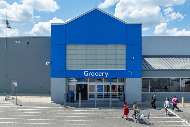
7525 Winchester Rd
Memphis, TN-MS-AR
Winchester/Nonconnah Pkwy Pd Ph 1
08-1085-0-0023
SS WINCHESTER/ NONCONNAH PKWY (SW) SEE MAP199F WINCHESTER/NONCONNAH PKWY PD PH 1 PT OF AREA A & PT OF AREA
Departmentstore
Shelby
AE
Tennessee
47157C0470F
pt1
2024
26.69 AC
2025
Southeast
021354
Memphis
216,086 SF
DEMOGRAPHICS near 7525 Winchester Rd
1 Mile
3 Mile
5 Mile
2024 Total Population
7,800
86,087
174,569
2029 Population
7,577
84,219
171,130
Pop Growth 2024-2029
(2.86%)
(2.17%)
(1.97%)
Average Age
37
37
38
2024 Total Households
3,325
34,523
68,467
HH Growth 2024-2029
(2.80%)
(2.04%)
(1.95%)
Median Household Inc
$74,568
$66,422
$71,140
Avg Household Size
2.30
2.40
2.50
2024 Avg HH Vehicles
2.00
2.00
2.00
Median Home Value
$184,336
$221,821
$261,262
Median Year Built
1991
1986
1984
Nearby Places
Map Layers
Map Styles
 Street
 Aerial
- Restaurants
- Banks
- Shops
- Fitness
- Groceries
PUBLIC TRANSPORTATION
AIRPORT
Memphis International
DRIVE
WALK
Distance
Memphis International
21 min
10.9 mi
Nearby Properties
Address
Land Use
TOTAL SIZE
Lot Size
Zoning
Address
Land Use
TOTAL SIZE
Lot Size
Zoning
73.56 AC
CA
Address
Land Use
TOTAL SIZE
Lot Size
Zoning
451,249 SF
24.28 AC
RU-2
Address
Land Use
TOTAL SIZE
Lot Size
Zoning
184,120 SF
11.11 AC
EMP
Address
Land Use
TOTAL SIZE
Lot Size
Zoning
56,237 SF
20.51 AC
CA
Address
Land Use
TOTAL SIZE
Lot Size
Zoning
160,832 SF
19.89 AC
CA
Address
Land Use
TOTAL SIZE
Lot Size
Zoning
52,688 SF
24.38 AC
CA
Address
Land Use
TOTAL SIZE
Lot Size
Zoning
62,013 SF
20 AC
CA
Address
Land Use
TOTAL SIZE
Lot Size
Zoning
262,984 SF
8.09 AC
R-TH
Address
Land Use
TOTAL SIZE
Lot Size
Zoning
251,597 SF
26.90 AC
EMP
Address
Land Use
TOTAL SIZE
Lot Size
Zoning
204,904 SF
6.87 AC
PD
Address
Land Use
TOTAL SIZE
Lot Size
Zoning
239,276 SF
17.72 AC
EMP
Address
Land Use
TOTAL SIZE
Lot Size
Zoning
117,381 SF
27.16 AC
RU-2
Address
Land Use
TOTAL SIZE
Lot Size
Zoning
67,052 SF
21.65 AC
R-15
Address
Land Use
TOTAL SIZE
Lot Size
Zoning
38,566 SF
27.90 AC
CA
Address
Land Use
TOTAL SIZE
Lot Size
Zoning
64,994 SF
19.07 AC
RU-2
Address
Land Use
TOTAL SIZE
Lot Size
Zoning
48,768 SF
7.51 AC
R-8
Address
Land Use
TOTAL SIZE
Lot Size
Zoning
142,971 SF
29.84 AC
R-15
Address
Land Use
TOTAL SIZE
Lot Size
Zoning
813,591 SF
37.02 AC
EMP
Address
Land Use
TOTAL SIZE
Lot Size
Zoning
176,176 SF
26.62 AC
R-8
Address
Land Use
TOTAL SIZE
Lot Size
Zoning
259,286 SF
12.76 AC
RU-3
Address
Land Use
TOTAL SIZE
Lot Size
Zoning
10,128 SF
23.35 AC
CA
Address
Land Use
TOTAL SIZE
Lot Size
Zoning
224,407 SF
23.22 AC
R-8
Address
Land Use
TOTAL SIZE
Lot Size
Zoning
71,363 SF
10 AC
R-T
Address
Land Use
TOTAL SIZE
Lot Size
Zoning
34,700 SF
5.83 AC
R-10
Address
Land Use
TOTAL SIZE
Lot Size
Zoning
113,990 SF
9.07 AC
R-15
Address
Land Use
TOTAL SIZE
Lot Size
Zoning
88,484 SF
15.28 AC
RU-3
Address
Land Use
TOTAL SIZE
Lot Size
Zoning
79,884 SF
16.73 AC
CMU-2
Address
Land Use
TOTAL SIZE
Lot Size
Zoning
35,001 SF
33.60 AC
R-10
Address
Land Use
TOTAL SIZE
Lot Size
Zoning
87,346 SF
15.02 AC
EMP
The World's #1 Commercial Real Estate Marketplace
Connect with us
© 2026 CoStar Group
The information above has been obtained from sources believed reliable. While we do not doubt its accuracy we have not verified it and make no guarantee, warranty or representation about it. It is your responsibility to independently confirm its accuracy and completeness. Any projections, opinions, assumptions, or estimates used are for example only and do not represent the current or future performance of the property. The value of this transaction to you depends on tax and other factors which should be evaluated by your tax, financial, and legal advisors. You and your advisors should conduct a careful, independent investigation of the property to determine to your satisfaction the suitability of the property for your needs.