Property Record
7530 Nw 23Rd St, Bethany, OK 73008


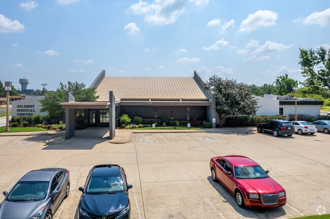

Property Detail
7530 Nw 23Rd St
Oklahoma City, OK
UNPLTD PT SEC 29 12N 4W BLK 000 LOT 000 PT NW4 SEC 29 12N 4W BEG 230FT W & 50FT S OF NE/C NW4 TH S170FT W165FT SWLY 233.7FT NLY ON A CURVE 276.13FT NELY ALONG A CURVE 40.14FT E399.27FT TO BEG OR TR 10
173800915
OKLAHOMA
Medicalbuilding
Oklahoma
B and X Area of moderate flood hazard, usually the area between the limits of the 100-year and 500-year floods.
000
2024
1.89 AC
2025
West/Central
106910
Oklahoma City
23,372 SF
NEARBY LISTINGS FOR SALE OR LEASE
DEMOGRAPHICS near 7530 Nw 23Rd St
1 mile
3 mile
5 mile
2025 Total Population
14,124
67,059
182,877
2030 Population
14,473
69,523
192,483
Pop Growth 2025-2030
+ 2.47%
+ 3.67%
+ 5.25%
Average Age
38
36
37
2025 Total Households
5,594
25,909
72,466
HH Growth 2025-2030
+ 2.66%
+ 3.72%
+ 4.93%
Median Household Inc
$60,920
$51,101
$61,830
Avg Household Size
2.40
2.50
2.40
2025 Avg HH Vehicles
2.00
2.00
2.00
Median Home Value
$195,162
$174,511
$211,837
Median Year Built
1969
1968
1973
Nearby Places
Map Layers
Map Styles
 Street
 Aerial
Layers
 Traffic
 Biking
Places
Listings with unknown addresses are not visible on the map
- Restaurants
- Banks
- Shops
- Fitness
- Groceries
PUBLIC TRANSPORTATION
AIRPORT
Will Rogers World
Drive
Walk
Distance
Will Rogers World
17 min
9.4 mi
SALE & LEASE HISTORY
LISTING DATE
SALE/LEASE

Mar 04, 2019
For Sale
Jun 01, 2020
For Lease
Nearby Properties
Address
Land Use
TOTAL SIZE
Lot Size
Zoning
Address
Land Use
TOTAL SIZE
Lot Size
Zoning
388,082 SF
34.03 AC
I-2
Address
Land Use
TOTAL SIZE
Lot Size
Zoning
1,198 SF
145 AC
Address
Land Use
TOTAL SIZE
Lot Size
Zoning
460,564 SF
27.08 AC
Address
Land Use
TOTAL SIZE
Lot Size
Zoning
4,896 SF
30.88 AC
Address
Land Use
TOTAL SIZE
Lot Size
Zoning
44,519 SF
3.39 AC
SPUD
Address
Land Use
TOTAL SIZE
Lot Size
Zoning
1,194,497 SF
89.98 AC
I-2
Address
Land Use
TOTAL SIZE
Lot Size
Zoning
144,735 SF
28 AC
Address
Land Use
TOTAL SIZE
Lot Size
Zoning
300,000 SF
123.06 AC
R-1
Address
Land Use
TOTAL SIZE
Lot Size
Zoning
279,224 SF
18.75 AC
PUD
Address
Land Use
TOTAL SIZE
Lot Size
Zoning
213,085 SF
3.64 AC
Address
Land Use
TOTAL SIZE
Lot Size
Zoning
177,623 SF
12.13 AC
Address
Land Use
TOTAL SIZE
Lot Size
Zoning
336,750 SF
15.53 AC
I-3
Address
Land Use
TOTAL SIZE
Lot Size
Zoning
294,820 SF
12.17 AC
Address
Land Use
TOTAL SIZE
Lot Size
Zoning
120,000 SF
6.69 AC
Address
Land Use
TOTAL SIZE
Lot Size
Zoning
223,679 SF
40.52 AC
PUD
Address
Land Use
TOTAL SIZE
Lot Size
Zoning
182,590 SF
11.35 AC
R-4
Address
Land Use
TOTAL SIZE
Lot Size
Zoning
110,391 SF
28.91 AC
I-2
Address
Land Use
TOTAL SIZE
Lot Size
Zoning
182,948 SF
10 AC
Address
Land Use
TOTAL SIZE
Lot Size
Zoning
83,055 SF
6.25 AC
PUD
Address
Land Use
TOTAL SIZE
Lot Size
Zoning
217,512 SF
8.79 AC
C-3
Address
Land Use
TOTAL SIZE
Lot Size
Zoning
81,491 SF
15 AC
C-3
Address
Land Use
TOTAL SIZE
Lot Size
Zoning
92,373 SF
38.73 AC
I-2
Address
Land Use
TOTAL SIZE
Lot Size
Zoning
1,690 SF
120.39 AC
Address
Land Use
TOTAL SIZE
Lot Size
Zoning
1,865 SF
32.08 AC
Address
Land Use
TOTAL SIZE
Lot Size
Zoning
65,850 SF
6.25 AC
PUD
Address
Land Use
TOTAL SIZE
Lot Size
Zoning
156,016 SF
11.04 AC
PUD
Address
Land Use
TOTAL SIZE
Lot Size
Zoning
75,440 SF
5.33 AC
PUD
Address
Land Use
TOTAL SIZE
Lot Size
Zoning
6,148 SF
2.50 AC
R-1
Address
Land Use
TOTAL SIZE
Lot Size
Zoning
22,684 SF
2.94 AC
SPUD
Address
Land Use
TOTAL SIZE
Lot Size
Zoning
51,224 SF
6.22 AC
I-2
The World's #1 Commercial Real Estate Marketplace
Connect with us
© 2026 CoStar Group
The information above has been obtained from sources believed reliable. While we do not doubt its accuracy we have not verified it and make no guarantee, warranty or representation about it. It is your responsibility to independently confirm its accuracy and completeness. Any projections, opinions, assumptions, or estimates used are for example only and do not represent the current or future performance of the property. The value of this transaction to you depends on tax and other factors which should be evaluated by your tax, financial, and legal advisors. You and your advisors should conduct a careful, independent investigation of the property to determine to your satisfaction the suitability of the property for your needs.