Property Record
7530 Roswell Rd, Atlanta, GA 30350


NEARBY LISTINGS FOR SALE OR LEASE
Property Detail
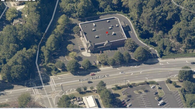
7530 Roswell Rd
17-0076-LL-037-6
PRINCETON FALLS UNIT 1 SUB
Storebuilding
Fulton
A
Georgia
13089C0005K
pr
2024
3.78 AC
2025
Sandy Spring/N Ctrl
010217
Atlanta
15,100 SF
Atlanta-Sandy Springs-Roswell, GA
DEMOGRAPHICS near 7530 Roswell Rd
1 Mile
3 Mile
5 Mile
2024 Total Population
14,772
88,716
214,790
2029 Population
14,896
89,667
216,984
Pop Growth 2024-2029
+ 0.84%
+ 1.07%
+ 1.02%
Average Age
36
39
40
2024 Total Households
7,234
39,346
90,842
HH Growth 2024-2029
+ 0.77%
+ 1.17%
+ 1.14%
Median Household Inc
$77,446
$97,932
$110,471
Avg Household Size
2.00
2.20
2.30
2024 Avg HH Vehicles
1.00
2.00
2.00
Median Home Value
$469,739
$573,301
$562,853
Median Year Built
1985
1986
1985
Nearby Places
Map Layers
Map Styles
 Street
 Aerial
- Restaurants
- Banks
- Shops
- Fitness
- Groceries
PUBLIC TRANSPORTATION
AIRPORT
Hartsfield - Jackson Atlanta International
DRIVE
WALK
Distance
Hartsfield - Jackson Atlanta International
39 min
26.7 mi
Freight Ports
Georgia Ports - Savannah
DRIVE
WALK
Distance
Georgia Ports - Savannah
302 min
266.0 mi
SALE & LEASE HISTORY
LISTING DATE
SALE/LEASE

Apr 15, 2020
For Sale
Apr 12, 2022
For Sale
Nearby Properties
Address
Land Use
TOTAL SIZE
Lot Size
Zoning
Address
Land Use
TOTAL SIZE
Lot Size
Zoning
1,123,714 SF
47.33 AC
C1
Address
Land Use
TOTAL SIZE
Lot Size
Zoning
409,493 SF
10.01 AC
OI
Address
Land Use
TOTAL SIZE
Lot Size
Zoning
543,090 SF
5.51 AC
R2
Address
Land Use
TOTAL SIZE
Lot Size
Zoning
485,132 SF
37.90 AC
OI
Address
Land Use
TOTAL SIZE
Lot Size
Zoning
542,845 SF
10.58 AC
X
Address
Land Use
TOTAL SIZE
Lot Size
Zoning
664,199 SF
2.85 AC
Address
Land Use
TOTAL SIZE
Lot Size
Zoning
937,800 SF
2.65 AC
Address
Land Use
TOTAL SIZE
Lot Size
Zoning
295,885 SF
3.50 AC
X
Address
Land Use
TOTAL SIZE
Lot Size
Zoning
258,909 SF
19.01 AC
X
Address
Land Use
TOTAL SIZE
Lot Size
Zoning
12,342,500 SF
125.51 AC
AC
Address
Land Use
TOTAL SIZE
Lot Size
Zoning
1,088,359 SF
7.07 AC
OIC
Address
Land Use
TOTAL SIZE
Lot Size
Zoning
4,555,620 SF
12.41 AC
OI
Address
Land Use
TOTAL SIZE
Lot Size
Zoning
106,770 SF
3.13 AC
X
Address
Land Use
TOTAL SIZE
Lot Size
Zoning
572,181 SF
3.76 AC
C1
Address
Land Use
TOTAL SIZE
Lot Size
Zoning
347,179 SF
18.24 AC
X
Address
Land Use
TOTAL SIZE
Lot Size
Zoning
316,391 SF
11.73 AC
OCR
Address
Land Use
TOTAL SIZE
Lot Size
Zoning
1,067,348 SF
6.41 AC
OIC
Address
Land Use
TOTAL SIZE
Lot Size
Zoning
828,002 SF
12.04 AC
R2
Address
Land Use
TOTAL SIZE
Lot Size
Zoning
732,923 SF
2.77 AC
OIC
Address
Land Use
TOTAL SIZE
Lot Size
Zoning
275,745 SF
12.52 AC
OCR
Address
Land Use
TOTAL SIZE
Lot Size
Zoning
1,119,177 SF
5.21 AC
OIC
Address
Land Use
TOTAL SIZE
Lot Size
Zoning
227,764 SF
5.49 AC
OI
Address
Land Use
TOTAL SIZE
Lot Size
Zoning
292,537 SF
10.50 AC
ACOND
Address
Land Use
TOTAL SIZE
Lot Size
Zoning
862,962 SF
4.72 AC
Address
Land Use
TOTAL SIZE
Lot Size
Zoning
426,949 SF
1.86 AC
OIC
Address
Land Use
TOTAL SIZE
Lot Size
Zoning
7,258,269 SF
38.75 AC
AC
Address
Land Use
TOTAL SIZE
Lot Size
Zoning
225,680 SF
17.40 AC
X
Address
Land Use
TOTAL SIZE
Lot Size
Zoning
732,896 SF
3.96 AC
OIC
Address
Land Use
TOTAL SIZE
Lot Size
Zoning
2,861,400 SF
5.77 AC
OIC
Address
Land Use
TOTAL SIZE
Lot Size
Zoning
226,026 SF
3.98 AC
OI
The World's #1 Commercial Real Estate Marketplace
Connect with us
© 2026 CoStar Group
The information above has been obtained from sources believed reliable. While we do not doubt its accuracy we have not verified it and make no guarantee, warranty or representation about it. It is your responsibility to independently confirm its accuracy and completeness. Any projections, opinions, assumptions, or estimates used are for example only and do not represent the current or future performance of the property. The value of this transaction to you depends on tax and other factors which should be evaluated by your tax, financial, and legal advisors. You and your advisors should conduct a careful, independent investigation of the property to determine to your satisfaction the suitability of the property for your needs.