Property Record
7531 N Silver Path, Paradise Valley, AZ 85253
This Property Is For Sale
NEARBY LISTINGS FOR SALE OR LEASE
Property Detail
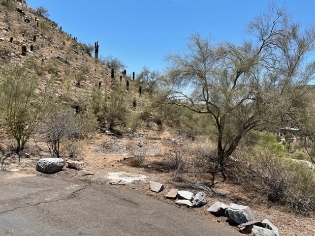
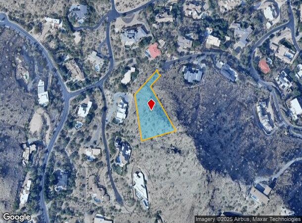
7531 N Silver Path
Phoenix-Mesa-Scottsdale, AZ
Clearwater Hills 2 Lots 197-198, 201-206
169-13-036
CLEARWATER HILLS 2 LOTS 197-198, 201-206 MCR 84/25
Residentialacreage
Maricopa
X
Arizona
04013C1765L
169
2025
1.51 AC
2025
Paradise Valley
105004
Phoenix
DEMOGRAPHICS near 7531 N Silver Path
1 Mile
3 Mile
5 Mile
2024 Total Population
2,162
36,871
259,162
2029 Population
2,386
40,153
282,869
Pop Growth 2024-2029
+ 10.36%
+ 8.90%
+ 9.15%
Average Age
51
46
42
2024 Total Households
886
16,160
121,323
HH Growth 2024-2029
+ 10.27%
+ 8.97%
+ 9.38%
Median Household Inc
$217,526
$147,294
$83,498
Avg Household Size
2.40
2.30
2.10
2024 Avg HH Vehicles
3.00
2.00
2.00
Median Home Value
$1,094,737
$959,548
$611,728
Median Year Built
1980
1977
1976
Nearby Places
Map Layers
Map Styles
 Street
 Aerial
- Restaurants
- Banks
- Shops
- Fitness
- Groceries
PUBLIC TRANSPORTATION
AIRPORT
Phoenix Sky Harbor International
DRIVE
WALK
Distance
Phoenix Sky Harbor International
22 min
10.8 mi
Phoenix-Mesa Gateway
DRIVE
WALK
Distance
Phoenix-Mesa Gateway
53 min
35.3 mi
Freight Ports
Port of San Diego
DRIVE
WALK
Distance
Port of San Diego
411 min
364.7 mi
Nearby Properties
Address
Land Use
TOTAL SIZE
Lot Size
Zoning
Address
Land Use
TOTAL SIZE
Lot Size
Zoning
969,844 SF
27.97 AC
PAD
Address
Land Use
TOTAL SIZE
Lot Size
Zoning
953,192 SF
28.99 AC
Address
Land Use
TOTAL SIZE
Lot Size
Zoning
244,924 SF
1.90 AC
C2
Address
Land Use
TOTAL SIZE
Lot Size
Zoning
194,253 SF
1.58 AC
C2
Address
Land Use
TOTAL SIZE
Lot Size
Zoning
517,502 SF
21.26 AC
SUPR
Address
Land Use
TOTAL SIZE
Lot Size
Zoning
567,481 SF
2 AC
Address
Land Use
TOTAL SIZE
Lot Size
Zoning
426,310 SF
1.44 AC
Address
Land Use
TOTAL SIZE
Lot Size
Zoning
1,137 SF
76.71 AC
RE35
Address
Land Use
TOTAL SIZE
Lot Size
Zoning
341,434 SF
22.48 AC
C-T
Address
Land Use
TOTAL SIZE
Lot Size
Zoning
533,579 SF
1.91 AC
Address
Land Use
TOTAL SIZE
Lot Size
Zoning
515,440 SF
3.02 AC
C-T
Address
Land Use
TOTAL SIZE
Lot Size
Zoning
508,796 SF
4.71 AC
PAD
Address
Land Use
TOTAL SIZE
Lot Size
Zoning
51,836 SF
43.32 AC
RE35
Address
Land Use
TOTAL SIZE
Lot Size
Zoning
440,344 SF
4.46 AC
CO
Address
Land Use
TOTAL SIZE
Lot Size
Zoning
7,665 SF
1.29 AC
C-T
Address
Land Use
TOTAL SIZE
Lot Size
Zoning
158,895 SF
6.83 AC
R-43
Address
Land Use
TOTAL SIZE
Lot Size
Zoning
347,721 SF
5.33 AC
PUD
Address
Land Use
TOTAL SIZE
Lot Size
Zoning
325,086 SF
4.52 AC
C-C
Address
Land Use
TOTAL SIZE
Lot Size
Zoning
532,382 SF
1.58 AC
Address
Land Use
TOTAL SIZE
Lot Size
Zoning
283,612 SF
4.06 AC
Address
Land Use
TOTAL SIZE
Lot Size
Zoning
181,494 SF
1.76 AC
PUD
Address
Land Use
TOTAL SIZE
Lot Size
Zoning
457,244 SF
4.63 AC
C-T
Address
Land Use
TOTAL SIZE
Lot Size
Zoning
214,351 SF
2.96 AC
PUD
Address
Land Use
TOTAL SIZE
Lot Size
Zoning
235,495 SF
2.07 AC
PUD
Address
Land Use
TOTAL SIZE
Lot Size
Zoning
144,107 SF
8.57 AC
R-35
Address
Land Use
TOTAL SIZE
Lot Size
Zoning
209,344 SF
19.23 AC
PF
Address
Land Use
TOTAL SIZE
Lot Size
Zoning
36,324 SF
9.40 AC
R-35
Address
Land Use
TOTAL SIZE
Lot Size
Zoning
357,358 SF
2.80 AC
C-C
Address
Land Use
TOTAL SIZE
Lot Size
Zoning
197,948 SF
9.83 AC
C-1
Address
Land Use
TOTAL SIZE
Lot Size
Zoning
135,017 SF
10.42 AC
C-R
The World's #1 Commercial Real Estate Marketplace
Connect with us
© 2025 CoStar Group
The information above has been obtained from sources believed reliable. While we do not doubt its accuracy we have not verified it and make no guarantee, warranty or representation about it. It is your responsibility to independently confirm its accuracy and completeness. Any projections, opinions, assumptions, or estimates used are for example only and do not represent the current or future performance of the property. The value of this transaction to you depends on tax and other factors which should be evaluated by your tax, financial, and legal advisors. You and your advisors should conduct a careful, independent investigation of the property to determine to your satisfaction the suitability of the property for your needs.