Property Record
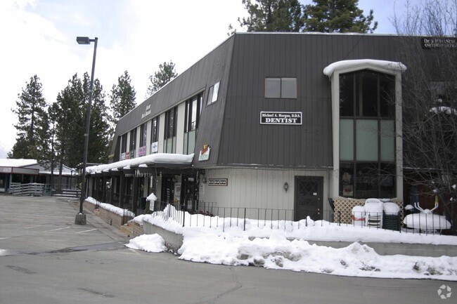
754 Mays Blvd, Incline Village, NV 89451


NEARBY LISTINGS FOR SALE OR LEASE
-
-
View all Incline Village listings for sale on LoopNet.com
Property Detail
754 Mays Blvd
132-201-07
_Unspecified
Commercialnec
S16 T16N R18E FRAC SE4
X
Washoe
32031C3425G
Nevada
2025
5.43 AC
2026
Incline Village
003306
Reno/Sparks
87,536 SF
Reno, NV
DEMOGRAPHICS near 754 Mays Blvd
1 Mile
3 Mile
5 Mile
2024 Total Population
4,966
13,447
17,021
2029 Population
5,330
14,651
18,551
Pop Growth 2024-2029
+ 7.33%
+ 8.95%
+ 8.99%
Average Age
46
48
46
2024 Total Households
2,159
5,950
7,446
HH Growth 2024-2029
+ 7.83%
+ 9.26%
+ 9.32%
Median Household Inc
$117,480
$139,690
$117,984
Avg Household Size
2.20
2.20
2.20
2024 Avg HH Vehicles
2.00
2.00
2.00
Median Home Value
$1,060,070
$1,043,826
$1,011,930
Median Year Built
1978
1979
1978
Nearby Places
Map Layers
Map Styles
 Street
 Aerial
- Restaurants
- Banks
- Shops
- Fitness
- Groceries
PUBLIC TRANSPORTATION
AIRPORT
Reno/Tahoe International
DRIVE
WALK
Distance
Reno/Tahoe International
71 min
37.4 mi
Nearby Properties
Address
Land Use
TOTAL SIZE
Lot Size
Zoning
Address
Land Use
TOTAL SIZE
Lot Size
Zoning
289,293 SF
16 AC
TA_IVT
Address
Land Use
TOTAL SIZE
Lot Size
Zoning
9.83 AC
TA_ES
Address
Land Use
TOTAL SIZE
Lot Size
Zoning
52,436 SF
8.56 AC
TA_IVT
Address
Land Use
TOTAL SIZE
Lot Size
Zoning
2,282 SF
12.01 AC
TA_L
Address
Land Use
TOTAL SIZE
Lot Size
Zoning
70,916 SF
3.31 AC
032
Address
Land Use
TOTAL SIZE
Lot Size
Zoning
1,236 SF
13.84 AC
TA_IVT
Address
Land Use
TOTAL SIZE
Lot Size
Zoning
612 SF
4.21 AC
TA_L
Address
Land Use
TOTAL SIZE
Lot Size
Zoning
61,841 SF
17.05 AC
TA_IVT
Address
Land Use
TOTAL SIZE
Lot Size
Zoning
54,085 SF
1.50 AC
029
Address
Land Use
TOTAL SIZE
Lot Size
Zoning
12,993 SF
3.89 AC
TA_CB
Address
Land Use
TOTAL SIZE
Lot Size
Zoning
52,257 SF
1.75 AC
032
Address
Land Use
TOTAL SIZE
Lot Size
Zoning
70,960 SF
8.70 AC
TA_IVC
Address
Land Use
TOTAL SIZE
Lot Size
Zoning
32,522 SF
367.33 AC
TA_IS 76%
Address
Land Use
TOTAL SIZE
Lot Size
Zoning
58,744 SF
4.60 AC
TA_IVT
Address
Land Use
TOTAL SIZE
Lot Size
Zoning
4,987 SF
1.13 AC
TA_MC
Address
Land Use
TOTAL SIZE
Lot Size
Zoning
139,654 SF
8.46 AC
TA_CBT
Address
Land Use
TOTAL SIZE
Lot Size
Zoning
36,637 SF
1.39 AC
TA_IVT
Address
Land Use
TOTAL SIZE
Lot Size
Zoning
33,478 SF
0.86 AC
TA_IVC
Address
Land Use
TOTAL SIZE
Lot Size
Zoning
640 SF
0.69 AC
TA_MC
Address
Land Use
TOTAL SIZE
Lot Size
Zoning
4,536 SF
0.85 AC
TA_L
Address
Land Use
TOTAL SIZE
Lot Size
Zoning
34,632 SF
20.60 AC
TA_IVC
Address
Land Use
TOTAL SIZE
Lot Size
Zoning
97,690 SF
7.98 AC
TA_IVC
Address
Land Use
TOTAL SIZE
Lot Size
Zoning
38,048 SF
16.17 AC
TA_IVT
Address
Land Use
TOTAL SIZE
Lot Size
Zoning
32,729 SF
87.30 AC
TA_TC 67%
Address
Land Use
TOTAL SIZE
Lot Size
Zoning
19.01 AC
TA_IVC
Address
Land Use
TOTAL SIZE
Lot Size
Zoning
1,175.62 AC
TA_MR 90%
Address
Land Use
TOTAL SIZE
Lot Size
Zoning
37,640 SF
80.28 AC
TA_F
Address
Land Use
TOTAL SIZE
Lot Size
Zoning
0.91 AC
032
Address
Land Use
TOTAL SIZE
Lot Size
Zoning
236,983 SF
2.92 AC
TA_CBT
Address
Land Use
TOTAL SIZE
Lot Size
Zoning
3,832 SF
0.26 AC
029
The World's #1 Commercial Real Estate Marketplace
Connect with us
© 2026 CoStar Group
The information above has been obtained from sources believed reliable. While we do not doubt its accuracy we have not verified it and make no guarantee, warranty or representation about it. It is your responsibility to independently confirm its accuracy and completeness. Any projections, opinions, assumptions, or estimates used are for example only and do not represent the current or future performance of the property. The value of this transaction to you depends on tax and other factors which should be evaluated by your tax, financial, and legal advisors. You and your advisors should conduct a careful, independent investigation of the property to determine to your satisfaction the suitability of the property for your needs.