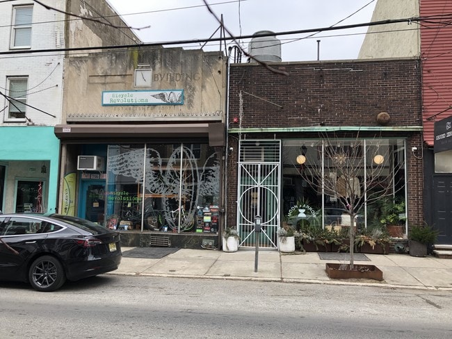
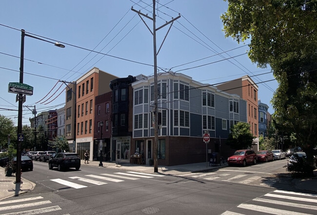
Property Record
754 S 4Th St, Philadelphia, PA 19147

Current Lease Availabilities
NEARBY LISTINGS FOR SALE OR LEASE
Property Detail
754 S 4Th St
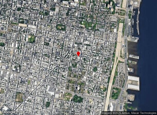
Philadelphia-Camden-Wilmington, PA-NJ-DE-MD
556S OF FITZWATER
881000069
Philadelphia
Apartment
Pennsylvania
2023
0.15 AC
2026
South Philadelphia
001700
Philadelphia
25,120 SF
DEMOGRAPHICS near 754 S 4Th St
1 Mile
3 Mile
5 Mile
2024 Total Population
71,201
419,442
883,785
2029 Population
68,611
411,116
868,637
Pop Growth 2024-2029
(3.64%)
(1.99%)
(1.71%)
Average Age
39
37
37
2024 Total Households
36,135
188,127
368,785
HH Growth 2024-2029
(3.79%)
(2.37%)
(2.02%)
Median Household Inc
$95,515
$73,157
$53,757
Avg Household Size
1.90
2.00
2.20
2024 Avg HH Vehicles
1.00
1.00
1.00
Median Home Value
$457,887
$356,396
$246,549
Median Year Built
1948
1951
1948
Nearby Places
Map Layers
Map Styles
 Street
 Aerial
- Restaurants
- Banks
- Shops
- Fitness
- Groceries
PUBLIC TRANSPORTATION
TRANSIT/SUBWAY
5th Street (Market-Frankford Line - Southeastern Pennsylvania Transportation Authority Rapid Transit (SEPTA Subway & Trolley))
DRIVE
WALK
Distance
5th Street (Market-Frankford Line - Southeastern Pennsylvania Transportation Authority Rapid Transit (SEPTA Subway & Trolley))
4 min
17 min
0.8 mi
9th-10th & Locust St (PATCO Speedline - Port Authority Transit Corporation Speedline (PATCO Speedline))
DRIVE
WALK
Distance
9th-10th & Locust St (PATCO Speedline - Port Authority Transit Corporation Speedline (PATCO Speedline))
4 min
18 min
0.9 mi
2nd Street (Market-Frankford Line - Southeastern Pennsylvania Transportation Authority Rapid Transit (SEPTA Subway & Trolley))
DRIVE
WALK
Distance
2nd Street (Market-Frankford Line - Southeastern Pennsylvania Transportation Authority Rapid Transit (SEPTA Subway & Trolley))
3 min
19 min
1.0 mi
COMMUTER RAIL
Market East (R1 - Southeastern Pennsylvania Transportation Authority Regional Rail (SEPTA Regional Rail), R2 - Southeastern Pennsylvania Transportation Authority Regional Rail (SEPTA Regional Rail), R3 - Southeastern Pennsylvania Transportation Authority Regional Rail (SEPTA Regional Rail), R5 - Southeastern Pennsylvania Transportation Authority Regional Rail (SEPTA Regional Rail), R6 - Southeastern Pennsylvania Transportation Authority Regional Rail (SEPTA Regional Rail), R7 - Southeastern Pennsylvania Transportation Authority Regional Rail (SEPTA Regional Rail), R8 - Southeastern Pennsylvania Transportation Authority Regional Rail (SEPTA Regional Rail))
DRIVE
WALK
Distance
Market East (R1 - Southeastern Pennsylvania Transportation Authority Regional Rail (SEPTA Regional Rail), R2 - Southeastern Pennsylvania Transportation Authority Regional Rail (SEPTA Regional Rail), R3 - Southeastern Pennsylvania Transportation Authority Regional Rail (SEPTA Regional Rail), R5 - Southeastern Pennsylvania Transportation Authority Regional Rail (SEPTA Regional Rail), R6 - Southeastern Pennsylvania Transportation Authority Regional Rail (SEPTA Regional Rail), R7 - Southeastern Pennsylvania Transportation Authority Regional Rail (SEPTA Regional Rail), R8 - Southeastern Pennsylvania Transportation Authority Regional Rail (SEPTA Regional Rail))
6 min
1.5 mi
Suburban Station (R1 - Southeastern Pennsylvania Transportation Authority Regional Rail (SEPTA Regional Rail), R2 - Southeastern Pennsylvania Transportation Authority Regional Rail (SEPTA Regional Rail), R3 - Southeastern Pennsylvania Transportation Authority Regional Rail (SEPTA Regional Rail), R5 - Southeastern Pennsylvania Transportation Authority Regional Rail (SEPTA Regional Rail), R6 - Southeastern Pennsylvania Transportation Authority Regional Rail (SEPTA Regional Rail), R7 - Southeastern Pennsylvania Transportation Authority Regional Rail (SEPTA Regional Rail), R8 - Southeastern Pennsylvania Transportation Authority Regional Rail (SEPTA Regional Rail))
DRIVE
WALK
Distance
Suburban Station (R1 - Southeastern Pennsylvania Transportation Authority Regional Rail (SEPTA Regional Rail), R2 - Southeastern Pennsylvania Transportation Authority Regional Rail (SEPTA Regional Rail), R3 - Southeastern Pennsylvania Transportation Authority Regional Rail (SEPTA Regional Rail), R5 - Southeastern Pennsylvania Transportation Authority Regional Rail (SEPTA Regional Rail), R6 - Southeastern Pennsylvania Transportation Authority Regional Rail (SEPTA Regional Rail), R7 - Southeastern Pennsylvania Transportation Authority Regional Rail (SEPTA Regional Rail), R8 - Southeastern Pennsylvania Transportation Authority Regional Rail (SEPTA Regional Rail))
7 min
2.2 mi
AIRPORT
Philadelphia International
DRIVE
WALK
Distance
Philadelphia International
20 min
10.7 mi
Trenton Mercer
DRIVE
WALK
Distance
Trenton Mercer
51 min
34.4 mi
Freight Ports
South Jersey Port
DRIVE
WALK
Distance
South Jersey Port
11 min
4.2 mi
Nearby Properties
Address
Land Use
TOTAL SIZE
Lot Size
Zoning
Address
Land Use
TOTAL SIZE
Lot Size
Zoning
608,400 SF
43.23 AC
SPSTA
Address
Land Use
TOTAL SIZE
Lot Size
Zoning
11,513 SF
19.92 AC
SPSTA
Address
Land Use
TOTAL SIZE
Lot Size
Zoning
159,630 SF
9.15 AC
SPENT
Address
Land Use
TOTAL SIZE
Lot Size
Zoning
1,449,928 SF
1.22 AC
CMX5
Address
Land Use
TOTAL SIZE
Lot Size
Zoning
1,076,400 SF
5 AC
CMX4
Address
Land Use
TOTAL SIZE
Lot Size
Zoning
1,200,021 SF
0.69 AC
CMX5
Address
Land Use
TOTAL SIZE
Lot Size
Zoning
26,690 SF
500 AC
SPINS
Address
Land Use
TOTAL SIZE
Lot Size
Zoning
1,103,300 SF
1.18 AC
CMX5
Address
Land Use
TOTAL SIZE
Lot Size
Zoning
1,464,000 SF
0.76 AC
CMX5
Address
Land Use
TOTAL SIZE
Lot Size
Zoning
319,590 SF
0.87 AC
I2
Address
Land Use
TOTAL SIZE
Lot Size
Zoning
760,635 SF
0.77 AC
CMX5
Address
Land Use
TOTAL SIZE
Lot Size
Zoning
1,179,072 SF
8.90 AC
RM4
Address
Land Use
TOTAL SIZE
Lot Size
Zoning
1,296,804 SF
2.71 AC
I2
Address
Land Use
TOTAL SIZE
Lot Size
Zoning
782,208 SF
0.68 AC
CMX5
Address
Land Use
TOTAL SIZE
Lot Size
Zoning
217,168 SF
54.93 AC
SPSTA
Address
Land Use
TOTAL SIZE
Lot Size
Zoning
2,215,276 SF
2.46 AC
CMX5
Address
Land Use
TOTAL SIZE
Lot Size
Zoning
880,950 SF
27.71 AC
SPENT
Address
Land Use
TOTAL SIZE
Lot Size
Zoning
624,696 SF
5.79 AC
CMX4
Address
Land Use
TOTAL SIZE
Lot Size
Zoning
1,200,000 SF
1.78 AC
CMX5
Address
Land Use
TOTAL SIZE
Lot Size
Zoning
1,075,580 SF
2.65 AC
CMX5
Address
Land Use
TOTAL SIZE
Lot Size
Zoning
1.17 AC
Address
Land Use
TOTAL SIZE
Lot Size
Zoning
468,307 SF
2.45 AC
CMX4
Address
Land Use
TOTAL SIZE
Lot Size
Zoning
500,165 SF
2.16 AC
SPPOA
Address
Land Use
TOTAL SIZE
Lot Size
Zoning
1,152,520 SF
1.49 AC
CMX5
Address
Land Use
TOTAL SIZE
Lot Size
Zoning
7.17 AC
Address
Land Use
TOTAL SIZE
Lot Size
Zoning
696,920 SF
10.55 AC
SPINS
Address
Land Use
TOTAL SIZE
Lot Size
Zoning
1,143,040 SF
0.81 AC
CMX5
Address
Land Use
TOTAL SIZE
Lot Size
Zoning
738,750 SF
1.19 AC
CMX5
Address
Land Use
TOTAL SIZE
Lot Size
Zoning
700,000 SF
7.88 AC
CMX5
Address
Land Use
TOTAL SIZE
Lot Size
Zoning
1,102,992 SF
2.14 AC
CMX5
The World's #1 Commercial Real Estate Marketplace
Connect with us
© 2026 CoStar Group
The information above has been obtained from sources believed reliable. While we do not doubt its accuracy we have not verified it and make no guarantee, warranty or representation about it. It is your responsibility to independently confirm its accuracy and completeness. Any projections, opinions, assumptions, or estimates used are for example only and do not represent the current or future performance of the property. The value of this transaction to you depends on tax and other factors which should be evaluated by your tax, financial, and legal advisors. You and your advisors should conduct a careful, independent investigation of the property to determine to your satisfaction the suitability of the property for your needs.