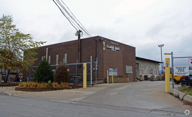
Property Record
7542 W 73Rd St, Bridgeview, IL 60455


NEARBY LISTINGS FOR SALE OR LEASE
Property Detail
7542 W 73Rd St
18-25-200-029-0000
Rudolph P Gluszeks Subdivision
Commercialbuilding
Cook
X
Illinois
17031C0495J
6
2023
1 AC
2025
North I-55 Corridor
820502
Chicago
2,850 SF
Chicago-Naperville-Elgin, IL-IN
DEMOGRAPHICS near 7542 W 73Rd St
1 Mile
3 Mile
5 Mile
2024 Total Population
7,426
118,516
359,483
2029 Population
7,194
114,647
346,531
Pop Growth 2024-2029
(3.12%)
(3.26%)
(3.60%)
Average Age
41
39
40
2024 Total Households
2,674
41,029
124,658
HH Growth 2024-2029
(3.52%)
(3.60%)
(3.89%)
Median Household Inc
$59,681
$67,496
$70,673
Avg Household Size
2.70
2.80
2.80
2024 Avg HH Vehicles
2.00
2.00
2.00
Median Home Value
$238,957
$246,623
$246,293
Median Year Built
1964
1965
1962
Nearby Places
Map Layers
Map Styles
 Street
 Aerial
- Restaurants
- Banks
- Shops
- Fitness
- Groceries
PUBLIC TRANSPORTATION
COMMUTER RAIL
Summit Station (Heritage Corridor Line - Northeast Illinois Regional Commuter Railroad (Metra))
DRIVE
WALK
Distance
Summit Station (Heritage Corridor Line - Northeast Illinois Regional Commuter Railroad (Metra))
9 min
3.6 mi
Willow Springs Station (Heritage Corridor Line - Northeast Illinois Regional Commuter Railroad (Metra))
DRIVE
WALK
Distance
Willow Springs Station (Heritage Corridor Line - Northeast Illinois Regional Commuter Railroad (Metra))
12 min
5.3 mi
AIRPORT
Chicago Midway International
DRIVE
WALK
Distance
Chicago Midway International
10 min
4.6 mi
Chicago O'Hare International
DRIVE
WALK
Distance
Chicago O'Hare International
58 min
22.8 mi
Nearby Properties
Address
Land Use
TOTAL SIZE
Lot Size
Zoning
Address
Land Use
TOTAL SIZE
Lot Size
Zoning
1,182,079 SF
Address
Land Use
TOTAL SIZE
Lot Size
Zoning
72,090 SF
10.19 AC
Address
Land Use
TOTAL SIZE
Lot Size
Zoning
246,248 SF
19.35 AC
Address
Land Use
TOTAL SIZE
Lot Size
Zoning
111,830 SF
2.16 AC
Address
Land Use
TOTAL SIZE
Lot Size
Zoning
266,580 SF
29.50 AC
Address
Land Use
TOTAL SIZE
Lot Size
Zoning
252,973 SF
11.68 AC
Address
Land Use
TOTAL SIZE
Lot Size
Zoning
61,003 SF
68.78 AC
Address
Land Use
TOTAL SIZE
Lot Size
Zoning
19.48 AC
Address
Land Use
TOTAL SIZE
Lot Size
Zoning
198,190 SF
15 AC
Address
Land Use
TOTAL SIZE
Lot Size
Zoning
16,077 SF
66.23 AC
Address
Land Use
TOTAL SIZE
Lot Size
Zoning
274,900 SF
13.14 AC
Address
Land Use
TOTAL SIZE
Lot Size
Zoning
45,196 SF
1.28 AC
Address
Land Use
TOTAL SIZE
Lot Size
Zoning
397,288 SF
10.18 AC
Address
Land Use
TOTAL SIZE
Lot Size
Zoning
124.04 AC
Address
Land Use
TOTAL SIZE
Lot Size
Zoning
256,416 SF
9.07 AC
Address
Land Use
TOTAL SIZE
Lot Size
Zoning
470,160 SF
23.66 AC
Address
Land Use
TOTAL SIZE
Lot Size
Zoning
98,811 SF
10.02 AC
Address
Land Use
TOTAL SIZE
Lot Size
Zoning
8.32 AC
Address
Land Use
TOTAL SIZE
Lot Size
Zoning
202,309 SF
13.02 AC
Address
Land Use
TOTAL SIZE
Lot Size
Zoning
367,185 SF
25 AC
Address
Land Use
TOTAL SIZE
Lot Size
Zoning
92,021 SF
Address
Land Use
TOTAL SIZE
Lot Size
Zoning
123,388 SF
11.14 AC
Address
Land Use
TOTAL SIZE
Lot Size
Zoning
1,583,756 SF
78.72 AC
Address
Land Use
TOTAL SIZE
Lot Size
Zoning
350,200 SF
Address
Land Use
TOTAL SIZE
Lot Size
Zoning
80.10 AC
Address
Land Use
TOTAL SIZE
Lot Size
Zoning
301,546 SF
11.59 AC
Address
Land Use
TOTAL SIZE
Lot Size
Zoning
145,018 SF
7.95 AC
Address
Land Use
TOTAL SIZE
Lot Size
Zoning
132,579 SF
9.11 AC
Address
Land Use
TOTAL SIZE
Lot Size
Zoning
332,889 SF
5.85 AC
Address
Land Use
TOTAL SIZE
Lot Size
Zoning
299,381 SF
9.70 AC
The World's #1 Commercial Real Estate Marketplace
Connect with us
© 2026 CoStar Group
The information above has been obtained from sources believed reliable. While we do not doubt its accuracy we have not verified it and make no guarantee, warranty or representation about it. It is your responsibility to independently confirm its accuracy and completeness. Any projections, opinions, assumptions, or estimates used are for example only and do not represent the current or future performance of the property. The value of this transaction to you depends on tax and other factors which should be evaluated by your tax, financial, and legal advisors. You and your advisors should conduct a careful, independent investigation of the property to determine to your satisfaction the suitability of the property for your needs.