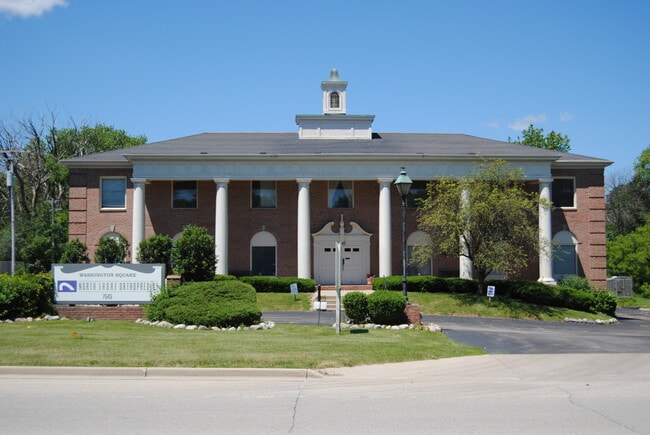
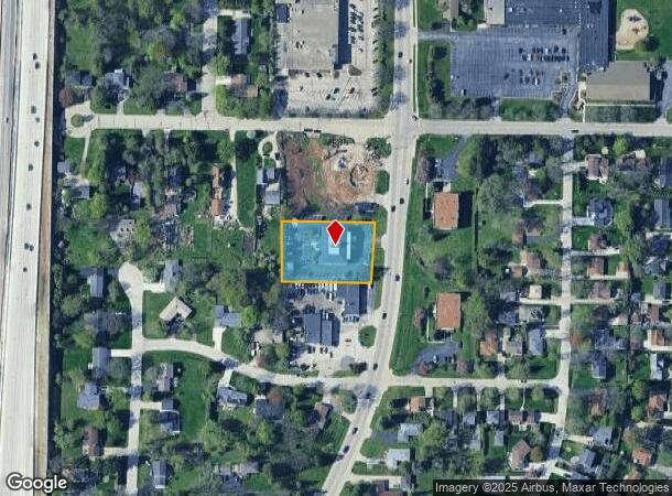
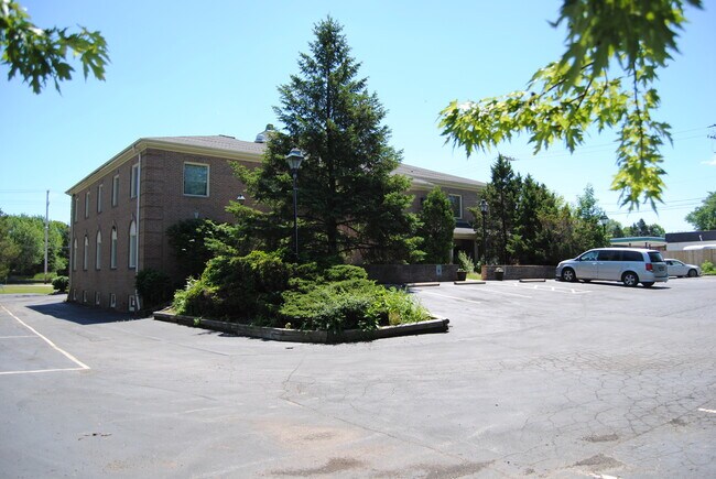
Property Record
7545 N Port Washington Rd, Milwaukee, WI 53217

NEARBY LISTINGS FOR SALE OR LEASE
Property Detail
7545 N Port Washington Rd
Milwaukee-Waukesha-West Allis, WI
Certified Surv Map 525
097-8001-000
MAP 525 SLIDE 294 PL 1130-1131 DOC 4238105
Commercialnec
Milwaukee
X
Wisconsin
55089C0270G
2
2024
0.84 AC
2024
North Shore
060101
Milwaukee/Madison
14,462 SF
DEMOGRAPHICS near 7545 N Port Washington Rd
1 Mile
3 Mile
5 Mile
2024 Total Population
5,447
41,574
151,206
2029 Population
5,318
40,560
148,909
Pop Growth 2024-2029
(2.37%)
(2.44%)
(1.52%)
Average Age
43
42
39
2024 Total Households
2,222
16,959
61,301
HH Growth 2024-2029
(2.43%)
(2.47%)
(1.64%)
Median Household Inc
$124,443
$95,421
$58,428
Avg Household Size
2.30
2.40
2.40
2024 Avg HH Vehicles
2.00
2.00
1.00
Median Home Value
$354,414
$331,357
$244,812
Median Year Built
1957
1958
1955
Nearby Places
Map Layers
Map Styles
 Street
 Aerial
- Restaurants
- Banks
- Shops
- Fitness
- Groceries
PUBLIC TRANSPORTATION
COMMUTER RAIL
Milwaukee (Empire Builder - Amtrak)
DRIVE
WALK
Distance
Milwaukee (Empire Builder - Amtrak)
16 min
9.1 mi
AIRPORT
General Mitchell International
DRIVE
WALK
Distance
General Mitchell International
26 min
15.7 mi
Freight Ports
Port Milwaukee
DRIVE
WALK
Distance
Port Milwaukee
19 min
11.5 mi
SALE & LEASE HISTORY
LISTING DATE
SALE/LEASE

Jul 07, 2020
For Sale
Jan 11, 2018
For Lease
Apr 19, 2018
For Sale
Apr 16, 2018
For Lease
Nearby Properties
Address
Land Use
TOTAL SIZE
Lot Size
Zoning
Address
Land Use
TOTAL SIZE
Lot Size
Zoning
305,573 SF
3.20 AC
Address
Land Use
TOTAL SIZE
Lot Size
Zoning
527,776 SF
33.23 AC
Address
Land Use
TOTAL SIZE
Lot Size
Zoning
19.64 AC
Address
Land Use
TOTAL SIZE
Lot Size
Zoning
Address
Land Use
TOTAL SIZE
Lot Size
Zoning
Address
Land Use
TOTAL SIZE
Lot Size
Zoning
145,218 SF
10.23 AC
Address
Land Use
TOTAL SIZE
Lot Size
Zoning
72,824 SF
11.57 AC
Address
Land Use
TOTAL SIZE
Lot Size
Zoning
Address
Land Use
TOTAL SIZE
Lot Size
Zoning
Address
Land Use
TOTAL SIZE
Lot Size
Zoning
294,553 SF
6.19 AC
Address
Land Use
TOTAL SIZE
Lot Size
Zoning
235,364 SF
7.20 AC
Address
Land Use
TOTAL SIZE
Lot Size
Zoning
90,714 SF
4.18 AC
Address
Land Use
TOTAL SIZE
Lot Size
Zoning
195,507 SF
1.92 AC
Address
Land Use
TOTAL SIZE
Lot Size
Zoning
72,676 SF
6.22 AC
Address
Land Use
TOTAL SIZE
Lot Size
Zoning
66.42 AC
IL1
Address
Land Use
TOTAL SIZE
Lot Size
Zoning
74,526 SF
5.42 AC
Address
Land Use
TOTAL SIZE
Lot Size
Zoning
48,540 SF
4.28 AC
Address
Land Use
TOTAL SIZE
Lot Size
Zoning
127,584 SF
3.28 AC
Address
Land Use
TOTAL SIZE
Lot Size
Zoning
61,910 SF
7.84 AC
Address
Land Use
TOTAL SIZE
Lot Size
Zoning
36,755 SF
6.44 AC
Address
Land Use
TOTAL SIZE
Lot Size
Zoning
81,300 SF
0.71 AC
Address
Land Use
TOTAL SIZE
Lot Size
Zoning
Address
Land Use
TOTAL SIZE
Lot Size
Zoning
128,512 SF
3.57 AC
Address
Land Use
TOTAL SIZE
Lot Size
Zoning
17,613 SF
1.44 AC
Address
Land Use
TOTAL SIZE
Lot Size
Zoning
13.08 AC
Address
Land Use
TOTAL SIZE
Lot Size
Zoning
34,949 SF
6.01 AC
Address
Land Use
TOTAL SIZE
Lot Size
Zoning
56,706 SF
4.53 AC
Address
Land Use
TOTAL SIZE
Lot Size
Zoning
7.84 AC
Address
Land Use
TOTAL SIZE
Lot Size
Zoning
29,816 SF
3.50 AC
Address
Land Use
TOTAL SIZE
Lot Size
Zoning
40,416 SF
2.49 AC
The World's #1 Commercial Real Estate Marketplace
Connect with us
© 2025 CoStar Group
The information above has been obtained from sources believed reliable. While we do not doubt its accuracy we have not verified it and make no guarantee, warranty or representation about it. It is your responsibility to independently confirm its accuracy and completeness. Any projections, opinions, assumptions, or estimates used are for example only and do not represent the current or future performance of the property. The value of this transaction to you depends on tax and other factors which should be evaluated by your tax, financial, and legal advisors. You and your advisors should conduct a careful, independent investigation of the property to determine to your satisfaction the suitability of the property for your needs.