Property Record
755 Mcpherson Park Dr, Howell, MI 48843


NEARBY LISTINGS FOR SALE OR LEASE
Property Detail
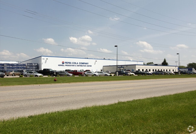
755 Mcpherson Park Dr
17-35-100-098
SEC 35 T3N R4E COM IN C/L MASON RD 2901.31 FT N 89*28'30"E FROM NW COR SEC 2, T2N R4E, TH N 0*04'W 385.6 FT FOR BEG, TH
Industrialgeneral
Livingston
X
Michigan
26093C0302D
27.72 AC
2025
Livingston County
2025
Detroit
725101
Detroit-Warren-Dearborn, MI
344,387 SF
DEMOGRAPHICS near 755 Mcpherson Park Dr
1 Mile
3 Mile
5 Mile
2024 Total Population
7,366
26,514
42,911
2029 Population
7,549
27,276
44,164
Pop Growth 2024-2029
+ 2.48%
+ 2.87%
+ 2.92%
Average Age
40
41
42
2024 Total Households
3,101
10,863
17,017
HH Growth 2024-2029
+ 2.48%
+ 2.88%
+ 2.89%
Median Household Inc
$62,005
$76,873
$85,103
Avg Household Size
2.20
2.40
2.50
2024 Avg HH Vehicles
2.00
2.00
2.00
Median Home Value
$221,941
$258,146
$276,643
Median Year Built
1972
1992
1993
Nearby Places
Map Layers
Map Styles
 Street
 Aerial
- Restaurants
- Banks
- Shops
- Fitness
- Groceries
PUBLIC TRANSPORTATION
AIRPORT
Bishop International
DRIVE
WALK
Distance
Bishop International
59 min
37.1 mi
Freight Ports
Port of Toledo
DRIVE
WALK
Distance
Port of Toledo
109 min
89.6 mi
Nearby Properties
Address
Land Use
TOTAL SIZE
Lot Size
Zoning
Address
Land Use
TOTAL SIZE
Lot Size
Zoning
767,161 SF
127.33 AC
I-1
Address
Land Use
TOTAL SIZE
Lot Size
Zoning
75,407 SF
159.26 AC
R2
Address
Land Use
TOTAL SIZE
Lot Size
Zoning
89,443 SF
10.45 AC
R-M
Address
Land Use
TOTAL SIZE
Lot Size
Zoning
102,971 SF
11.95 AC
I-1
Address
Land Use
TOTAL SIZE
Lot Size
Zoning
171,564 SF
30.98 AC
O-1
Address
Land Use
TOTAL SIZE
Lot Size
Zoning
321,167 SF
27.01 AC
IFZ
Address
Land Use
TOTAL SIZE
Lot Size
Zoning
145,366 SF
13.60 AC
R-M
Address
Land Use
TOTAL SIZE
Lot Size
Zoning
95,252 SF
11.56 AC
R-M
Address
Land Use
TOTAL SIZE
Lot Size
Zoning
37.65 AC
MFR
Address
Land Use
TOTAL SIZE
Lot Size
Zoning
81,417 SF
13.10 AC
R-M
Address
Land Use
TOTAL SIZE
Lot Size
Zoning
161,366 SF
18.67 AC
HDR
Address
Land Use
TOTAL SIZE
Lot Size
Zoning
165,868 SF
27.80 AC
HDR
Address
Land Use
TOTAL SIZE
Lot Size
Zoning
80,330 SF
10 AC
MFR
Address
Land Use
TOTAL SIZE
Lot Size
Zoning
152,606 SF
16 AC
R-M
Address
Land Use
TOTAL SIZE
Lot Size
Zoning
16.65 AC
MFR
Address
Land Use
TOTAL SIZE
Lot Size
Zoning
106,170 SF
6.68 AC
I
Address
Land Use
TOTAL SIZE
Lot Size
Zoning
91,380 SF
11.55 AC
HDR
Address
Land Use
TOTAL SIZE
Lot Size
Zoning
35,546 SF
7.64 AC
R-M
Address
Land Use
TOTAL SIZE
Lot Size
Zoning
79,801 SF
10.60 AC
B-2
Address
Land Use
TOTAL SIZE
Lot Size
Zoning
43,959 SF
33.51 AC
IFZ
Address
Land Use
TOTAL SIZE
Lot Size
Zoning
154,040 SF
13.70 AC
I
Address
Land Use
TOTAL SIZE
Lot Size
Zoning
112,419 SF
9.31 AC
I
Address
Land Use
TOTAL SIZE
Lot Size
Zoning
107,867 SF
26.53 AC
AR
Address
Land Use
TOTAL SIZE
Lot Size
Zoning
121,850 SF
11.85 AC
I-1
Address
Land Use
TOTAL SIZE
Lot Size
Zoning
121,265 SF
15.10 AC
RCD
Address
Land Use
TOTAL SIZE
Lot Size
Zoning
246 SF
32.70 AC
I-1
Address
Land Use
TOTAL SIZE
Lot Size
Zoning
116,885 SF
13.78 AC
RCD
Address
Land Use
TOTAL SIZE
Lot Size
Zoning
119,436 SF
12.20 AC
I-1
Address
Land Use
TOTAL SIZE
Lot Size
Zoning
37,892 SF
5.40 AC
R-M
The World's #1 Commercial Real Estate Marketplace
Connect with us
© 2025 CoStar Group
The information above has been obtained from sources believed reliable. While we do not doubt its accuracy we have not verified it and make no guarantee, warranty or representation about it. It is your responsibility to independently confirm its accuracy and completeness. Any projections, opinions, assumptions, or estimates used are for example only and do not represent the current or future performance of the property. The value of this transaction to you depends on tax and other factors which should be evaluated by your tax, financial, and legal advisors. You and your advisors should conduct a careful, independent investigation of the property to determine to your satisfaction the suitability of the property for your needs.