Property Record
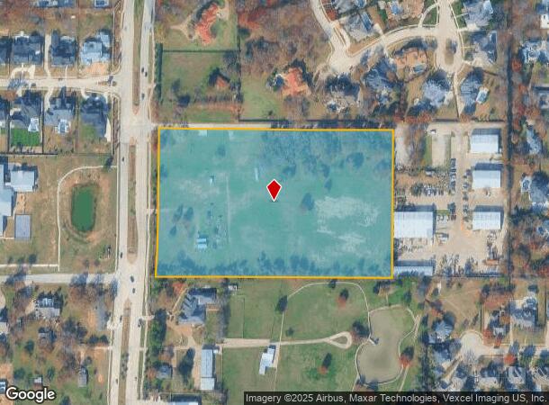
755 Randol Mill Ave, Southlake, TX 76092


NEARBY LISTINGS FOR SALE OR LEASE
Property Detail
755 Randol Mill Ave
03882462
Foster, Ben J Survey
Residentialacreage
FOSTER, BEN J SURVEY ABSTRACT 519 TRACT 1A01A3 ABST 519 TR 1A01A3 HS
X
Tarrant
48121C0660G
Texas
2024
1.06 AC
2025
Westlake/Grapevine
113906
Dallas/Ft Worth
796 SF
Dallas-Fort Worth-Arlington, TX
DEMOGRAPHICS near 755 Randol Mill Ave
1 Mile
3 Mile
5 Mile
2024 Total Population
5,384
48,356
152,949
2029 Population
5,677
51,184
164,070
Pop Growth 2024-2029
+ 5.44%
+ 5.85%
+ 7.27%
Average Age
41
41
40
2024 Total Households
1,696
15,700
51,542
HH Growth 2024-2029
+ 5.60%
+ 5.98%
+ 7.51%
Median Household Inc
$192,003
$200,673
$151,049
Avg Household Size
3.10
3.00
2.90
2024 Avg HH Vehicles
3.00
2.00
2.00
Median Home Value
$733,170
$717,835
$511,885
Median Year Built
1995
1998
1997
Nearby Places
Map Layers
Map Styles
 Street
 Aerial
- Restaurants
- Banks
- Shops
- Fitness
- Groceries
PUBLIC TRANSPORTATION
AIRPORT
Dallas-Fort Worth International
DRIVE
WALK
Distance
Dallas-Fort Worth International
22 min
13.3 mi
Dallas Love Field
DRIVE
WALK
Distance
Dallas Love Field
41 min
27.1 mi
Freight Ports
Port of Shreveport
DRIVE
WALK
Distance
Port of Shreveport
251 min
226.9 mi
Nearby Properties
Address
Land Use
TOTAL SIZE
Lot Size
Zoning
Address
Land Use
TOTAL SIZE
Lot Size
Zoning
1,315,600 SF
106.95 AC
Address
Land Use
TOTAL SIZE
Lot Size
Zoning
255,937 SF
55.03 AC
Address
Land Use
TOTAL SIZE
Lot Size
Zoning
1,603,686 SF
81.43 AC
Address
Land Use
TOTAL SIZE
Lot Size
Zoning
203,458 SF
16.58 AC
Address
Land Use
TOTAL SIZE
Lot Size
Zoning
1,872,003 SF
52.16 AC
Address
Land Use
TOTAL SIZE
Lot Size
Zoning
298,773 SF
17.40 AC
Address
Land Use
TOTAL SIZE
Lot Size
Zoning
1,420,661 SF
40.78 AC
Address
Land Use
TOTAL SIZE
Lot Size
Zoning
270,044 SF
30.51 AC
Address
Land Use
TOTAL SIZE
Lot Size
Zoning
314,692 SF
78.63 AC
Address
Land Use
TOTAL SIZE
Lot Size
Zoning
645,587 SF
12.57 AC
Address
Land Use
TOTAL SIZE
Lot Size
Zoning
367,008 SF
29.55 AC
Address
Land Use
TOTAL SIZE
Lot Size
Zoning
258,155 SF
5.55 AC
Address
Land Use
TOTAL SIZE
Lot Size
Zoning
342,090 SF
12.83 AC
Address
Land Use
TOTAL SIZE
Lot Size
Zoning
191,001 SF
17.58 AC
Address
Land Use
TOTAL SIZE
Lot Size
Zoning
597,855 SF
Address
Land Use
TOTAL SIZE
Lot Size
Zoning
1,188,418 SF
20.15 AC
Address
Land Use
TOTAL SIZE
Lot Size
Zoning
219,109 SF
24.78 AC
Address
Land Use
TOTAL SIZE
Lot Size
Zoning
214,425 SF
6.24 AC
Address
Land Use
TOTAL SIZE
Lot Size
Zoning
121,348 SF
13.78 AC
Address
Land Use
TOTAL SIZE
Lot Size
Zoning
188,500 SF
6.28 AC
Address
Land Use
TOTAL SIZE
Lot Size
Zoning
133,430 SF
19.75 AC
Address
Land Use
TOTAL SIZE
Lot Size
Zoning
317,920 SF
3.42 AC
Address
Land Use
TOTAL SIZE
Lot Size
Zoning
59,556 SF
13.40 AC
Address
Land Use
TOTAL SIZE
Lot Size
Zoning
25,965 SF
79.42 AC
Address
Land Use
TOTAL SIZE
Lot Size
Zoning
244,297 SF
6.29 AC
Address
Land Use
TOTAL SIZE
Lot Size
Zoning
105,813 SF
12.68 AC
Address
Land Use
TOTAL SIZE
Lot Size
Zoning
98,778 SF
11.96 AC
Address
Land Use
TOTAL SIZE
Lot Size
Zoning
153,206 SF
3 AC
Address
Land Use
TOTAL SIZE
Lot Size
Zoning
34,633 SF
6.58 AC
Address
Land Use
TOTAL SIZE
Lot Size
Zoning
101,941 SF
8.54 AC
The World's #1 Commercial Real Estate Marketplace
Connect with us
© 2025 CoStar Group
The information above has been obtained from sources believed reliable. While we do not doubt its accuracy we have not verified it and make no guarantee, warranty or representation about it. It is your responsibility to independently confirm its accuracy and completeness. Any projections, opinions, assumptions, or estimates used are for example only and do not represent the current or future performance of the property. The value of this transaction to you depends on tax and other factors which should be evaluated by your tax, financial, and legal advisors. You and your advisors should conduct a careful, independent investigation of the property to determine to your satisfaction the suitability of the property for your needs.