Property Record
755 Riverpoint Ct, West Sacramento, CA 95605

NEARBY LISTINGS FOR SALE OR LEASE
Property Detail
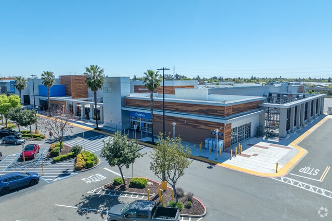
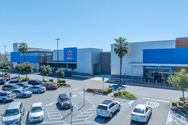
755 Riverpoint Ct
014-793-066-000
Riverpoint Marketplace
Storebuilding
Yolo
ARE
California
06067C0160J
22.03 AC
2024
West Sacramento
2025
Sacramento
010102
Sacramento--Roseville--Arden-Arcade, CA
216,425 SF
DEMOGRAPHICS near 755 Riverpoint Ct
1 Mile
3 Mile
5 Mile
2024 Total Population
10,278
63,286
211,637
2029 Population
10,358
64,330
214,678
Pop Growth 2024-2029
+ 0.78%
+ 1.65%
+ 1.44%
Average Age
37
38
38
2024 Total Households
3,775
25,028
86,418
HH Growth 2024-2029
+ 0.77%
+ 1.85%
+ 1.62%
Median Household Inc
$45,543
$67,883
$80,876
Avg Household Size
2.60
2.40
2.30
2024 Avg HH Vehicles
2.00
2.00
2.00
Median Home Value
$98,153
$438,711
$492,560
Median Year Built
1966
1983
1980
Nearby Places
Map Layers
Map Styles
 Street
 Aerial
- Restaurants
- Banks
- Shops
- Fitness
- Groceries
PUBLIC TRANSPORTATION
COMMUTER RAIL
Sacramento (Capitol Corridor - Capitol Corridor Joint Powers Authority)
DRIVE
WALK
Distance
Sacramento (Capitol Corridor - Capitol Corridor Joint Powers Authority)
7 min
3.4 mi
AIRPORT
Sacramento International
DRIVE
WALK
Distance
Sacramento International
19 min
11.8 mi
Freight Ports
Port of Stockton
DRIVE
WALK
Distance
Port of Stockton
58 min
48.8 mi
Nearby Properties
Address
Land Use
TOTAL SIZE
Lot Size
Zoning
Address
Land Use
TOTAL SIZE
Lot Size
Zoning
5.64 AC
C-3-SPD
Address
Land Use
TOTAL SIZE
Lot Size
Zoning
487,483 SF
1.12 AC
C-3-SPD
Address
Land Use
TOTAL SIZE
Lot Size
Zoning
399,626 SF
2.41 AC
C-3-SPD
Address
Land Use
TOTAL SIZE
Lot Size
Zoning
594,942 SF
2.39 AC
C-3-SPD
Address
Land Use
TOTAL SIZE
Lot Size
Zoning
676,447 SF
1.43 AC
C-3-SPD
Address
Land Use
TOTAL SIZE
Lot Size
Zoning
193,521 SF
0.60 AC
C-3-SPD
Address
Land Use
TOTAL SIZE
Lot Size
Zoning
339,329 SF
6.40 AC
R-5-PUD-SP
Address
Land Use
TOTAL SIZE
Lot Size
Zoning
213,557 SF
2.33 AC
C-3-SPD
Address
Land Use
TOTAL SIZE
Lot Size
Zoning
467,970 SF
4.59 AC
W-F
Address
Land Use
TOTAL SIZE
Lot Size
Zoning
318,616 SF
16.40 AC
R-2B-PUD
Address
Land Use
TOTAL SIZE
Lot Size
Zoning
R-4-PUD C-
Address
Land Use
TOTAL SIZE
Lot Size
Zoning
110,584 SF
9.76 AC
B-P
Address
Land Use
TOTAL SIZE
Lot Size
Zoning
0.13 AC
WF
Address
Land Use
TOTAL SIZE
Lot Size
Zoning
26,712 SF
1.90 AC
R-5-PUD-SP
Address
Land Use
TOTAL SIZE
Lot Size
Zoning
26,712 SF
1.85 AC
R-5-PUD-SP
Address
Land Use
TOTAL SIZE
Lot Size
Zoning
2.88 AC
C-3-SPD
Address
Land Use
TOTAL SIZE
Lot Size
Zoning
303,254 SF
10.63 AC
OB-PUD
Address
Land Use
TOTAL SIZE
Lot Size
Zoning
246,417 SF
1.19 AC
C-3-SPD
Address
Land Use
TOTAL SIZE
Lot Size
Zoning
405,074 SF
2.39 AC
C-3-SPD
Address
Land Use
TOTAL SIZE
Lot Size
Zoning
0.90 AC
C-3-SPD
Address
Land Use
TOTAL SIZE
Lot Size
Zoning
4.41 AC
W-F
Address
Land Use
TOTAL SIZE
Lot Size
Zoning
1.04 AC
C-2-SPD
Address
Land Use
TOTAL SIZE
Lot Size
Zoning
568,239 SF
32.68 AC
R-2B-PUD
Address
Land Use
TOTAL SIZE
Lot Size
Zoning
267,053 SF
22.19 AC
M2
Address
Land Use
TOTAL SIZE
Lot Size
Zoning
R-4-PUD
Address
Land Use
TOTAL SIZE
Lot Size
Zoning
379,161 SF
22.70 AC
MU
Address
Land Use
TOTAL SIZE
Lot Size
Zoning
253,713 SF
24.83 AC
M-L
Address
Land Use
TOTAL SIZE
Lot Size
Zoning
34,993 SF
9.06 AC
R-2B-PUD
Address
Land Use
TOTAL SIZE
Lot Size
Zoning
218,656 SF
0.08 AC
MU
The World's #1 Commercial Real Estate Marketplace
Connect with us
© 2025 CoStar Group
The information above has been obtained from sources believed reliable. While we do not doubt its accuracy we have not verified it and make no guarantee, warranty or representation about it. It is your responsibility to independently confirm its accuracy and completeness. Any projections, opinions, assumptions, or estimates used are for example only and do not represent the current or future performance of the property. The value of this transaction to you depends on tax and other factors which should be evaluated by your tax, financial, and legal advisors. You and your advisors should conduct a careful, independent investigation of the property to determine to your satisfaction the suitability of the property for your needs.