Property Record
755 W Coe Ave, Stanfield, OR 97875

Property Detail
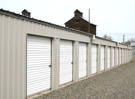
755 W Coe Ave
Countyproperty
UMATILLA
LI
Oregon
AE The base floodplain where base flood elevations are provided. AE Zones are now used on new format FIRMs instead of A1-A30 Zones.
1.52 AC
2025
Other Market Areas
2025
Hermiston-Pendleton, OR
951300
155455
13,200 SF
NEARBY LISTINGS FOR SALE OR LEASE
DEMOGRAPHICS near 755 W Coe Ave
1 mile
3 mile
5 mile
2025 Total Population
1,710
2,905
8,143
2030 Population
1,724
2,918
8,168
Pop Growth 2025-2030
+ 0.82%
+ 0.45%
+ 0.31%
Average Age
38
39
37
2025 Total Households
619
1,077
2,916
HH Growth 2025-2030
+ 0.81%
+ 0.28%
+ 0.27%
Median Household Inc
$55,869
$55,286
$65,445
Avg Household Size
2.80
2.70
2.80
2025 Avg HH Vehicles
2.00
2.00
2.00
Median Home Value
$216,092
$239,807
$317,769
Median Year Built
1974
1973
1978
Nearby Places
Map Layers
Map Styles
 Street
 Aerial
Layers
 Traffic
 Biking
Places
Listings with unknown addresses are not visible on the map
- Restaurants
- Banks
- Shops
- Fitness
- Groceries
PUBLIC TRANSPORTATION
AIRPORT
Tri-Cities
Drive
Walk
Distance
Tri-Cities
54 min
41.9 mi
Nearby Properties
Address
Land Use
TOTAL SIZE
Lot Size
Zoning
Address
Land Use
TOTAL SIZE
Lot Size
Zoning
1,144,892 SF
186.54 AC
C-2,M-2
Address
Land Use
TOTAL SIZE
Lot Size
Zoning
571.50 AC
EFU, F-1,
Address
Land Use
TOTAL SIZE
Lot Size
Zoning
48,499 SF
18.35 AC
R
Address
Land Use
TOTAL SIZE
Lot Size
Zoning
10,570 SF
14.69 AC
D-TC
Address
Land Use
TOTAL SIZE
Lot Size
Zoning
10 SF
10 AC
GI
Address
Land Use
TOTAL SIZE
Lot Size
Zoning
18,196 SF
3.16 AC
RLI
Address
Land Use
TOTAL SIZE
Lot Size
Zoning
576 SF
0.50 AC
D-TC
Address
Land Use
TOTAL SIZE
Lot Size
Zoning
13,903 SF
53.49 AC
POS
Address
Land Use
TOTAL SIZE
Lot Size
Zoning
12,020 SF
1.32 AC
R
Address
Land Use
TOTAL SIZE
Lot Size
Zoning
10,845 SF
1.02 AC
LI
Address
Land Use
TOTAL SIZE
Lot Size
Zoning
4,732.58 AC
EFU
Address
Land Use
TOTAL SIZE
Lot Size
Zoning
23,610 SF
8.35 AC
M-1
Address
Land Use
TOTAL SIZE
Lot Size
Zoning
10 SF
5.54 AC
LI
Address
Land Use
TOTAL SIZE
Lot Size
Zoning
20,736 SF
0.92 AC
R-MF
Address
Land Use
TOTAL SIZE
Lot Size
Zoning
9,046 SF
EFU
Address
Land Use
TOTAL SIZE
Lot Size
Zoning
17,456 SF
2.37 AC
R-MF,D
Address
Land Use
TOTAL SIZE
Lot Size
Zoning
10 SF
10 AC
GI
Address
Land Use
TOTAL SIZE
Lot Size
Zoning
6,912 SF
1.57 AC
TC
Address
Land Use
TOTAL SIZE
Lot Size
Zoning
7,410 SF
1.20 AC
R-4
Address
Land Use
TOTAL SIZE
Lot Size
Zoning
4,346 SF
6.56 AC
R1
Address
Land Use
TOTAL SIZE
Lot Size
Zoning
8,640 SF
1.44 AC
R-UH
Address
Land Use
TOTAL SIZE
Lot Size
Zoning
8,026 SF
118.46 AC
EFU
Address
Land Use
TOTAL SIZE
Lot Size
Zoning
4,834 SF
1.02 AC
R-3
Address
Land Use
TOTAL SIZE
Lot Size
Zoning
6,260 SF
109.23 AC
EFU-40
Address
Land Use
TOTAL SIZE
Lot Size
Zoning
3,463 SF
1 AC
R-4
Address
Land Use
TOTAL SIZE
Lot Size
Zoning
4,306 SF
1.07 AC
R-4
Address
Land Use
TOTAL SIZE
Lot Size
Zoning
3,841 SF
1.02 AC
R-4
Address
Land Use
TOTAL SIZE
Lot Size
Zoning
4,785 SF
4.04 AC
EFU-40
The World's #1 Commercial Real Estate Marketplace
Connect with us
© 2026 CoStar Group
The information above has been obtained from sources believed reliable. While we do not doubt its accuracy we have not verified it and make no guarantee, warranty or representation about it. It is your responsibility to independently confirm its accuracy and completeness. Any projections, opinions, assumptions, or estimates used are for example only and do not represent the current or future performance of the property. The value of this transaction to you depends on tax and other factors which should be evaluated by your tax, financial, and legal advisors. You and your advisors should conduct a careful, independent investigation of the property to determine to your satisfaction the suitability of the property for your needs.