Property Record
7550 Central Parke Blvd, Mason, OH 45040
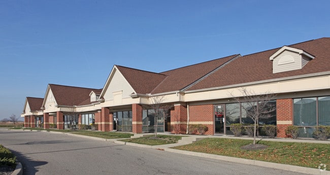

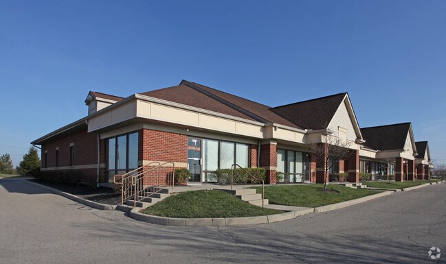
Property Detail
7550 Central Parke Blvd
16-34-200-071
CENTRAL PARKE
Officebuilding
WARREN
B and X Area of moderate flood hazard, usually the area between the limits of the 100-year and 500-year floods.
Ohio
2024
2.52 AC
2025
I-71 Corridor
032009
Cincinnati/Dayton
15,860 SF
Cincinnati, OH-KY-IN
NEARBY LISTINGS FOR SALE OR LEASE
DEMOGRAPHICS near 7550 Central Parke Blvd
1 mile
3 mile
5 mile
2025 Total Population
9,989
68,265
158,262
2030 Population
10,485
70,990
163,650
Pop Growth 2025-2030
+ 4.97%
+ 3.99%
+ 3.40%
Average Age
41
40
41
2025 Total Households
3,863
26,284
59,708
HH Growth 2025-2030
+ 5.05%
+ 4.06%
+ 3.40%
Median Household Inc
$129,695
$115,862
$118,341
Avg Household Size
2.50
2.50
2.60
2025 Avg HH Vehicles
2.00
2.00
2.00
Median Home Value
$452,719
$378,441
$399,832
Median Year Built
1996
1992
1991
Nearby Places
Map Layers
Map Styles
 Street
 Aerial
Layers
 Traffic
 Biking
Places
Listings with unknown addresses are not visible on the map
- Restaurants
- Banks
- Shops
- Fitness
- Groceries
PUBLIC TRANSPORTATION
AIRPORT
Cincinnati/Northern Kentucky International
Drive
Walk
Distance
Cincinnati/Northern Kentucky International
40 min
34.1 mi
Freight Ports
Virginia Port Authority - Richmond
Drive
Walk
Distance
Virginia Port Authority - Richmond
1 min
395.0 mi
SALE & LEASE HISTORY
LISTING DATE
SALE/LEASE

May 15, 2019
For Lease
Feb 20, 2019
For Lease
Nearby Properties
Address
Land Use
TOTAL SIZE
Lot Size
Zoning
Address
Land Use
TOTAL SIZE
Lot Size
Zoning
232.72 AC
Address
Land Use
TOTAL SIZE
Lot Size
Zoning
Address
Land Use
TOTAL SIZE
Lot Size
Zoning
274,436 SF
27.12 AC
Address
Land Use
TOTAL SIZE
Lot Size
Zoning
590.28 AC
Address
Land Use
TOTAL SIZE
Lot Size
Zoning
17,484 SF
35.55 AC
Address
Land Use
TOTAL SIZE
Lot Size
Zoning
80,767 SF
7.31 AC
Address
Land Use
TOTAL SIZE
Lot Size
Zoning
4,190 SF
36 AC
Address
Land Use
TOTAL SIZE
Lot Size
Zoning
71,866 SF
14.33 AC
Address
Land Use
TOTAL SIZE
Lot Size
Zoning
42,906 SF
23.76 AC
Address
Land Use
TOTAL SIZE
Lot Size
Zoning
9,804 SF
40 AC
Address
Land Use
TOTAL SIZE
Lot Size
Zoning
179,048 SF
12.32 AC
Address
Land Use
TOTAL SIZE
Lot Size
Zoning
121,429 SF
14.59 AC
Address
Land Use
TOTAL SIZE
Lot Size
Zoning
42,086 SF
8.17 AC
Address
Land Use
TOTAL SIZE
Lot Size
Zoning
40.92 AC
Address
Land Use
TOTAL SIZE
Lot Size
Zoning
211,734 SF
18.14 AC
Address
Land Use
TOTAL SIZE
Lot Size
Zoning
45.96 AC
Address
Land Use
TOTAL SIZE
Lot Size
Zoning
294,645 SF
42.76 AC
Address
Land Use
TOTAL SIZE
Lot Size
Zoning
67,636 SF
8.74 AC
Address
Land Use
TOTAL SIZE
Lot Size
Zoning
116,775 SF
12.37 AC
Address
Land Use
TOTAL SIZE
Lot Size
Zoning
2,173 SF
22 AC
E
Address
Land Use
TOTAL SIZE
Lot Size
Zoning
85,759 SF
13.80 AC
Address
Land Use
TOTAL SIZE
Lot Size
Zoning
30,844 SF
15.87 AC
Address
Land Use
TOTAL SIZE
Lot Size
Zoning
8,801 SF
29.24 AC
Address
Land Use
TOTAL SIZE
Lot Size
Zoning
35,188 SF
38.49 AC
Address
Land Use
TOTAL SIZE
Lot Size
Zoning
1,248 SF
21.67 AC
Address
Land Use
TOTAL SIZE
Lot Size
Zoning
1,600 SF
18.74 AC
Address
Land Use
TOTAL SIZE
Lot Size
Zoning
46,424 SF
11.61 AC
Address
Land Use
TOTAL SIZE
Lot Size
Zoning
9,744 SF
13.93 AC
E
Address
Land Use
TOTAL SIZE
Lot Size
Zoning
18,883 SF
24.97 AC
Address
Land Use
TOTAL SIZE
Lot Size
Zoning
13,584 SF
3.20 AC
The World's #1 Commercial Real Estate Marketplace
Connect with us
© 2026 CoStar Group
The information above has been obtained from sources believed reliable. While we do not doubt its accuracy we have not verified it and make no guarantee, warranty or representation about it. It is your responsibility to independently confirm its accuracy and completeness. Any projections, opinions, assumptions, or estimates used are for example only and do not represent the current or future performance of the property. The value of this transaction to you depends on tax and other factors which should be evaluated by your tax, financial, and legal advisors. You and your advisors should conduct a careful, independent investigation of the property to determine to your satisfaction the suitability of the property for your needs.