Property Record
7560 Chesteridge Ave, Southaven, MS 38671

NEARBY LISTINGS FOR SALE OR LEASE
-
-
View all Southaven listings for sale on LoopNet.com
Property Detail
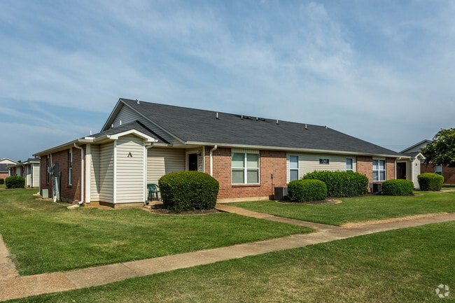
7560 Chesteridge Ave
Memphis, TN-MS-AR
Pine Ridge Apartments Ph I
1087261100000200
HERITAGE HILLS PUD PINERIDGE APARTMENT PHASE I LOT 2
Apartment
DeSoto
AE
Mississippi
47157C0560F
2
2025
7.11 AC
2025
Olive Branch
070412
Memphis
3,773 SF
DEMOGRAPHICS near 7560 Chesteridge Ave
1 Mile
3 Mile
5 Mile
2024 Total Population
6,644
60,156
122,626
2029 Population
7,210
64,990
129,458
Pop Growth 2024-2029
+ 8.52%
+ 8.04%
+ 5.57%
Average Age
37
37
38
2024 Total Households
2,608
23,248
46,375
HH Growth 2024-2029
+ 8.59%
+ 8.22%
+ 5.58%
Median Household Inc
$37,747
$46,829
$50,551
Avg Household Size
2.40
2.50
2.60
2024 Avg HH Vehicles
2.00
2.00
2.00
Median Home Value
$125,349
$140,863
$152,817
Median Year Built
1980
1987
1982
Nearby Places
Map Layers
Map Styles
 Street
 Aerial
- Restaurants
- Banks
- Shops
- Fitness
- Groceries
PUBLIC TRANSPORTATION
AIRPORT
Memphis International
DRIVE
WALK
Distance
Memphis International
15 min
7.9 mi
Freight Ports
Port of Shreveport
DRIVE
WALK
Distance
Port of Shreveport
418 min
381.9 mi
Nearby Properties
Address
Land Use
TOTAL SIZE
Lot Size
Zoning
Address
Land Use
TOTAL SIZE
Lot Size
Zoning
1,013,319 SF
38.86 AC
EMP
Address
Land Use
TOTAL SIZE
Lot Size
Zoning
732,894 SF
79.73 AC
WD
Address
Land Use
TOTAL SIZE
Lot Size
Zoning
1,009,363 SF
78.56 AC
EMP
Address
Land Use
TOTAL SIZE
Lot Size
Zoning
853,440 SF
39.22 AC
EMP
Address
Land Use
TOTAL SIZE
Lot Size
Zoning
1,021,440 SF
57.67 AC
M-1
Address
Land Use
TOTAL SIZE
Lot Size
Zoning
432,700 SF
28.16 AC
EMP
Address
Land Use
TOTAL SIZE
Lot Size
Zoning
810,225 SF
47.71 AC
M-1
Address
Land Use
TOTAL SIZE
Lot Size
Zoning
188,404 SF
59.17 AC
R-8
Address
Land Use
TOTAL SIZE
Lot Size
Zoning
581,346 SF
39.98 AC
PUD
Address
Land Use
TOTAL SIZE
Lot Size
Zoning
62,561 SF
33.01 AC
PUD
Address
Land Use
TOTAL SIZE
Lot Size
Zoning
18,830 SF
25.45 AC
PUD
Address
Land Use
TOTAL SIZE
Lot Size
Zoning
740,964 SF
34.89 AC
PBP
Address
Land Use
TOTAL SIZE
Lot Size
Zoning
61,164 SF
36.95 AC
RU-3
Address
Land Use
TOTAL SIZE
Lot Size
Zoning
15,472 SF
25.97 AC
PUD
Address
Land Use
TOTAL SIZE
Lot Size
Zoning
230,103 SF
22.07 AC
CMU-2
Address
Land Use
TOTAL SIZE
Lot Size
Zoning
779,632 SF
46.22 AC
PBP
Address
Land Use
TOTAL SIZE
Lot Size
Zoning
222,932 SF
19.52 AC
C-1
Address
Land Use
TOTAL SIZE
Lot Size
Zoning
702,792 SF
37.11 AC
PBP
Address
Land Use
TOTAL SIZE
Lot Size
Zoning
619,021 SF
28.71 AC
PBP
Address
Land Use
TOTAL SIZE
Lot Size
Zoning
601,700 SF
29.51 AC
PBP
Address
Land Use
TOTAL SIZE
Lot Size
Zoning
14,122 SF
24 AC
PUD
Address
Land Use
TOTAL SIZE
Lot Size
Zoning
408,580 SF
31.28 AC
M-1
Address
Land Use
TOTAL SIZE
Lot Size
Zoning
111,541 SF
8.88 AC
R-8
Address
Land Use
TOTAL SIZE
Lot Size
Zoning
519,647 SF
29.67 AC
PBP
Address
Land Use
TOTAL SIZE
Lot Size
Zoning
554,433 SF
24.57 AC
PBP
Address
Land Use
TOTAL SIZE
Lot Size
Zoning
18,228 SF
6.17 AC
CMU-1
Address
Land Use
TOTAL SIZE
Lot Size
Zoning
454,272 SF
22.28 AC
PBP
Address
Land Use
TOTAL SIZE
Lot Size
Zoning
12,775 SF
26.29 AC
PUD
Address
Land Use
TOTAL SIZE
Lot Size
Zoning
432,771 SF
21.84 AC
PBP
Address
Land Use
TOTAL SIZE
Lot Size
Zoning
404,676 SF
19.25 AC
PBP
The World's #1 Commercial Real Estate Marketplace
Connect with us
© 2026 CoStar Group
The information above has been obtained from sources believed reliable. While we do not doubt its accuracy we have not verified it and make no guarantee, warranty or representation about it. It is your responsibility to independently confirm its accuracy and completeness. Any projections, opinions, assumptions, or estimates used are for example only and do not represent the current or future performance of the property. The value of this transaction to you depends on tax and other factors which should be evaluated by your tax, financial, and legal advisors. You and your advisors should conduct a careful, independent investigation of the property to determine to your satisfaction the suitability of the property for your needs.