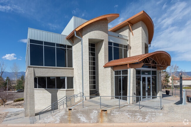
Property Record
7560 Rangewood Dr, Colorado Springs, CO 80920

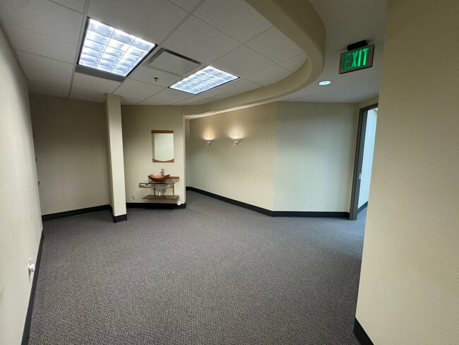

Current Lease Availabilities
NEARBY LISTINGS FOR SALE OR LEASE
Property Detail
7560 Rangewood Dr
Colorado Springs, CO
Mdp Office Park
63023-19-009
TR A & LOT 2 M D P OFFICE PARK
Commercialnec
El Paso
X
Colorado
08041C0509G
2
2024
2.32 AC
2025
Northeast
006802
Colorado Springs
13,765 SF
DEMOGRAPHICS near 7560 Rangewood Dr
1 Mile
3 Mile
5 Mile
2024 Total Population
14,423
112,796
228,344
2029 Population
14,950
117,956
239,170
Pop Growth 2024-2029
+ 3.65%
+ 4.57%
+ 4.74%
Average Age
37
38
38
2024 Total Households
5,397
42,126
86,750
HH Growth 2024-2029
+ 3.78%
+ 4.74%
+ 4.88%
Median Household Inc
$93,932
$97,002
$92,578
Avg Household Size
2.70
2.60
2.60
2024 Avg HH Vehicles
2.00
2.00
2.00
Median Home Value
$380,749
$422,199
$416,201
Median Year Built
1987
1994
1994
Nearby Places
Map Layers
Map Styles
 Street
 Aerial
- Restaurants
- Banks
- Shops
- Fitness
- Groceries
PUBLIC TRANSPORTATION
AIRPORT
City of Colorado Springs Municipal
DRIVE
WALK
Distance
City of Colorado Springs Municipal
23 min
11.8 mi
Nearby Properties
Address
Land Use
TOTAL SIZE
Lot Size
Zoning
Address
Land Use
TOTAL SIZE
Lot Size
Zoning
1,129,761 SF
32.88 AC
MX-M HR AO
Address
Land Use
TOTAL SIZE
Lot Size
Zoning
361,165 SF
59.11 AC
PDZ
Address
Land Use
TOTAL SIZE
Lot Size
Zoning
356,093 SF
16.27 AC
R-5 AO SS
Address
Land Use
TOTAL SIZE
Lot Size
Zoning
32,792 SF
7 AC
MX-M AO
Address
Land Use
TOTAL SIZE
Lot Size
Zoning
409,164 SF
19.26 AC
PUD
Address
Land Use
TOTAL SIZE
Lot Size
Zoning
103,166 SF
8.88 AC
BP
Address
Land Use
TOTAL SIZE
Lot Size
Zoning
86,020 SF
15.30 AC
R-1 6 CU H
Address
Land Use
TOTAL SIZE
Lot Size
Zoning
82,316 SF
4.08 AC
R-5/CR SS
Address
Land Use
TOTAL SIZE
Lot Size
Zoning
80,110 SF
2.61 AC
OR CU
Address
Land Use
TOTAL SIZE
Lot Size
Zoning
43,033 SF
17 AC
MX-M AO
Address
Land Use
TOTAL SIZE
Lot Size
Zoning
114,474 SF
12.95 AC
BP
Address
Land Use
TOTAL SIZE
Lot Size
Zoning
15,559 SF
6 AC
MX-M CU AO
Address
Land Use
TOTAL SIZE
Lot Size
Zoning
15,559 SF
6 AC
MX-M CU AO
Address
Land Use
TOTAL SIZE
Lot Size
Zoning
15,559 SF
6 AC
MX-M CU AO
Address
Land Use
TOTAL SIZE
Lot Size
Zoning
14,257 SF
6 AC
MX-M CU AO
Address
Land Use
TOTAL SIZE
Lot Size
Zoning
14,257 SF
6 AC
MX-M CU AO
Address
Land Use
TOTAL SIZE
Lot Size
Zoning
14,257 SF
6 AC
MX-M CU AO
Address
Land Use
TOTAL SIZE
Lot Size
Zoning
13,882 SF
6 AC
MX-M CU AO
Address
Land Use
TOTAL SIZE
Lot Size
Zoning
12,827 SF
6 AC
MX-M CU AO
Address
Land Use
TOTAL SIZE
Lot Size
Zoning
1,251,233 SF
17.63 AC
BP/CR HR
Address
Land Use
TOTAL SIZE
Lot Size
Zoning
58,774 SF
5 AC
BP
Address
Land Use
TOTAL SIZE
Lot Size
Zoning
41,117 SF
5.04 AC
MX-M
Address
Land Use
TOTAL SIZE
Lot Size
Zoning
64,928 SF
31.47 AC
A
Address
Land Use
TOTAL SIZE
Lot Size
Zoning
8,830 SF
6 AC
MX-M CU AO
Address
Land Use
TOTAL SIZE
Lot Size
Zoning
8,830 SF
6 AC
MX-M CU AO
Address
Land Use
TOTAL SIZE
Lot Size
Zoning
71,542 SF
10.11 AC
PF
Address
Land Use
TOTAL SIZE
Lot Size
Zoning
30,475 SF
13.03 AC
MX-M/CR AO
Address
Land Use
TOTAL SIZE
Lot Size
Zoning
35,862 SF
5.95 AC
MX-N
Address
Land Use
TOTAL SIZE
Lot Size
Zoning
5,934 SF
6 AC
MX-M CU AO
Address
Land Use
TOTAL SIZE
Lot Size
Zoning
4,752 SF
6 AC
MX-M CU AO
The World's #1 Commercial Real Estate Marketplace
Connect with us
© 2025 CoStar Group
The information above has been obtained from sources believed reliable. While we do not doubt its accuracy we have not verified it and make no guarantee, warranty or representation about it. It is your responsibility to independently confirm its accuracy and completeness. Any projections, opinions, assumptions, or estimates used are for example only and do not represent the current or future performance of the property. The value of this transaction to you depends on tax and other factors which should be evaluated by your tax, financial, and legal advisors. You and your advisors should conduct a careful, independent investigation of the property to determine to your satisfaction the suitability of the property for your needs.