Property Record
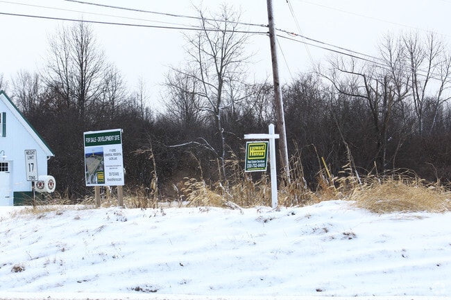
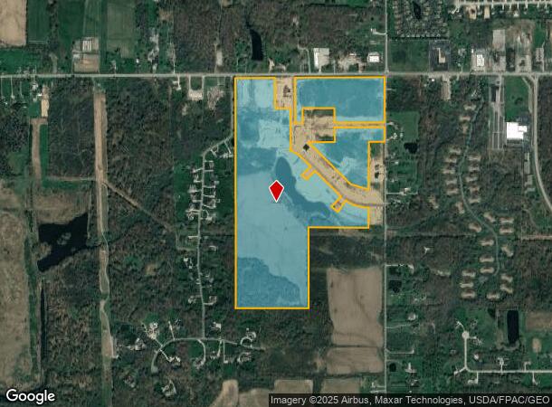
7561 W Akron Canfield Rd, Canfield, OH 44406
NEARBY LISTINGS FOR SALE OR LEASE
-
-
View all Canfield listings for sale on LoopNet.com
Property Detail
7561 W Akron Canfield Rd
Youngstown/Warren/Boardman
Township/Canfield 03 Div
Youngstown-Warren-Boardman, OH-PA
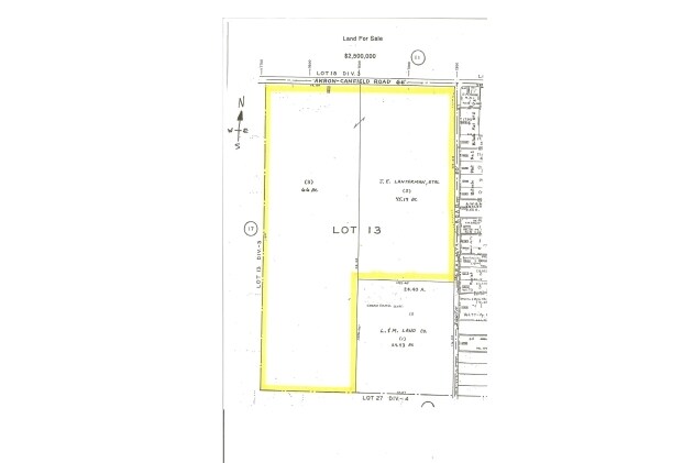
GL 13 DIV 3
26-018-0-003.00-0
Mahoning
Agriculturalland
Ohio
2024
13
2024
91.76 AC
812200
Mahoning County
2,500 SF
DEMOGRAPHICS near 7561 W Akron Canfield Rd
1 Mile
3 Mile
5 Mile
2024 Total Population
1,210
10,970
34,634
2029 Population
1,169
10,628
33,499
Pop Growth 2024-2029
(3.39%)
(3.12%)
(3.28%)
Average Age
45
45
45
2024 Total Households
464
4,441
14,651
HH Growth 2024-2029
(3.45%)
(3.22%)
(3.31%)
Median Household Inc
$91,527
$95,712
$77,494
Avg Household Size
2.60
2.50
2.30
2024 Avg HH Vehicles
2.00
2.00
2.00
Median Home Value
$283,221
$243,540
$210,646
Median Year Built
1987
1974
1977
Nearby Places
Map Layers
Map Styles
 Street
 Aerial
- Restaurants
- Banks
- Shops
- Fitness
- Groceries
SALE & LEASE HISTORY
LISTING DATE
SALE/LEASE

Feb 01, 2017
For Sale
Feb 01, 2017
For Sale
Nearby Properties
Address
Land Use
TOTAL SIZE
Lot Size
Zoning
Address
Land Use
TOTAL SIZE
Lot Size
Zoning
326,658 SF
78.41 AC
S
Address
Land Use
TOTAL SIZE
Lot Size
Zoning
Address
Land Use
TOTAL SIZE
Lot Size
Zoning
161,184 SF
29.51 AC
S
Address
Land Use
TOTAL SIZE
Lot Size
Zoning
213,207 SF
18.39 AC
M1
Address
Land Use
TOTAL SIZE
Lot Size
Zoning
Address
Land Use
TOTAL SIZE
Lot Size
Zoning
33,854 SF
3.36 AC
R1
Address
Land Use
TOTAL SIZE
Lot Size
Zoning
332.96 AC
A
Address
Land Use
TOTAL SIZE
Lot Size
Zoning
163,207 SF
9.19 AC
S
Address
Land Use
TOTAL SIZE
Lot Size
Zoning
46,813 SF
8.40 AC
Address
Land Use
TOTAL SIZE
Lot Size
Zoning
56,432 SF
8.42 AC
B3
Address
Land Use
TOTAL SIZE
Lot Size
Zoning
58,972 SF
23.65 AC
S
Address
Land Use
TOTAL SIZE
Lot Size
Zoning
4,014 SF
22.66 AC
AG
Address
Land Use
TOTAL SIZE
Lot Size
Zoning
43,236 SF
13.30 AC
S
Address
Land Use
TOTAL SIZE
Lot Size
Zoning
39,684 SF
4.48 AC
B3
Address
Land Use
TOTAL SIZE
Lot Size
Zoning
31,542 SF
7.83 AC
B2
Address
Land Use
TOTAL SIZE
Lot Size
Zoning
18,391 SF
2.69 AC
R2
Address
Land Use
TOTAL SIZE
Lot Size
Zoning
55,109 SF
13.97 AC
S
Address
Land Use
TOTAL SIZE
Lot Size
Zoning
100,460 SF
10.22 AC
I
Address
Land Use
TOTAL SIZE
Lot Size
Zoning
6,687 SF
1.99 AC
B
Address
Land Use
TOTAL SIZE
Lot Size
Zoning
26,760 SF
103.91 AC
AG
Address
Land Use
TOTAL SIZE
Lot Size
Zoning
33,395 SF
5.63 AC
B2
Address
Land Use
TOTAL SIZE
Lot Size
Zoning
6,342 SF
1.72 AC
B
Address
Land Use
TOTAL SIZE
Lot Size
Zoning
27,385 SF
6.72 AC
S
Address
Land Use
TOTAL SIZE
Lot Size
Zoning
17,692 SF
48.17 AC
A
Address
Land Use
TOTAL SIZE
Lot Size
Zoning
21,594 SF
6.07 AC
R5
Address
Land Use
TOTAL SIZE
Lot Size
Zoning
5,385 SF
1.61 AC
B
Address
Land Use
TOTAL SIZE
Lot Size
Zoning
40,178 SF
3.50 AC
S
Address
Land Use
TOTAL SIZE
Lot Size
Zoning
19,088 SF
80.13 AC
A
Address
Land Use
TOTAL SIZE
Lot Size
Zoning
31,791 SF
2.29 AC
S
Address
Land Use
TOTAL SIZE
Lot Size
Zoning
57,682 SF
3.79 AC
I
The World's #1 Commercial Real Estate Marketplace
Connect with us
© 2026 CoStar Group
The information above has been obtained from sources believed reliable. While we do not doubt its accuracy we have not verified it and make no guarantee, warranty or representation about it. It is your responsibility to independently confirm its accuracy and completeness. Any projections, opinions, assumptions, or estimates used are for example only and do not represent the current or future performance of the property. The value of this transaction to you depends on tax and other factors which should be evaluated by your tax, financial, and legal advisors. You and your advisors should conduct a careful, independent investigation of the property to determine to your satisfaction the suitability of the property for your needs.