Property Record
7575 Dr Phillips Blvd, Orlando, FL 32819
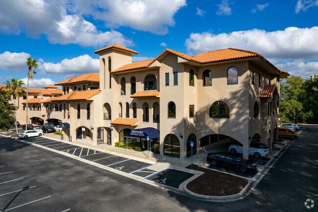

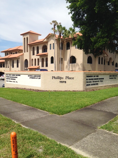

Property Detail
7575 Dr Phillips Blvd
26-2328-0000-00-067
BEG 1170 FT E & 611.52 FT W OF SW COR OF SEC RUN N 640 FT NL Y ALONG A CURVE 38.02 FT SELY ALONG A CURVE 124.91 FT N 67 D EG E 25 FT S 22 DEG E 540 FT S 30 DEG E 133.9 FT SWLY ALONG
Officebuilding
Orange
RSTD C-1
Florida
B and X Area of moderate flood hazard, usually the area between the limits of the 100-year and 500-year floods.
67
2025
3.70 AC
2025
Tourist Corridor
014813
Orlando
94,512 SF
Orlando-Kissimmee-Sanford, FL
NEARBY LISTINGS FOR SALE OR LEASE
DEMOGRAPHICS near 7575 Dr Phillips Blvd
1 mile
3 mile
5 mile
2025 Total Population
11,264
53,367
188,282
2030 Population
12,527
59,356
206,288
Pop Growth 2025-2030
+ 11.21%
+ 11.22%
+ 9.56%
Average Age
44
42
38
2025 Total Households
4,885
20,629
71,925
HH Growth 2025-2030
+ 11.89%
+ 11.76%
+ 10.04%
Median Household Inc
$104,949
$106,242
$80,208
Avg Household Size
2.30
2.50
2.60
2025 Avg HH Vehicles
2.00
2.00
2.00
Median Home Value
$545,871
$613,012
$509,621
Median Year Built
2001
1994
1997
Nearby Places
Map Layers
Map Styles
 Street
 Aerial
Transit
 Traffic
 Biking
Places
Listings with unknown addresses are not visible on the map
- Restaurants
- Banks
- Shops
- Fitness
- Groceries
PUBLIC TRANSPORTATION
COMMUTER RAIL
Sand Lake Road (SunRail - Florida Department of Transportation)
Drive
Walk
Distance
Sand Lake Road (SunRail - Florida Department of Transportation)
15 min
8.4 mi
Orlando Health/Amtrak (SunRail - Florida Department of Transportation)
Drive
Walk
Distance
Orlando Health/Amtrak (SunRail - Florida Department of Transportation)
15 min
9.8 mi
AIRPORT
Orlando International
Drive
Walk
Distance
Orlando International
22 min
12.6 mi
Orlando Sanford International
Drive
Walk
Distance
Orlando Sanford International
48 min
36.9 mi
Freight Ports
Port Canaveral
Drive
Walk
Distance
Port Canaveral
70 min
55.1 mi
SALE & LEASE HISTORY
LISTING DATE
SALE/LEASE

Sep 30, 2021
For Lease
Sep 25, 2016
For Lease
Sep 19, 2024
For Lease
Jun 18, 2021
For Lease
Jun 07, 2019
For Lease
Jan 20, 2021
For Lease
Apr 23, 2021
For Lease
Nearby Properties
Address
Land Use
TOTAL SIZE
Lot Size
Zoning
Address
Land Use
TOTAL SIZE
Lot Size
Zoning
4,537,256 SF
116.95 AC
C-2
Address
Land Use
TOTAL SIZE
Lot Size
Zoning
1,144,744 SF
341.89 AC
P-D
Address
Land Use
TOTAL SIZE
Lot Size
Zoning
2,991,707 SF
209.18 AC
P-D
Address
Land Use
TOTAL SIZE
Lot Size
Zoning
2,749,886 SF
28.19 AC
C-2
Address
Land Use
TOTAL SIZE
Lot Size
Zoning
1,975,273 SF
108.43 AC
AC-3/MA
Address
Land Use
TOTAL SIZE
Lot Size
Zoning
961,099 SF
53.30 AC
AC-3/MA
Address
Land Use
TOTAL SIZE
Lot Size
Zoning
1,185,430 SF
101.60 AC
AC-3/MA
Address
Land Use
TOTAL SIZE
Lot Size
Zoning
1,644,096 SF
25.95 AC
P-D
Address
Land Use
TOTAL SIZE
Lot Size
Zoning
2,650,536 SF
270.51 AC
P-D
Address
Land Use
TOTAL SIZE
Lot Size
Zoning
1,886,760 SF
39.58 AC
AC-3/MA
Address
Land Use
TOTAL SIZE
Lot Size
Zoning
685,382 SF
118.46 AC
P-D
Address
Land Use
TOTAL SIZE
Lot Size
Zoning
599,757 SF
14.42 AC
P-D
Address
Land Use
TOTAL SIZE
Lot Size
Zoning
7,091,624 SF
69.06 AC
AC-3/MA
Address
Land Use
TOTAL SIZE
Lot Size
Zoning
565,692 SF
20.96 AC
P-D
Address
Land Use
TOTAL SIZE
Lot Size
Zoning
1,049,539 SF
51.78 AC
AC-3/MA
Address
Land Use
TOTAL SIZE
Lot Size
Zoning
628,040 SF
20.16 AC
AC-3/MA
Address
Land Use
TOTAL SIZE
Lot Size
Zoning
1,689,748 SF
28.45 AC
PD/SP
Address
Land Use
TOTAL SIZE
Lot Size
Zoning
1,560,635 SF
20.91 AC
C-2
Address
Land Use
TOTAL SIZE
Lot Size
Zoning
472,100 SF
19.48 AC
P-D
Address
Land Use
TOTAL SIZE
Lot Size
Zoning
1,374,230 SF
20.86 AC
AC-3/MA
Address
Land Use
TOTAL SIZE
Lot Size
Zoning
276,852 SF
3.04 AC
P-D
Address
Land Use
TOTAL SIZE
Lot Size
Zoning
1,438,825 SF
31.14 AC
AC-3/MA
Address
Land Use
TOTAL SIZE
Lot Size
Zoning
1,008,278 SF
35.15 AC
AC-3/MA
Address
Land Use
TOTAL SIZE
Lot Size
Zoning
1,021 SF
1.04 AC
P-D
Address
Land Use
TOTAL SIZE
Lot Size
Zoning
701,216 SF
A-ORL-AC-3
Address
Land Use
TOTAL SIZE
Lot Size
Zoning
490,183 SF
28.16 AC
AC-3/SP
Address
Land Use
TOTAL SIZE
Lot Size
Zoning
754,480 SF
18.69 AC
P-D
Address
Land Use
TOTAL SIZE
Lot Size
Zoning
548,548 SF
16.05 AC
C-2
Address
Land Use
TOTAL SIZE
Lot Size
Zoning
426,493 SF
51.27 AC
AC-3/SP
Address
Land Use
TOTAL SIZE
Lot Size
Zoning
1,420,315 SF
28.56 AC
P-D
The World's #1 Commercial Real Estate Marketplace
Connect with us
© 2026 CoStar Group
The information above has been obtained from sources believed reliable. While we do not doubt its accuracy we have not verified it and make no guarantee, warranty or representation about it. It is your responsibility to independently confirm its accuracy and completeness. Any projections, opinions, assumptions, or estimates used are for example only and do not represent the current or future performance of the property. The value of this transaction to you depends on tax and other factors which should be evaluated by your tax, financial, and legal advisors. You and your advisors should conduct a careful, independent investigation of the property to determine to your satisfaction the suitability of the property for your needs.