Property Record
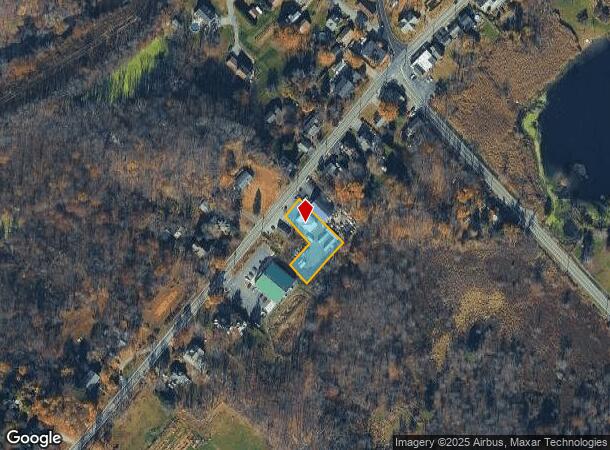
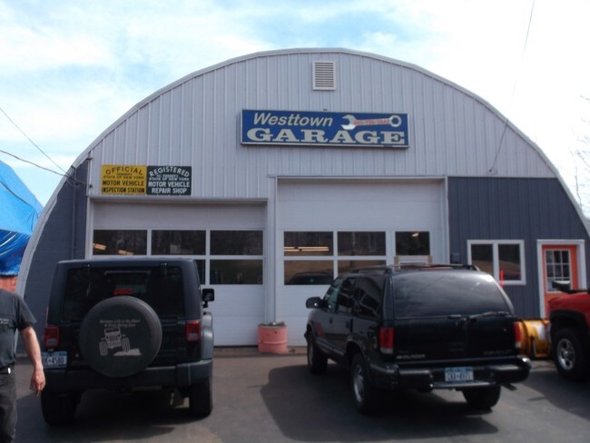
758 Route 284, Westtown, NY 10998
NEARBY LISTINGS FOR SALE OR LEASE
Property Detail
758 Route 284
333889-010-000-0004-002.200-0000
Orange
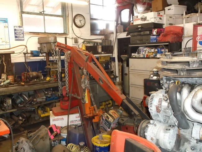
Autorepair
New York
X
2.200
36071C0408E
0.43 AC
2024
Monroe
2024
Northern New Jersey
011702
New York-Jersey City-White Plains, NY-NJ
DEMOGRAPHICS near 758 Route 284
1 Mile
3 Mile
5 Mile
2024 Total Population
824
4,970
11,462
2029 Population
828
4,967
11,543
Pop Growth 2024-2029
+ 0.49%
(0.06%)
+ 0.71%
Average Age
40
40
40
2024 Total Households
271
1,706
3,962
HH Growth 2024-2029
+ 0.37%
0.00%
+ 0.73%
Median Household Inc
$120,356
$111,524
$118,827
Avg Household Size
3.00
2.90
2.80
2024 Avg HH Vehicles
3.00
3.00
2.00
Median Home Value
$398,610
$380,817
$365,261
Median Year Built
1982
1980
1981
Nearby Places
- Restaurants
- Banks
- Shops
- Fitness
- Groceries
PUBLIC TRANSPORTATION
AIRPORT
New York Stewart International
DRIVE
WALK
Distance
New York Stewart International
43 min
30.4 mi
Freight Ports
Port Newark Container Terminal
DRIVE
WALK
Distance
Port Newark Container Terminal
94 min
65.6 mi
SALE & LEASE HISTORY
LISTING DATE
SALE/LEASE

May 26, 2017
For Sale
Nearby Properties
Address
Land Use
TOTAL SIZE
Lot Size
Zoning
Address
Land Use
TOTAL SIZE
Lot Size
Zoning
10 AC
AR
Address
Land Use
TOTAL SIZE
Lot Size
Zoning
Address
Land Use
TOTAL SIZE
Lot Size
Zoning
1,200 SF
13.80 AC
AR
Address
Land Use
TOTAL SIZE
Lot Size
Zoning
200 AC
AP
Address
Land Use
TOTAL SIZE
Lot Size
Zoning
19.50 AC
AR
Address
Land Use
TOTAL SIZE
Lot Size
Zoning
18,180 SF
209.70 AC
BT
Address
Land Use
TOTAL SIZE
Lot Size
Zoning
0.23 AC
Address
Land Use
TOTAL SIZE
Lot Size
Zoning
15.30 AC
AR
Address
Land Use
TOTAL SIZE
Lot Size
Zoning
Address
Land Use
TOTAL SIZE
Lot Size
Zoning
44.30 AC
AR
Address
Land Use
TOTAL SIZE
Lot Size
Zoning
128.80 AC
AR
Address
Land Use
TOTAL SIZE
Lot Size
Zoning
7,922 SF
162.90 AC
AR
Address
Land Use
TOTAL SIZE
Lot Size
Zoning
105.80 AC
SR
Address
Land Use
TOTAL SIZE
Lot Size
Zoning
30.90 AC
AR
Address
Land Use
TOTAL SIZE
Lot Size
Zoning
70.10 AC
AR
Address
Land Use
TOTAL SIZE
Lot Size
Zoning
7,300 SF
4.70 AC
NC
Address
Land Use
TOTAL SIZE
Lot Size
Zoning
4,278 SF
168.10 AC
AR
Address
Land Use
TOTAL SIZE
Lot Size
Zoning
9.90 AC
Address
Land Use
TOTAL SIZE
Lot Size
Zoning
5,294 SF
150.40 AC
AR
Address
Land Use
TOTAL SIZE
Lot Size
Zoning
4,334 SF
169 AC
AR
Address
Land Use
TOTAL SIZE
Lot Size
Zoning
2,360 SF
275.10 AC
AR
Address
Land Use
TOTAL SIZE
Lot Size
Zoning
3,012 SF
85.40 AC
BT
Address
Land Use
TOTAL SIZE
Lot Size
Zoning
2,784 SF
140 AC
AR
Address
Land Use
TOTAL SIZE
Lot Size
Zoning
3,971 SF
156.10 AC
AR
Address
Land Use
TOTAL SIZE
Lot Size
Zoning
1,632 SF
91 AC
AR
Address
Land Use
TOTAL SIZE
Lot Size
Zoning
2,600 SF
179.80 AC
Address
Land Use
TOTAL SIZE
Lot Size
Zoning
16.80 AC
AR
Address
Land Use
TOTAL SIZE
Lot Size
Zoning
6,196 SF
24.50 AC
BT
Address
Land Use
TOTAL SIZE
Lot Size
Zoning
2,116 SF
60.30 AC
AR
Address
Land Use
TOTAL SIZE
Lot Size
Zoning
2,002 SF
74.60 AC
AR
The World's #1 Commercial Real Estate Marketplace
Connect with us
© 2025 CoStar Group
The information above has been obtained from sources believed reliable. While we do not doubt its accuracy we have not verified it and make no guarantee, warranty or representation about it. It is your responsibility to independently confirm its accuracy and completeness. Any projections, opinions, assumptions, or estimates used are for example only and do not represent the current or future performance of the property. The value of this transaction to you depends on tax and other factors which should be evaluated by your tax, financial, and legal advisors. You and your advisors should conduct a careful, independent investigation of the property to determine to your satisfaction the suitability of the property for your needs.