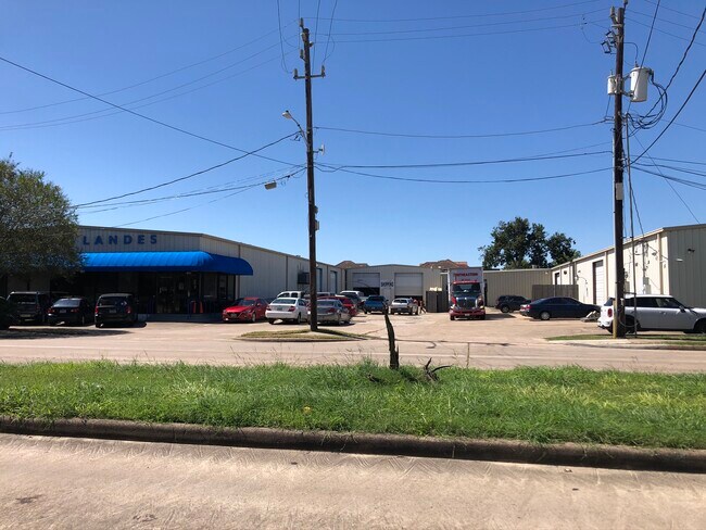
Property Record
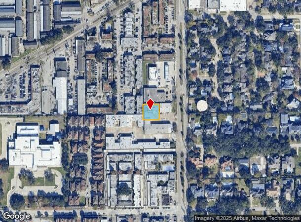
7580 Renwick Dr, Houston, TX 77081
NEARBY LISTINGS FOR SALE OR LEASE
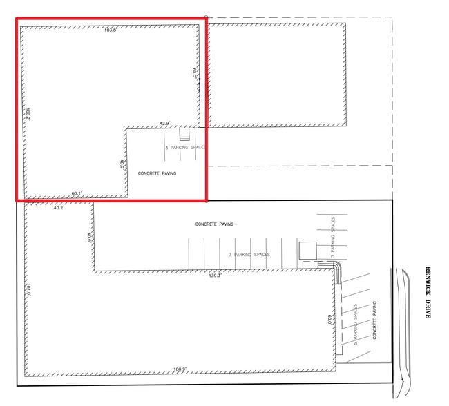
Property Detail
7580 Renwick Dr
0370630000073
Westmoreland Farms Sec 2
Warehouse
TR 12A-1 & 21D-1 BLK 5 WESTMORELAND FARMS SEC 2
X
Harris
48201C0855L
Texas
2024
0.28 AC
2025
Hwy 59/Hwy 90 (Alt)
421700
Houston
8,580 SF
Houston-The Woodlands-Sugar Land, TX
DEMOGRAPHICS near 7580 Renwick Dr
1 Mile
3 Mile
5 Mile
2024 Total Population
23,942
224,128
570,627
2029 Population
24,436
230,391
587,195
Pop Growth 2024-2029
+ 2.06%
+ 2.79%
+ 2.90%
Average Age
36
36
37
2024 Total Households
8,308
86,386
239,415
HH Growth 2024-2029
+ 1.95%
+ 2.76%
+ 2.96%
Median Household Inc
$45,321
$51,776
$56,491
Avg Household Size
2.80
2.50
2.30
2024 Avg HH Vehicles
2.00
2.00
1.00
Median Home Value
$446,210
$388,277
$371,613
Median Year Built
1973
1976
1981
Nearby Places
Map Layers
Map Styles
 Street
 Aerial
- Restaurants
- Banks
- Shops
- Fitness
- Groceries
PUBLIC TRANSPORTATION
AIRPORT
William P Hobby
DRIVE
WALK
Distance
William P Hobby
33 min
17.7 mi
George Bush Intcntl/Houston
DRIVE
WALK
Distance
George Bush Intcntl/Houston
39 min
29.7 mi
Freight Ports
Port of Houston
DRIVE
WALK
Distance
Port of Houston
29 min
18.0 mi
SALE & LEASE HISTORY
LISTING DATE
SALE/LEASE

Oct 02, 2020
For Lease
Jan 24, 2024
For Lease
Jan 24, 2024
For Sale
Dec 23, 2020
For Sale
Nearby Properties
Address
Land Use
TOTAL SIZE
Lot Size
Zoning
Address
Land Use
TOTAL SIZE
Lot Size
Zoning
777,791 SF
47.90 AC
Address
Land Use
TOTAL SIZE
Lot Size
Zoning
1,202,191 SF
39.08 AC
Address
Land Use
TOTAL SIZE
Lot Size
Zoning
323,456 SF
3.91 AC
Address
Land Use
TOTAL SIZE
Lot Size
Zoning
760,932 SF
14.37 AC
Address
Land Use
TOTAL SIZE
Lot Size
Zoning
550,115 SF
6.38 AC
Address
Land Use
TOTAL SIZE
Lot Size
Zoning
579,789 SF
7 AC
Address
Land Use
TOTAL SIZE
Lot Size
Zoning
1,612,349 SF
54.03 AC
Address
Land Use
TOTAL SIZE
Lot Size
Zoning
507,252 SF
5.93 AC
Address
Land Use
TOTAL SIZE
Lot Size
Zoning
417,988 SF
15.70 AC
Address
Land Use
TOTAL SIZE
Lot Size
Zoning
461,938 SF
10.14 AC
Address
Land Use
TOTAL SIZE
Lot Size
Zoning
807,423 SF
30.01 AC
Address
Land Use
TOTAL SIZE
Lot Size
Zoning
812,087 SF
28.58 AC
Address
Land Use
TOTAL SIZE
Lot Size
Zoning
599,112 SF
11.93 AC
Address
Land Use
TOTAL SIZE
Lot Size
Zoning
335,626 SF
4.22 AC
Address
Land Use
TOTAL SIZE
Lot Size
Zoning
85,691 SF
12.63 AC
Address
Land Use
TOTAL SIZE
Lot Size
Zoning
360,345 SF
3.46 AC
Address
Land Use
TOTAL SIZE
Lot Size
Zoning
413,734 SF
6.22 AC
Address
Land Use
TOTAL SIZE
Lot Size
Zoning
769,005 SF
20.46 AC
Address
Land Use
TOTAL SIZE
Lot Size
Zoning
1,008,102 SF
3.54 AC
Address
Land Use
TOTAL SIZE
Lot Size
Zoning
544,698 SF
15.66 AC
Address
Land Use
TOTAL SIZE
Lot Size
Zoning
640,860 SF
5.31 AC
Address
Land Use
TOTAL SIZE
Lot Size
Zoning
398,772 SF
2.97 AC
Address
Land Use
TOTAL SIZE
Lot Size
Zoning
453,314 SF
8.93 AC
Address
Land Use
TOTAL SIZE
Lot Size
Zoning
297,620 SF
11.01 AC
Address
Land Use
TOTAL SIZE
Lot Size
Zoning
478,210 SF
4.52 AC
Address
Land Use
TOTAL SIZE
Lot Size
Zoning
768,015 SF
17.98 AC
Address
Land Use
TOTAL SIZE
Lot Size
Zoning
426,919 SF
12.62 AC
Address
Land Use
TOTAL SIZE
Lot Size
Zoning
290,624 SF
3.17 AC
Address
Land Use
TOTAL SIZE
Lot Size
Zoning
450,314 SF
10.81 AC
Address
Land Use
TOTAL SIZE
Lot Size
Zoning
493,494 SF
13.54 AC
The World's #1 Commercial Real Estate Marketplace
Connect with us
© 2025 CoStar Group
The information above has been obtained from sources believed reliable. While we do not doubt its accuracy we have not verified it and make no guarantee, warranty or representation about it. It is your responsibility to independently confirm its accuracy and completeness. Any projections, opinions, assumptions, or estimates used are for example only and do not represent the current or future performance of the property. The value of this transaction to you depends on tax and other factors which should be evaluated by your tax, financial, and legal advisors. You and your advisors should conduct a careful, independent investigation of the property to determine to your satisfaction the suitability of the property for your needs.