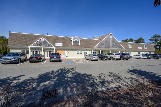
Property Record
759 Falmouth Rd, Mashpee, MA 02649


NEARBY LISTINGS FOR SALE OR LEASE
Property Detail
759 Falmouth Rd
Commercialcondominium
Barnstable
X
Massachusetts
25001C0751J
Cape Cod
0
Other Market Areas
2025
Barnstable Town, MA
015100
MASH-000081-000029-000007
1,496 SF
DEMOGRAPHICS near 759 Falmouth Rd
1 Mile
3 Mile
5 Mile
2024 Total Population
1,653
17,986
38,072
2029 Population
1,678
18,639
39,315
Pop Growth 2024-2029
+ 1.51%
+ 3.63%
+ 3.26%
Average Age
52
50
49
2024 Total Households
822
8,168
16,643
HH Growth 2024-2029
+ 1.22%
+ 3.53%
+ 3.27%
Median Household Inc
$78,684
$87,239
$86,261
Avg Household Size
2.00
2.20
2.20
2024 Avg HH Vehicles
2.00
2.00
2.00
Median Home Value
$451,602
$471,960
$472,315
Median Year Built
1987
1985
1983
Nearby Places
Map Layers
Map Styles
 Street
 Aerial
- Restaurants
- Banks
- Shops
- Fitness
- Groceries
PUBLIC TRANSPORTATION
AIRPORT
Martha's Vineyard
DRIVE
WALK
Distance
Martha's Vineyard
84 min
26.3 mi
Freight Ports
Port of New Bedford Harbor
DRIVE
WALK
Distance
Port of New Bedford Harbor
60 min
42.0 mi
SALE & LEASE HISTORY
LISTING DATE
SALE/LEASE

Sep 25, 2016
For Lease
Mar 25, 2022
For Sale
Dec 10, 2018
For Sale
Dec 04, 2018
For Lease
Nearby Properties
Address
Land Use
TOTAL SIZE
Lot Size
Zoning
Address
Land Use
TOTAL SIZE
Lot Size
Zoning
12,713 SF
29.28 AC
C1
Address
Land Use
TOTAL SIZE
Lot Size
Zoning
10.94 AC
R3
Address
Land Use
TOTAL SIZE
Lot Size
Zoning
181,756 SF
135.43 AC
R5
Address
Land Use
TOTAL SIZE
Lot Size
Zoning
9 AC
C1
Address
Land Use
TOTAL SIZE
Lot Size
Zoning
15.10 AC
C1
Address
Land Use
TOTAL SIZE
Lot Size
Zoning
24.40 AC
R3
Address
Land Use
TOTAL SIZE
Lot Size
Zoning
2,993 SF
67.60 AC
R3
Address
Land Use
TOTAL SIZE
Lot Size
Zoning
65,930 SF
3.97 AC
C1
Address
Land Use
TOTAL SIZE
Lot Size
Zoning
8,472 SF
14.29 AC
R
Address
Land Use
TOTAL SIZE
Lot Size
Zoning
2,429 SF
67.57 AC
R
Address
Land Use
TOTAL SIZE
Lot Size
Zoning
4.66 AC
R
Address
Land Use
TOTAL SIZE
Lot Size
Zoning
24.50 AC
C2
Address
Land Use
TOTAL SIZE
Lot Size
Zoning
27.80 AC
R3
Address
Land Use
TOTAL SIZE
Lot Size
Zoning
13.30 AC
I1
Address
Land Use
TOTAL SIZE
Lot Size
Zoning
41,386 SF
7.59 AC
AGA
Address
Land Use
TOTAL SIZE
Lot Size
Zoning
8,544 SF
20.31 AC
R3
Address
Land Use
TOTAL SIZE
Lot Size
Zoning
6.27 AC
R3
Address
Land Use
TOTAL SIZE
Lot Size
Zoning
8,910 SF
31.84 AC
R5
Address
Land Use
TOTAL SIZE
Lot Size
Zoning
1.26 AC
R3
Address
Land Use
TOTAL SIZE
Lot Size
Zoning
31,520 SF
3.89 AC
I1
Address
Land Use
TOTAL SIZE
Lot Size
Zoning
Address
Land Use
TOTAL SIZE
Lot Size
Zoning
34.48 AC
R
Address
Land Use
TOTAL SIZE
Lot Size
Zoning
158.42 AC
R
Address
Land Use
TOTAL SIZE
Lot Size
Zoning
5.13 AC
Address
Land Use
TOTAL SIZE
Lot Size
Zoning
28.88 AC
R
Address
Land Use
TOTAL SIZE
Lot Size
Zoning
229.61 AC
R3
Address
Land Use
TOTAL SIZE
Lot Size
Zoning
250.40 AC
R5
Address
Land Use
TOTAL SIZE
Lot Size
Zoning
1.56 AC
R
Address
Land Use
TOTAL SIZE
Lot Size
Zoning
2 AC
R
Address
Land Use
TOTAL SIZE
Lot Size
Zoning
16.45 AC
R3
The World's #1 Commercial Real Estate Marketplace
Connect with us
© 2025 CoStar Group
The information above has been obtained from sources believed reliable. While we do not doubt its accuracy we have not verified it and make no guarantee, warranty or representation about it. It is your responsibility to independently confirm its accuracy and completeness. Any projections, opinions, assumptions, or estimates used are for example only and do not represent the current or future performance of the property. The value of this transaction to you depends on tax and other factors which should be evaluated by your tax, financial, and legal advisors. You and your advisors should conduct a careful, independent investigation of the property to determine to your satisfaction the suitability of the property for your needs.