Property Record
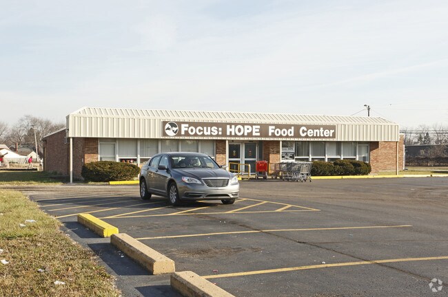
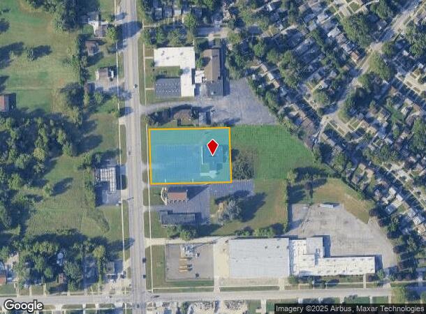
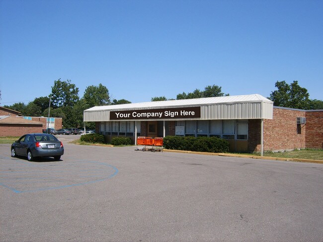
759 Inkster Rd, Inkster, MI 48141
NEARBY LISTINGS FOR SALE OR LEASE
Property Detail
759 Inkster Rd
Detroit
Incl Westwood Hill
Detroit-Warren-Dearborn, MI
Wayne
44-017-99-0001-006
Michigan
Sfr
3.39 AC
X
Dearborn
26163C0241E
DEMOGRAPHICS near 759 Inkster Rd
1 Mile
3 Mile
5 Mile
2024 Total Population
16,218
124,768
289,755
2029 Population
15,664
120,300
279,062
Pop Growth 2024-2029
(3.42%)
(3.58%)
(3.69%)
Average Age
37
39
39
2024 Total Households
6,030
47,930
115,443
HH Growth 2024-2029
(3.47%)
(3.64%)
(3.72%)
Median Household Inc
$52,324
$60,620
$59,907
Avg Household Size
2.60
2.50
2.50
2024 Avg HH Vehicles
2.00
2.00
2.00
Median Home Value
$135,479
$161,633
$154,348
Median Year Built
1957
1956
1956
Nearby Places
Map Layers
Map Styles
 Street
 Aerial
- Restaurants
- Banks
- Shops
- Fitness
- Groceries
PUBLIC TRANSPORTATION
COMMUTER RAIL
Dearborn (Wolverine - Amtrak)
DRIVE
WALK
Distance
Dearborn (Wolverine - Amtrak)
11 min
4.9 mi
AIRPORT
Detroit Metro Wayne County
DRIVE
WALK
Distance
Detroit Metro Wayne County
20 min
9.9 mi
Windsor International
DRIVE
WALK
Distance
Windsor International
50 min
26.3 mi
Freight Ports
Port of Toledo
DRIVE
WALK
Distance
Port of Toledo
76 min
57.7 mi
SALE & LEASE HISTORY
LISTING DATE
SALE/LEASE

Sep 25, 2019
For Sale
Mar 13, 2019
For Sale
Nearby Properties
Address
Land Use
TOTAL SIZE
Lot Size
Zoning
Address
Land Use
TOTAL SIZE
Lot Size
Zoning
126,712 SF
4.52 AC
BC
Address
Land Use
TOTAL SIZE
Lot Size
Zoning
188,958 SF
7.71 AC
Address
Land Use
TOTAL SIZE
Lot Size
Zoning
463,642 SF
22.82 AC
Address
Land Use
TOTAL SIZE
Lot Size
Zoning
197,774 SF
11.72 AC
Address
Land Use
TOTAL SIZE
Lot Size
Zoning
328,480 SF
11.54 AC
IA
Address
Land Use
TOTAL SIZE
Lot Size
Zoning
196,930 SF
9.93 AC
Address
Land Use
TOTAL SIZE
Lot Size
Zoning
107,680 SF
7.46 AC
BC
Address
Land Use
TOTAL SIZE
Lot Size
Zoning
138,541 SF
8.65 AC
Address
Land Use
TOTAL SIZE
Lot Size
Zoning
99.86 AC
Address
Land Use
TOTAL SIZE
Lot Size
Zoning
142,269 SF
8.62 AC
Address
Land Use
TOTAL SIZE
Lot Size
Zoning
Address
Land Use
TOTAL SIZE
Lot Size
Zoning
58,958 SF
2.15 AC
BC
Address
Land Use
TOTAL SIZE
Lot Size
Zoning
127,017 SF
6.91 AC
Address
Land Use
TOTAL SIZE
Lot Size
Zoning
94,353 SF
8.70 AC
BC
Address
Land Use
TOTAL SIZE
Lot Size
Zoning
176,883 SF
10.83 AC
Address
Land Use
TOTAL SIZE
Lot Size
Zoning
93,425 SF
7.75 AC
Address
Land Use
TOTAL SIZE
Lot Size
Zoning
88,769 SF
0.91 AC
IB
Address
Land Use
TOTAL SIZE
Lot Size
Zoning
171,414 SF
23.57 AC
Address
Land Use
TOTAL SIZE
Lot Size
Zoning
93,202 SF
25.98 AC
M1-LIG
Address
Land Use
TOTAL SIZE
Lot Size
Zoning
53,263 SF
2.80 AC
Address
Land Use
TOTAL SIZE
Lot Size
Zoning
50,974 SF
8.48 AC
Address
Land Use
TOTAL SIZE
Lot Size
Zoning
61,031 SF
5.14 AC
BC
Address
Land Use
TOTAL SIZE
Lot Size
Zoning
47,900 SF
2.34 AC
BC
Address
Land Use
TOTAL SIZE
Lot Size
Zoning
61,200 SF
10.10 AC
Address
Land Use
TOTAL SIZE
Lot Size
Zoning
110,371 SF
8.68 AC
Address
Land Use
TOTAL SIZE
Lot Size
Zoning
42,928 SF
4.88 AC
Address
Land Use
TOTAL SIZE
Lot Size
Zoning
111,699 SF
10.08 AC
Address
Land Use
TOTAL SIZE
Lot Size
Zoning
97,740 SF
4.47 AC
Address
Land Use
TOTAL SIZE
Lot Size
Zoning
99,831 SF
8.54 AC
Address
Land Use
TOTAL SIZE
Lot Size
Zoning
93,059 SF
26.53 AC
M-T
The World's #1 Commercial Real Estate Marketplace
Connect with us
© 2025 CoStar Group
The information above has been obtained from sources believed reliable. While we do not doubt its accuracy we have not verified it and make no guarantee, warranty or representation about it. It is your responsibility to independently confirm its accuracy and completeness. Any projections, opinions, assumptions, or estimates used are for example only and do not represent the current or future performance of the property. The value of this transaction to you depends on tax and other factors which should be evaluated by your tax, financial, and legal advisors. You and your advisors should conduct a careful, independent investigation of the property to determine to your satisfaction the suitability of the property for your needs.