Property Record
76 Address Unassigned, , MN

Property Detail
76 Address Unassigned
Minneapolis/St Paul
T FAIRVIEW 610 ADDN OUTLOT B IRREGULAR
Minneapolis-St. Paul-Bloomington, MN-WI
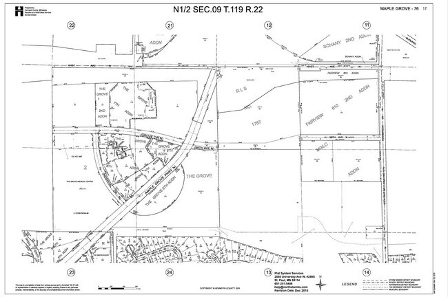
HENNEPIN
09-119-22-11-0006
Minnesota
Industrialacreage
b
B and X Area of moderate flood hazard, usually the area between the limits of the 100-year and 500-year floods.
4.61 AC
0
Northwest
2024
NEARBY LISTINGS FOR SALE OR LEASE
DEMOGRAPHICS near 76 Address Unassigned
1 mile
3 mile
5 mile
2024 Total Population
3,162
42,558
106,339
2029 Population
3,296
43,191
107,411
Pop Growth 2024-2029
+ 4.24%
+ 1.49%
+ 1.01%
Average Age
42
41
41
2024 Total Households
1,247
16,356
39,821
HH Growth 2024-2029
+ 4.01%
+ 1.32%
+ 0.89%
Median Household Inc
$125,630
$124,167
$122,214
Avg Household Size
2.50
2.50
2.60
2024 Avg HH Vehicles
2.00
2.00
2.00
Median Home Value
$369,070
$398,995
$401,936
Median Year Built
1991
1993
1992
Nearby Places
Map Layers
Map Styles
 Street
 Aerial
Transit
 Traffic
 Biking
Places
Listings with unknown addresses are not visible on the map
- Restaurants
- Banks
- Shops
- Fitness
- Groceries
PUBLIC TRANSPORTATION
AIRPORT
Minneapolis-St Paul International/Wold-Chamberlain
Drive
Walk
Distance
Minneapolis-St Paul International/Wold-Chamberlain
43 min
30.3 mi
Freight Ports
Port Milwaukee
Drive
Walk
Distance
Port Milwaukee
393 min
357.6 mi
Nearby Properties
Address
Land Use
TOTAL SIZE
Lot Size
Zoning
Address
Land Use
TOTAL SIZE
Lot Size
Zoning
4.33 AC
Address
Land Use
TOTAL SIZE
Lot Size
Zoning
68.12 AC
Address
Land Use
TOTAL SIZE
Lot Size
Zoning
42.21 AC
Address
Land Use
TOTAL SIZE
Lot Size
Zoning
297,060 SF
19.17 AC
Address
Land Use
TOTAL SIZE
Lot Size
Zoning
25.06 AC
Address
Land Use
TOTAL SIZE
Lot Size
Zoning
7.53 AC
Address
Land Use
TOTAL SIZE
Lot Size
Zoning
8.11 AC
Address
Land Use
TOTAL SIZE
Lot Size
Zoning
Address
Land Use
TOTAL SIZE
Lot Size
Zoning
Address
Land Use
TOTAL SIZE
Lot Size
Zoning
Address
Land Use
TOTAL SIZE
Lot Size
Zoning
16.54 AC
Address
Land Use
TOTAL SIZE
Lot Size
Zoning
228,208 SF
24.92 AC
Address
Land Use
TOTAL SIZE
Lot Size
Zoning
350,014 SF
56.09 AC
Address
Land Use
TOTAL SIZE
Lot Size
Zoning
17.75 AC
Address
Land Use
TOTAL SIZE
Lot Size
Zoning
10.44 AC
Address
Land Use
TOTAL SIZE
Lot Size
Zoning
132,200 SF
28.23 AC
Address
Land Use
TOTAL SIZE
Lot Size
Zoning
17.09 AC
Address
Land Use
TOTAL SIZE
Lot Size
Zoning
Address
Land Use
TOTAL SIZE
Lot Size
Zoning
13.39 AC
Address
Land Use
TOTAL SIZE
Lot Size
Zoning
Address
Land Use
TOTAL SIZE
Lot Size
Zoning
20.09 AC
Address
Land Use
TOTAL SIZE
Lot Size
Zoning
Address
Land Use
TOTAL SIZE
Lot Size
Zoning
11.45 AC
Address
Land Use
TOTAL SIZE
Lot Size
Zoning
218,144 SF
3.71 AC
Address
Land Use
TOTAL SIZE
Lot Size
Zoning
11.61 AC
Address
Land Use
TOTAL SIZE
Lot Size
Zoning
10.26 AC
Address
Land Use
TOTAL SIZE
Lot Size
Zoning
219,980 SF
18.09 AC
Address
Land Use
TOTAL SIZE
Lot Size
Zoning
168,961 SF
15.61 AC
Address
Land Use
TOTAL SIZE
Lot Size
Zoning
175,096 SF
18.91 AC
Address
Land Use
TOTAL SIZE
Lot Size
Zoning
178,023 SF
14.24 AC
The World's #1 Commercial Real Estate Marketplace
Connect with us
© 2026 CoStar Group
The information above has been obtained from sources believed reliable. While we do not doubt its accuracy we have not verified it and make no guarantee, warranty or representation about it. It is your responsibility to independently confirm its accuracy and completeness. Any projections, opinions, assumptions, or estimates used are for example only and do not represent the current or future performance of the property. The value of this transaction to you depends on tax and other factors which should be evaluated by your tax, financial, and legal advisors. You and your advisors should conduct a careful, independent investigation of the property to determine to your satisfaction the suitability of the property for your needs.