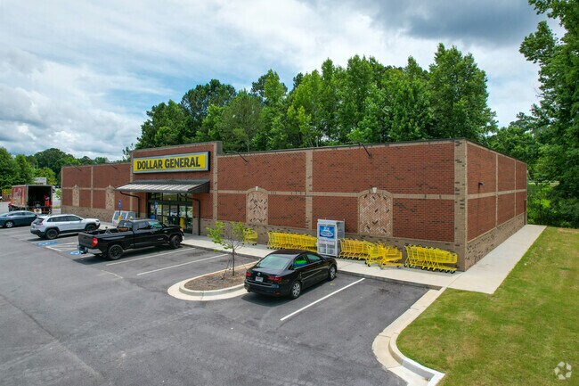
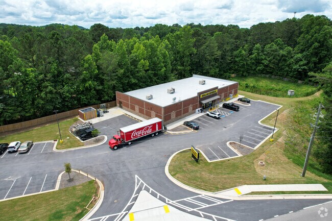
Property Record
76 E Paulding Dr, Dallas, GA 30157

Property Detail
76 E Paulding Dr
082.4.3.022.0000
DIST: 3 SEC: 3 LOT: 1250
Storebuilding
Paulding
B2
Georgia
B and X Area of moderate flood hazard, usually the area between the limits of the 100-year and 500-year floods.
1250
2025
2.18 AC
2025
Paulding Cnty/Dallas
120208
Atlanta
43,095 SF
Atlanta-Sandy Springs-Roswell, GA
NEARBY LISTINGS FOR SALE OR LEASE
DEMOGRAPHICS near 76 E Paulding Dr
1 mile
3 mile
5 mile
2025 Total Population
4,418
32,933
97,898
2030 Population
4,889
36,405
106,774
Pop Growth 2025-2030
+ 10.66%
+ 10.54%
+ 9.07%
Average Age
37
38
38
2025 Total Households
1,426
10,865
32,890
HH Growth 2025-2030
+ 10.80%
+ 10.62%
+ 9.19%
Median Household Inc
$108,313
$116,248
$111,748
Avg Household Size
3.00
3.00
2.90
2025 Avg HH Vehicles
2.00
2.00
2.00
Median Home Value
$334,922
$347,704
$373,614
Median Year Built
2003
2003
2002
Nearby Places
Map Layers
Map Styles
 Street
 Aerial
Layers
 Traffic
 Biking
Places
Listings with unknown addresses are not visible on the map
- Restaurants
- Banks
- Shops
- Fitness
- Groceries
PUBLIC TRANSPORTATION
AIRPORT
Hartsfield - Jackson Atlanta International
Drive
Walk
Distance
Hartsfield - Jackson Atlanta International
64 min
41.8 mi
Nearby Properties
Address
Land Use
TOTAL SIZE
Lot Size
Zoning
Address
Land Use
TOTAL SIZE
Lot Size
Zoning
46.05 AC
Address
Land Use
TOTAL SIZE
Lot Size
Zoning
37.28 AC
Address
Land Use
TOTAL SIZE
Lot Size
Zoning
41.85 AC
Address
Land Use
TOTAL SIZE
Lot Size
Zoning
19.14 AC
Address
Land Use
TOTAL SIZE
Lot Size
Zoning
Address
Land Use
TOTAL SIZE
Lot Size
Zoning
18.44 AC
Address
Land Use
TOTAL SIZE
Lot Size
Zoning
151,906 SF
21.07 AC
B2
Address
Land Use
TOTAL SIZE
Lot Size
Zoning
Address
Land Use
TOTAL SIZE
Lot Size
Zoning
80,738 SF
10.30 AC
B2
Address
Land Use
TOTAL SIZE
Lot Size
Zoning
74,036 SF
23.20 AC
B2
Address
Land Use
TOTAL SIZE
Lot Size
Zoning
128.92 AC
Address
Land Use
TOTAL SIZE
Lot Size
Zoning
7.37 AC
Address
Land Use
TOTAL SIZE
Lot Size
Zoning
151.43 AC
Address
Land Use
TOTAL SIZE
Lot Size
Zoning
4,838 SF
3.42 AC
Address
Land Use
TOTAL SIZE
Lot Size
Zoning
80,476 SF
23.36 AC
B2
Address
Land Use
TOTAL SIZE
Lot Size
Zoning
22,974 SF
3.61 AC
B1
Address
Land Use
TOTAL SIZE
Lot Size
Zoning
Address
Land Use
TOTAL SIZE
Lot Size
Zoning
22,270 SF
2.18 AC
B2
Address
Land Use
TOTAL SIZE
Lot Size
Zoning
6.58 AC
Address
Land Use
TOTAL SIZE
Lot Size
Zoning
12.51 AC
Address
Land Use
TOTAL SIZE
Lot Size
Zoning
12,958 SF
19.27 AC
B2
Address
Land Use
TOTAL SIZE
Lot Size
Zoning
14,494 SF
1.57 AC
B2
Address
Land Use
TOTAL SIZE
Lot Size
Zoning
36,635 SF
28.28 AC
B2
Address
Land Use
TOTAL SIZE
Lot Size
Zoning
62,232 SF
2.02 AC
B2
Address
Land Use
TOTAL SIZE
Lot Size
Zoning
5.30 AC
Address
Land Use
TOTAL SIZE
Lot Size
Zoning
140,120 SF
9.15 AC
I1
Address
Land Use
TOTAL SIZE
Lot Size
Zoning
13.42 AC
Address
Land Use
TOTAL SIZE
Lot Size
Zoning
9,776 SF
22.13 AC
Address
Land Use
TOTAL SIZE
Lot Size
Zoning
44,850 SF
3 AC
B2
The World's #1 Commercial Real Estate Marketplace
Connect with us
© 2026 CoStar Group
The information above has been obtained from sources believed reliable. While we do not doubt its accuracy we have not verified it and make no guarantee, warranty or representation about it. It is your responsibility to independently confirm its accuracy and completeness. Any projections, opinions, assumptions, or estimates used are for example only and do not represent the current or future performance of the property. The value of this transaction to you depends on tax and other factors which should be evaluated by your tax, financial, and legal advisors. You and your advisors should conduct a careful, independent investigation of the property to determine to your satisfaction the suitability of the property for your needs.