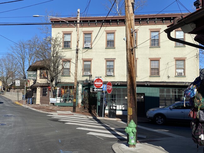
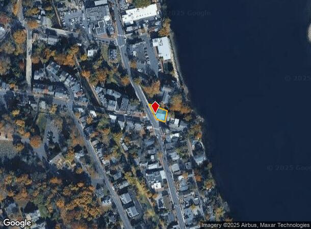
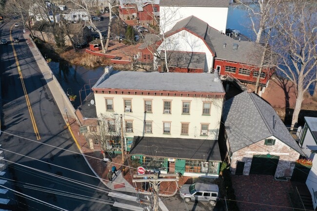
Property Record
76 S Main St, New Hope, PA 18938

NEARBY LISTINGS FOR SALE OR LEASE
Property Detail
76 S Main St
27-010-147
NE COR MAIN & MECHANIC ST 43X66
Retailwithmorethanonenonretailuse
Bucks
AE
Pennsylvania
42017C0327J
0.11 AC
2024
Lower Bucks County
2025
Philadelphia
104400
Philadelphia-Camden-Wilmington, PA-NJ-DE-MD
4,661 SF
DEMOGRAPHICS near 76 S Main St
1 mile
3 mile
5 mile
2024 Total Population
6,511
13,406
22,265
2029 Population
6,585
13,435
22,173
Pop Growth 2024-2029
+ 1.14%
+ 0.22%
(0.41%)
Average Age
49
48
47
2024 Total Households
3,304
6,089
9,477
HH Growth 2024-2029
+ 1.18%
+ 0.34%
(0.30%)
Median Household Inc
$111,768
$128,560
$140,664
Avg Household Size
2.00
2.20
2.30
2024 Avg HH Vehicles
2.00
2.00
2.00
Median Home Value
$510,253
$634,211
$683,320
Median Year Built
1964
1972
1974
Nearby Places
Map Layers
Map Styles
 Street
 Aerial
Transit
 Traffic
 Biking
Places
Listings with unknown addresses are not visible on the map
- Restaurants
- Banks
- Shops
- Fitness
- Groceries
PUBLIC TRANSPORTATION
AIRPORT
Trenton Mercer
Drive
Walk
Distance
Trenton Mercer
24 min
12.3 mi
Lehigh Valley International
Drive
Walk
Distance
Lehigh Valley International
74 min
40.7 mi
Philadelphia International
Drive
Walk
Distance
Philadelphia International
76 min
49.9 mi
Freight Ports
Port of Philadelphia
Drive
Walk
Distance
Port of Philadelphia
55 min
29.8 mi
SALE & LEASE HISTORY
LISTING DATE
SALE/LEASE

May 07, 2021
For Lease
Jan 28, 2020
For Lease
Feb 08, 2018
For Lease
Nearby Properties
Address
Land Use
TOTAL SIZE
Lot Size
Zoning
Address
Land Use
TOTAL SIZE
Lot Size
Zoning
11.51 AC
PRD
Address
Land Use
TOTAL SIZE
Lot Size
Zoning
4 AC
PRD
Address
Land Use
TOTAL SIZE
Lot Size
Zoning
Address
Land Use
TOTAL SIZE
Lot Size
Zoning
24,768 SF
1.47 AC
FP
Address
Land Use
TOTAL SIZE
Lot Size
Zoning
8,456 SF
2.36 AC
R-2
Address
Land Use
TOTAL SIZE
Lot Size
Zoning
7,765 SF
0.13 AC
CBD
Address
Land Use
TOTAL SIZE
Lot Size
Zoning
0.36 AC
CBD
Address
Land Use
TOTAL SIZE
Lot Size
Zoning
1,620 SF
0.23 AC
Address
Land Use
TOTAL SIZE
Lot Size
Zoning
4,924 SF
0.57 AC
CBD
Address
Land Use
TOTAL SIZE
Lot Size
Zoning
30,048 SF
22.12 AC
SRPD
Address
Land Use
TOTAL SIZE
Lot Size
Zoning
14,429 SF
2.20 AC
COM
Address
Land Use
TOTAL SIZE
Lot Size
Zoning
4,434 SF
1.47 AC
HC
Address
Land Use
TOTAL SIZE
Lot Size
Zoning
127.42 AC
MRC
Address
Land Use
TOTAL SIZE
Lot Size
Zoning
39,390 SF
1.80 AC
R-2
Address
Land Use
TOTAL SIZE
Lot Size
Zoning
100 AC
I-2
Address
Land Use
TOTAL SIZE
Lot Size
Zoning
4,200 SF
14.98 AC
HC
Address
Land Use
TOTAL SIZE
Lot Size
Zoning
4,423 SF
0.40 AC
R-2
Address
Land Use
TOTAL SIZE
Lot Size
Zoning
132.95 AC
MRC
Address
Land Use
TOTAL SIZE
Lot Size
Zoning
2,618 SF
83.19 AC
MRC
Address
Land Use
TOTAL SIZE
Lot Size
Zoning
3,474 SF
4.09 AC
HC
Address
Land Use
TOTAL SIZE
Lot Size
Zoning
14,331 SF
3.88 AC
HC
Address
Land Use
TOTAL SIZE
Lot Size
Zoning
24,742 SF
0.11 AC
CBD
Address
Land Use
TOTAL SIZE
Lot Size
Zoning
5,600 SF
10.99 AC
HC
Address
Land Use
TOTAL SIZE
Lot Size
Zoning
9,100 SF
5.40 AC
HC
Address
Land Use
TOTAL SIZE
Lot Size
Zoning
11,452 SF
3.95 AC
PRD
Address
Land Use
TOTAL SIZE
Lot Size
Zoning
20,505 SF
0.14 AC
CBD
Address
Land Use
TOTAL SIZE
Lot Size
Zoning
8,976 SF
14.04 AC
SRPD
Address
Land Use
TOTAL SIZE
Lot Size
Zoning
0.42 AC
CBD
Address
Land Use
TOTAL SIZE
Lot Size
Zoning
9,975 SF
0.11 AC
CBD
Address
Land Use
TOTAL SIZE
Lot Size
Zoning
20,316 SF
8.81 AC
HC
The World's #1 Commercial Real Estate Marketplace
Connect with us
© 2026 CoStar Group
The information above has been obtained from sources believed reliable. While we do not doubt its accuracy we have not verified it and make no guarantee, warranty or representation about it. It is your responsibility to independently confirm its accuracy and completeness. Any projections, opinions, assumptions, or estimates used are for example only and do not represent the current or future performance of the property. The value of this transaction to you depends on tax and other factors which should be evaluated by your tax, financial, and legal advisors. You and your advisors should conduct a careful, independent investigation of the property to determine to your satisfaction the suitability of the property for your needs.