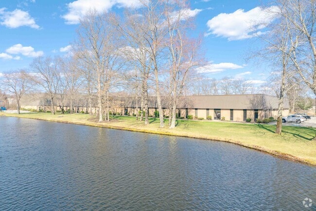
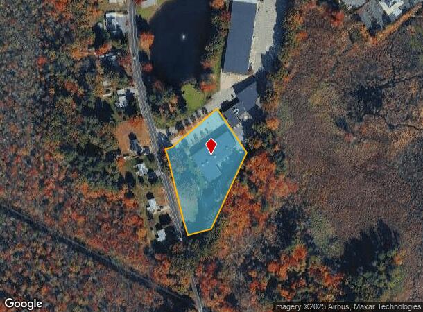
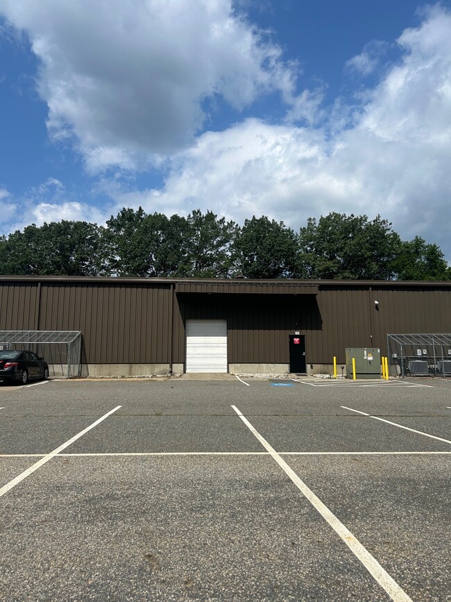
Property Record
76 Treble Cove Rd, Billerica, MA 01821
Current Lease Availabilities
NEARBY LISTINGS FOR SALE OR LEASE
Property Detail
76 Treble Cove Rd
BILL-22[13[1-2
Middlesex
Commercialnec
Massachusetts
AE
1-3
25017C0258F
7.81 AC
2020
Lowell/Chelmsford
2025
Boston
316102
Boston-Cambridge-Newton, MA-NH
17,437 SF
DEMOGRAPHICS near 76 Treble Cove Rd
1 Mile
3 Mile
5 Mile
2024 Total Population
4,882
43,448
166,680
2029 Population
4,812
43,091
164,447
Pop Growth 2024-2029
(1.43%)
(0.82%)
(1.34%)
Average Age
42
42
41
2024 Total Households
1,783
16,066
61,208
HH Growth 2024-2029
(1.57%)
(0.91%)
(1.38%)
Median Household Inc
$100,543
$111,542
$97,263
Avg Household Size
2.60
2.60
2.60
2024 Avg HH Vehicles
2.00
2.00
2.00
Median Home Value
$409,725
$468,468
$468,416
Median Year Built
1967
1972
1965
Nearby Places
Map Layers
Map Styles
 Street
 Aerial
- Restaurants
- Banks
- Shops
- Fitness
- Groceries
PUBLIC TRANSPORTATION
COMMUTER RAIL
North Billerica (Lowell Line - Massachusetts Bay Transportation Authority Commuter Rail (Purple Line))
DRIVE
WALK
Distance
North Billerica (Lowell Line - Massachusetts Bay Transportation Authority Commuter Rail (Purple Line))
4 min
1.5 mi
Lowell (Lowell Line - Massachusetts Bay Transportation Authority Commuter Rail (Purple Line))
DRIVE
WALK
Distance
Lowell (Lowell Line - Massachusetts Bay Transportation Authority Commuter Rail (Purple Line))
10 min
5.4 mi
AIRPORT
General Edward Lawrence Logan International
DRIVE
WALK
Distance
General Edward Lawrence Logan International
42 min
25.7 mi
Manchester Boston Regional
DRIVE
WALK
Distance
Manchester Boston Regional
45 min
32.8 mi
Worcester Regional
DRIVE
WALK
Distance
Worcester Regional
62 min
46.3 mi
Freight Ports
Port of Boston
DRIVE
WALK
Distance
Port of Boston
42 min
25.4 mi
Nearby Properties
Address
Land Use
TOTAL SIZE
Lot Size
Zoning
Address
Land Use
TOTAL SIZE
Lot Size
Zoning
225,792 SF
9.90 AC
4
Address
Land Use
TOTAL SIZE
Lot Size
Zoning
9.50 AC
Address
Land Use
TOTAL SIZE
Lot Size
Zoning
Address
Land Use
TOTAL SIZE
Lot Size
Zoning
27.48 AC
5
Address
Land Use
TOTAL SIZE
Lot Size
Zoning
504,154 SF
19.40 AC
2
Address
Land Use
TOTAL SIZE
Lot Size
Zoning
189,960 SF
7.88 AC
4
Address
Land Use
TOTAL SIZE
Lot Size
Zoning
16.63 AC
2
Address
Land Use
TOTAL SIZE
Lot Size
Zoning
6.36 AC
5
Address
Land Use
TOTAL SIZE
Lot Size
Zoning
15.16 AC
SMF
Address
Land Use
TOTAL SIZE
Lot Size
Zoning
174 SF
IA
Address
Land Use
TOTAL SIZE
Lot Size
Zoning
396,990 SF
48.84 AC
IH
Address
Land Use
TOTAL SIZE
Lot Size
Zoning
345,780 SF
64.77 AC
3
Address
Land Use
TOTAL SIZE
Lot Size
Zoning
218,780 SF
55.49 AC
MN
Address
Land Use
TOTAL SIZE
Lot Size
Zoning
608,598 SF
21.08 AC
5
Address
Land Use
TOTAL SIZE
Lot Size
Zoning
380,132 SF
35.87 AC
5
Address
Land Use
TOTAL SIZE
Lot Size
Zoning
137,235 SF
12.77 AC
5
Address
Land Use
TOTAL SIZE
Lot Size
Zoning
26.65 AC
IA
Address
Land Use
TOTAL SIZE
Lot Size
Zoning
4.85 AC
IA
Address
Land Use
TOTAL SIZE
Lot Size
Zoning
Address
Land Use
TOTAL SIZE
Lot Size
Zoning
22.30 AC
IA
Address
Land Use
TOTAL SIZE
Lot Size
Zoning
3,954 SF
13.42 AC
IA
Address
Land Use
TOTAL SIZE
Lot Size
Zoning
Address
Land Use
TOTAL SIZE
Lot Size
Zoning
1.58 AC
Address
Land Use
TOTAL SIZE
Lot Size
Zoning
13.23 AC
Address
Land Use
TOTAL SIZE
Lot Size
Zoning
47.07 AC
5
Address
Land Use
TOTAL SIZE
Lot Size
Zoning
182,135 SF
37.16 AC
2
Address
Land Use
TOTAL SIZE
Lot Size
Zoning
148,890 SF
6.99 AC
5
Address
Land Use
TOTAL SIZE
Lot Size
Zoning
37.14 AC
IA
Address
Land Use
TOTAL SIZE
Lot Size
Zoning
104,258 SF
7.89 AC
5
Address
Land Use
TOTAL SIZE
Lot Size
Zoning
5.26 AC
SMF
The World's #1 Commercial Real Estate Marketplace
Connect with us
© 2025 CoStar Group
The information above has been obtained from sources believed reliable. While we do not doubt its accuracy we have not verified it and make no guarantee, warranty or representation about it. It is your responsibility to independently confirm its accuracy and completeness. Any projections, opinions, assumptions, or estimates used are for example only and do not represent the current or future performance of the property. The value of this transaction to you depends on tax and other factors which should be evaluated by your tax, financial, and legal advisors. You and your advisors should conduct a careful, independent investigation of the property to determine to your satisfaction the suitability of the property for your needs.