Property Record
760 Castle Ct, Charlottesville, VA 22901

Property Detail
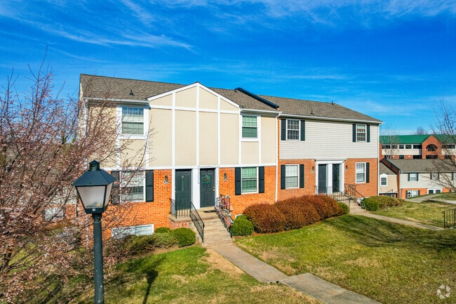
760 Castle Ct
06100-00-00-129G0
ACREAGE ABBINGTON CROSSING II APTS
Multifamilydwelling
Albemarle
R15 RESIDE
Virginia
B and X Area of moderate flood hazard, usually the area between the limits of the 100-year and 500-year floods.
3.85 AC
2025
Charlottesville
2025
Other Market Areas
010603
Charlottesville, VA
144,744 SF
NEARBY LISTINGS FOR SALE OR LEASE
DEMOGRAPHICS near 760 Castle Ct
1 mile
3 mile
5 mile
2025 Total Population
9,625
46,944
100,580
2030 Population
9,878
47,711
101,911
Pop Growth 2025-2030
+ 2.63%
+ 1.63%
+ 1.32%
Average Age
44
41
38
2025 Total Households
4,080
19,871
40,484
HH Growth 2025-2030
+ 3.11%
+ 1.73%
+ 1.42%
Median Household Inc
$89,964
$85,404
$82,853
Avg Household Size
2.20
2.20
2.20
2025 Avg HH Vehicles
2.00
2.00
2.00
Median Home Value
$459,924
$499,187
$480,295
Median Year Built
1989
1983
1984
Nearby Places
Map Layers
Map Styles
 Street
 Aerial
Layers
 Traffic
 Biking
Places
Listings with unknown addresses are not visible on the map
- Restaurants
- Banks
- Shops
- Fitness
- Groceries
PUBLIC TRANSPORTATION
COMMUTER RAIL
Charlottesville (Cardinal - Amtrak, Crescent - Amtrak, Northeast Regional - Amtrak)
Drive
Walk
Distance
Charlottesville (Cardinal - Amtrak, Crescent - Amtrak, Northeast Regional - Amtrak)
11 min
4.6 mi
AIRPORT
Charlottesville-Albemarle
Drive
Walk
Distance
Charlottesville-Albemarle
14 min
6.3 mi
Freight Ports
Virginia Port Authority - Richmond
Drive
Walk
Distance
Virginia Port Authority - Richmond
99 min
79.3 mi
Nearby Properties
Address
Land Use
TOTAL SIZE
Lot Size
Zoning
Address
Land Use
TOTAL SIZE
Lot Size
Zoning
13,125 SF
100.40 AC
R1 RESIDEN
Address
Land Use
TOTAL SIZE
Lot Size
Zoning
61,177 SF
30.40 AC
R1 RESIDEN
Address
Land Use
TOTAL SIZE
Lot Size
Zoning
497,658 SF
39.83 AC
NX-10
Address
Land Use
TOTAL SIZE
Lot Size
Zoning
3,465 SF
145.17 AC
CV
Address
Land Use
TOTAL SIZE
Lot Size
Zoning
254,749 SF
80.72 AC
CM
Address
Land Use
TOTAL SIZE
Lot Size
Zoning
62,900 SF
4.71 AC
NX-10
Address
Land Use
TOTAL SIZE
Lot Size
Zoning
3,803 SF
266.70 AC
CV
Address
Land Use
TOTAL SIZE
Lot Size
Zoning
12,876 SF
32.70 AC
NEIGHBORHO
Address
Land Use
TOTAL SIZE
Lot Size
Zoning
393,960 SF
16.14 AC
NMD
Address
Land Use
TOTAL SIZE
Lot Size
Zoning
78,332 SF
33.82 AC
CM
Address
Land Use
TOTAL SIZE
Lot Size
Zoning
46,770 SF
216.69 AC
RURAL AREA
Address
Land Use
TOTAL SIZE
Lot Size
Zoning
Address
Land Use
TOTAL SIZE
Lot Size
Zoning
224,196 SF
58.91 AC
PLANNED RE
Address
Land Use
TOTAL SIZE
Lot Size
Zoning
1.38 AC
CX-3
Address
Land Use
TOTAL SIZE
Lot Size
Zoning
263,304 SF
9.77 AC
R15 RESIDE
Address
Land Use
TOTAL SIZE
Lot Size
Zoning
226,576 SF
2.72 AC
Address
Land Use
TOTAL SIZE
Lot Size
Zoning
249,740 SF
42.40 AC
CM
Address
Land Use
TOTAL SIZE
Lot Size
Zoning
288,555 SF
30.98 AC
PDSC
Address
Land Use
TOTAL SIZE
Lot Size
Zoning
12,495 SF
4.50 AC
NX-10
Address
Land Use
TOTAL SIZE
Lot Size
Zoning
16,000 SF
29.86 AC
R1 RESIDEN
Address
Land Use
TOTAL SIZE
Lot Size
Zoning
100 SF
19 AC
RURAL AREA
Address
Land Use
TOTAL SIZE
Lot Size
Zoning
117,270 SF
14.62 AC
CV
Address
Land Use
TOTAL SIZE
Lot Size
Zoning
175,683 SF
5.52 AC
Address
Land Use
TOTAL SIZE
Lot Size
Zoning
103,624 SF
9.49 AC
NX-10
Address
Land Use
TOTAL SIZE
Lot Size
Zoning
105,590 SF
4.68 AC
NMD
Address
Land Use
TOTAL SIZE
Lot Size
Zoning
366,877 SF
25.42 AC
LIGHT INDU
Address
Land Use
TOTAL SIZE
Lot Size
Zoning
69,624 SF
17.66 AC
CM
Address
Land Use
TOTAL SIZE
Lot Size
Zoning
154,479 SF
13.61 AC
NEIGHBORHO
Address
Land Use
TOTAL SIZE
Lot Size
Zoning
114,235 SF
6.95 AC
PLANNED UN
Address
Land Use
TOTAL SIZE
Lot Size
Zoning
12,597 SF
25.20 AC
R1 RESIDEN
The World's #1 Commercial Real Estate Marketplace
Connect with us
© 2026 CoStar Group
The information above has been obtained from sources believed reliable. While we do not doubt its accuracy we have not verified it and make no guarantee, warranty or representation about it. It is your responsibility to independently confirm its accuracy and completeness. Any projections, opinions, assumptions, or estimates used are for example only and do not represent the current or future performance of the property. The value of this transaction to you depends on tax and other factors which should be evaluated by your tax, financial, and legal advisors. You and your advisors should conduct a careful, independent investigation of the property to determine to your satisfaction the suitability of the property for your needs.