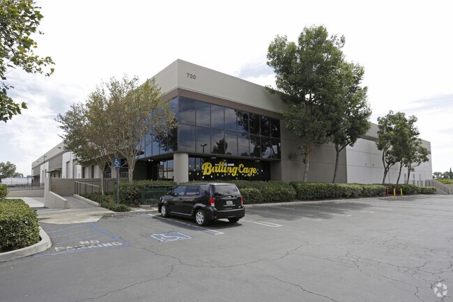
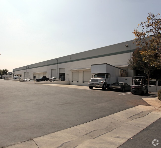
Property Record
760 E Lambert Rd, La Habra, CA 90631


Current Lease Availabilities
Property Detail
760 E Lambert Rd
Anaheim-Santa Ana-Irvine, CA
S TWP 3 RGE 10 SEC 9 T 3 R 10 SEC 9 POR SW1/4
019-101-23
Orange
Industrialgeneral
California
B and X Area of moderate flood hazard, usually the area between the limits of the 100-year and 500-year floods.
6.03 AC
2024
Brea/La Habra
2025
Orange County (California)
001304
NEARBY LISTINGS FOR SALE OR LEASE
DEMOGRAPHICS near 760 E Lambert Rd
1 mile
3 mile
5 mile
2025 Total Population
25,496
143,730
415,857
2030 Population
25,526
143,077
412,735
Pop Growth 2025-2030
+ 0.12%
(0.45%)
(0.75%)
Average Age
39
42
41
2025 Total Households
7,725
47,977
135,671
HH Growth 2025-2030
(0.12%)
(0.63%)
(0.95%)
Median Household Inc
$89,555
$111,748
$104,989
Avg Household Size
3.20
2.90
2.90
2025 Avg HH Vehicles
2.00
2.00
2.00
Median Home Value
$712,156
$855,182
$823,550
Median Year Built
1971
1970
1969
Nearby Places
Map Layers
Map Styles
 Street
 Aerial
Transit
 Traffic
 Biking
Places
Listings with unknown addresses are not visible on the map
- Restaurants
- Banks
- Shops
- Fitness
- Groceries
PUBLIC TRANSPORTATION
COMMUTER RAIL
Fullerton (91 Line - Southern California Regional Rail Authority (Metrolink), Orange County Line - Southern California Regional Rail Authority (Metrolink))
Drive
Walk
Distance
Fullerton (91 Line - Southern California Regional Rail Authority (Metrolink), Orange County Line - Southern California Regional Rail Authority (Metrolink))
10 min
4.9 mi
Buena Park (91 Line - Southern California Regional Rail Authority (Metrolink), Orange County Line - Southern California Regional Rail Authority (Metrolink))
Drive
Walk
Distance
Buena Park (91 Line - Southern California Regional Rail Authority (Metrolink), Orange County Line - Southern California Regional Rail Authority (Metrolink))
11 min
6.0 mi
AIRPORT
Long Beach (Daugherty Field)
Drive
Walk
Distance
Long Beach (Daugherty Field)
33 min
20.3 mi
John Wayne/Orange County
Drive
Walk
Distance
John Wayne/Orange County
30 min
22.3 mi
Ontario International
Drive
Walk
Distance
Ontario International
37 min
26.5 mi
Nearby Properties
Address
Land Use
TOTAL SIZE
Lot Size
Zoning
Address
Land Use
TOTAL SIZE
Lot Size
Zoning
Address
Land Use
TOTAL SIZE
Lot Size
Zoning
18.57 AC
Address
Land Use
TOTAL SIZE
Lot Size
Zoning
10.49 AC
Address
Land Use
TOTAL SIZE
Lot Size
Zoning
Address
Land Use
TOTAL SIZE
Lot Size
Zoning
26.38 AC
Address
Land Use
TOTAL SIZE
Lot Size
Zoning
35.82 AC
Address
Land Use
TOTAL SIZE
Lot Size
Zoning
Address
Land Use
TOTAL SIZE
Lot Size
Zoning
32.48 AC
Address
Land Use
TOTAL SIZE
Lot Size
Zoning
12.02 AC
Address
Land Use
TOTAL SIZE
Lot Size
Zoning
17.20 AC
Address
Land Use
TOTAL SIZE
Lot Size
Zoning
10.49 AC
Address
Land Use
TOTAL SIZE
Lot Size
Zoning
178,140 SF
10.88 AC
Address
Land Use
TOTAL SIZE
Lot Size
Zoning
4.28 AC
Address
Land Use
TOTAL SIZE
Lot Size
Zoning
16.88 AC
Address
Land Use
TOTAL SIZE
Lot Size
Zoning
15.11 AC
Address
Land Use
TOTAL SIZE
Lot Size
Zoning
Address
Land Use
TOTAL SIZE
Lot Size
Zoning
13.40 AC
Address
Land Use
TOTAL SIZE
Lot Size
Zoning
Address
Land Use
TOTAL SIZE
Lot Size
Zoning
187,810 SF
9.09 AC
Address
Land Use
TOTAL SIZE
Lot Size
Zoning
6.11 AC
OP
Address
Land Use
TOTAL SIZE
Lot Size
Zoning
Address
Land Use
TOTAL SIZE
Lot Size
Zoning
7.69 AC
Address
Land Use
TOTAL SIZE
Lot Size
Zoning
Address
Land Use
TOTAL SIZE
Lot Size
Zoning
31.82 AC
Address
Land Use
TOTAL SIZE
Lot Size
Zoning
18.96 AC
Address
Land Use
TOTAL SIZE
Lot Size
Zoning
Address
Land Use
TOTAL SIZE
Lot Size
Zoning
2.71 AC
Address
Land Use
TOTAL SIZE
Lot Size
Zoning
96,802 SF
4.93 AC
Address
Land Use
TOTAL SIZE
Lot Size
Zoning
Address
Land Use
TOTAL SIZE
Lot Size
Zoning
The World's #1 Commercial Real Estate Marketplace
Connect with us
© 2026 CoStar Group
The information above has been obtained from sources believed reliable. While we do not doubt its accuracy we have not verified it and make no guarantee, warranty or representation about it. It is your responsibility to independently confirm its accuracy and completeness. Any projections, opinions, assumptions, or estimates used are for example only and do not represent the current or future performance of the property. The value of this transaction to you depends on tax and other factors which should be evaluated by your tax, financial, and legal advisors. You and your advisors should conduct a careful, independent investigation of the property to determine to your satisfaction the suitability of the property for your needs.