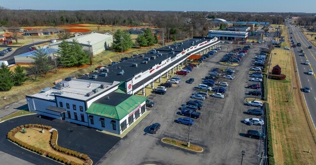
Property Record
760 N Campbell Rd, Bowling Green, KY 42101


NEARBY LISTINGS FOR SALE OR LEASE
Property Detail
760 N Campbell Rd
040B-23-027A
Mainspring Condominium
Communitycenter
Warren
X
Kentucky
21227C0304E
4.05 AC
2025
Bowling Green Area
2025
Other Market Areas
011300
Bowling Green, KY
38,782 SF
DEMOGRAPHICS near 760 N Campbell Rd
1 Mile
3 Mile
5 Mile
2024 Total Population
7,319
67,085
98,338
2029 Population
7,845
73,445
108,281
Pop Growth 2024-2029
+ 7.19%
+ 9.48%
+ 10.11%
Average Age
34
35
36
2024 Total Households
3,232
25,854
37,924
HH Growth 2024-2029
+ 7.24%
+ 10.20%
+ 10.78%
Median Household Inc
$46,513
$43,885
$53,676
Avg Household Size
2.20
2.30
2.40
2024 Avg HH Vehicles
2.00
2.00
2.00
Median Home Value
$218,323
$209,544
$234,502
Median Year Built
1987
1987
1992
Nearby Places
Map Layers
Map Styles
 Street
 Aerial
- Restaurants
- Banks
- Shops
- Fitness
- Groceries
SALE & LEASE HISTORY
LISTING DATE
SALE/LEASE

May 02, 2017
For Lease
Jun 26, 2025
For Sale
Apr 17, 2023
For Lease
Nearby Properties
Address
Land Use
TOTAL SIZE
Lot Size
Zoning
Address
Land Use
TOTAL SIZE
Lot Size
Zoning
26,586 SF
17.19 AC
Address
Land Use
TOTAL SIZE
Lot Size
Zoning
7,399 SF
57.89 AC
Address
Land Use
TOTAL SIZE
Lot Size
Zoning
15,440 SF
16.52 AC
Address
Land Use
TOTAL SIZE
Lot Size
Zoning
117,551 SF
5.06 AC
Address
Land Use
TOTAL SIZE
Lot Size
Zoning
884,032 SF
42.74 AC
Address
Land Use
TOTAL SIZE
Lot Size
Zoning
261,579 SF
17.71 AC
Address
Land Use
TOTAL SIZE
Lot Size
Zoning
16.99 AC
Address
Land Use
TOTAL SIZE
Lot Size
Zoning
59,812 SF
21.30 AC
Address
Land Use
TOTAL SIZE
Lot Size
Zoning
150,327 SF
2.54 AC
Address
Land Use
TOTAL SIZE
Lot Size
Zoning
304,620 SF
38.65 AC
Address
Land Use
TOTAL SIZE
Lot Size
Zoning
64,770 SF
21.31 AC
Address
Land Use
TOTAL SIZE
Lot Size
Zoning
39,504 SF
19.74 AC
Address
Land Use
TOTAL SIZE
Lot Size
Zoning
36,984 SF
7.26 AC
Address
Land Use
TOTAL SIZE
Lot Size
Zoning
261,196 SF
13.01 AC
Address
Land Use
TOTAL SIZE
Lot Size
Zoning
100,193 SF
9.82 AC
Address
Land Use
TOTAL SIZE
Lot Size
Zoning
260,800 SF
16.76 AC
Address
Land Use
TOTAL SIZE
Lot Size
Zoning
49,434 SF
43.95 AC
Address
Land Use
TOTAL SIZE
Lot Size
Zoning
Address
Land Use
TOTAL SIZE
Lot Size
Zoning
19.61 AC
Address
Land Use
TOTAL SIZE
Lot Size
Zoning
142,199 SF
12.95 AC
Address
Land Use
TOTAL SIZE
Lot Size
Zoning
192,994 SF
22.55 AC
Address
Land Use
TOTAL SIZE
Lot Size
Zoning
418,117 SF
44.30 AC
Address
Land Use
TOTAL SIZE
Lot Size
Zoning
214,273 SF
26.97 AC
Address
Land Use
TOTAL SIZE
Lot Size
Zoning
54.74 AC
Address
Land Use
TOTAL SIZE
Lot Size
Zoning
96,696 SF
9.69 AC
Address
Land Use
TOTAL SIZE
Lot Size
Zoning
208,264 SF
26.05 AC
Address
Land Use
TOTAL SIZE
Lot Size
Zoning
43,144 SF
18.61 AC
Address
Land Use
TOTAL SIZE
Lot Size
Zoning
Address
Land Use
TOTAL SIZE
Lot Size
Zoning
Address
Land Use
TOTAL SIZE
Lot Size
Zoning
The World's #1 Commercial Real Estate Marketplace
Connect with us
© 2026 CoStar Group
The information above has been obtained from sources believed reliable. While we do not doubt its accuracy we have not verified it and make no guarantee, warranty or representation about it. It is your responsibility to independently confirm its accuracy and completeness. Any projections, opinions, assumptions, or estimates used are for example only and do not represent the current or future performance of the property. The value of this transaction to you depends on tax and other factors which should be evaluated by your tax, financial, and legal advisors. You and your advisors should conduct a careful, independent investigation of the property to determine to your satisfaction the suitability of the property for your needs.