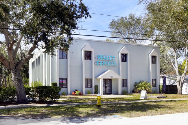
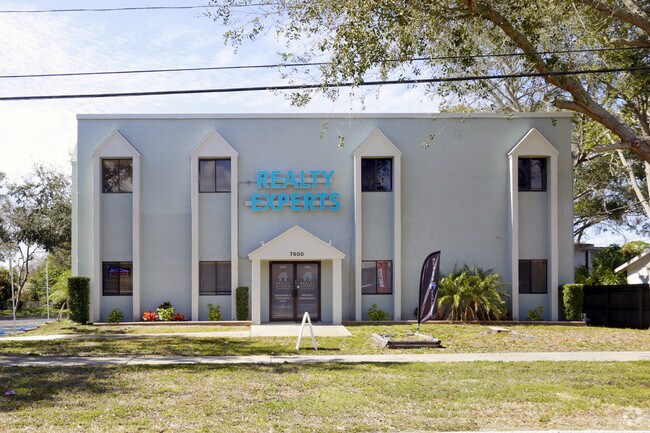
Property Record
7600 131St St, Seminole, FL 33776
NEARBY LISTINGS FOR SALE OR LEASE
Property Detail
7600 131St St
Tampa-St. Petersburg-Clearwater, FL
Pinellas Groves
29-30-15-70794-300-0106
PINELLAS GROVES SW 1/4, S PART OF LOT 1 DESC AS BEG SW COR SD LOT TH N 147.5FT TH E 292.9FT TH S 149.9FT TH W 293.1FT TO POB
Officebuilding
Pinellas
X
Florida
12103C0179H
1
2024
1 AC
2025
South Pinellas
025110
Tampa/St Petersburg
8,430 SF
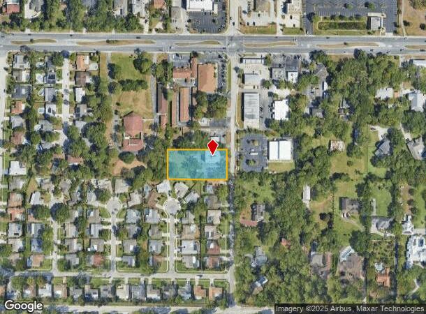
DEMOGRAPHICS near 7600 131St St
1 Mile
3 Mile
5 Mile
2024 Total Population
9,126
69,382
146,651
2029 Population
9,030
70,335
148,687
Pop Growth 2024-2029
(1.05%)
+ 1.37%
+ 1.39%
Average Age
45
50
50
2024 Total Households
3,642
32,531
69,344
HH Growth 2024-2029
(1.13%)
+ 1.58%
+ 1.49%
Median Household Inc
$93,160
$73,057
$66,755
Avg Household Size
2.40
2.10
2.00
2024 Avg HH Vehicles
2.00
2.00
2.00
Median Home Value
$395,005
$351,889
$313,198
Median Year Built
1975
1975
1975
Nearby Places
Map Layers
Map Styles
 Street
 Aerial
- Restaurants
- Banks
- Shops
- Fitness
- Groceries
PUBLIC TRANSPORTATION
AIRPORT
St Pete-Clearwater International
DRIVE
WALK
Distance
St Pete-Clearwater International
30 min
14.1 mi
Tampa International
DRIVE
WALK
Distance
Tampa International
41 min
25.0 mi
Freight Ports
Port Manatee
DRIVE
WALK
Distance
Port Manatee
55 min
35.7 mi
SALE & LEASE HISTORY
LISTING DATE
SALE/LEASE

Sep 24, 2016
For Sale
Mar 15, 2017
For Lease
Jun 14, 2017
For Lease
Nearby Properties
Address
Land Use
TOTAL SIZE
Lot Size
Zoning
Address
Land Use
TOTAL SIZE
Lot Size
Zoning
372,952 SF
31.56 AC
Address
Land Use
TOTAL SIZE
Lot Size
Zoning
453,486 SF
15.73 AC
Address
Land Use
TOTAL SIZE
Lot Size
Zoning
328,466 SF
18.81 AC
Address
Land Use
TOTAL SIZE
Lot Size
Zoning
223,748 SF
100.32 AC
R3
Address
Land Use
TOTAL SIZE
Lot Size
Zoning
318,185 SF
38.78 AC
C2
Address
Land Use
TOTAL SIZE
Lot Size
Zoning
101,642 SF
1.43 AC
Address
Land Use
TOTAL SIZE
Lot Size
Zoning
10,474 SF
660.47 AC
R3
Address
Land Use
TOTAL SIZE
Lot Size
Zoning
267,730 SF
35.84 AC
AE
Address
Land Use
TOTAL SIZE
Lot Size
Zoning
6,098 SF
374.66 AC
AE
Address
Land Use
TOTAL SIZE
Lot Size
Zoning
5,647 SF
187.56 AC
AE
Address
Land Use
TOTAL SIZE
Lot Size
Zoning
29,644 SF
19.13 AC
Address
Land Use
TOTAL SIZE
Lot Size
Zoning
160,086 SF
1.18 AC
Address
Land Use
TOTAL SIZE
Lot Size
Zoning
204,891 SF
18.20 AC
Address
Land Use
TOTAL SIZE
Lot Size
Zoning
236,240 SF
12.38 AC
RPD15
Address
Land Use
TOTAL SIZE
Lot Size
Zoning
222,888 SF
11.83 AC
RPD15
Address
Land Use
TOTAL SIZE
Lot Size
Zoning
385,858 SF
8.83 AC
Address
Land Use
TOTAL SIZE
Lot Size
Zoning
4,704 SF
3.36 AC
Address
Land Use
TOTAL SIZE
Lot Size
Zoning
133,440 SF
6.85 AC
RM15
Address
Land Use
TOTAL SIZE
Lot Size
Zoning
176,209 SF
27.52 AC
Address
Land Use
TOTAL SIZE
Lot Size
Zoning
440 SF
3.47 AC
Address
Land Use
TOTAL SIZE
Lot Size
Zoning
102,073 SF
9.07 AC
Address
Land Use
TOTAL SIZE
Lot Size
Zoning
160,134 SF
18.61 AC
R2
Address
Land Use
TOTAL SIZE
Lot Size
Zoning
84,008 SF
1.49 AC
Address
Land Use
TOTAL SIZE
Lot Size
Zoning
151,149 SF
8.84 AC
RM15
Address
Land Use
TOTAL SIZE
Lot Size
Zoning
160,616 SF
11.88 AC
Address
Land Use
TOTAL SIZE
Lot Size
Zoning
147,755 SF
6.86 AC
Address
Land Use
TOTAL SIZE
Lot Size
Zoning
6,898 SF
157.25 AC
Address
Land Use
TOTAL SIZE
Lot Size
Zoning
110,192 SF
4.58 AC
Address
Land Use
TOTAL SIZE
Lot Size
Zoning
36,102 SF
2.32 AC
Address
Land Use
TOTAL SIZE
Lot Size
Zoning
139,181 SF
22.21 AC
R2
The World's #1 Commercial Real Estate Marketplace
Connect with us
© 2025 CoStar Group
The information above has been obtained from sources believed reliable. While we do not doubt its accuracy we have not verified it and make no guarantee, warranty or representation about it. It is your responsibility to independently confirm its accuracy and completeness. Any projections, opinions, assumptions, or estimates used are for example only and do not represent the current or future performance of the property. The value of this transaction to you depends on tax and other factors which should be evaluated by your tax, financial, and legal advisors. You and your advisors should conduct a careful, independent investigation of the property to determine to your satisfaction the suitability of the property for your needs.