Property Record
7600 E Interstate 40, Amarillo, TX 79118
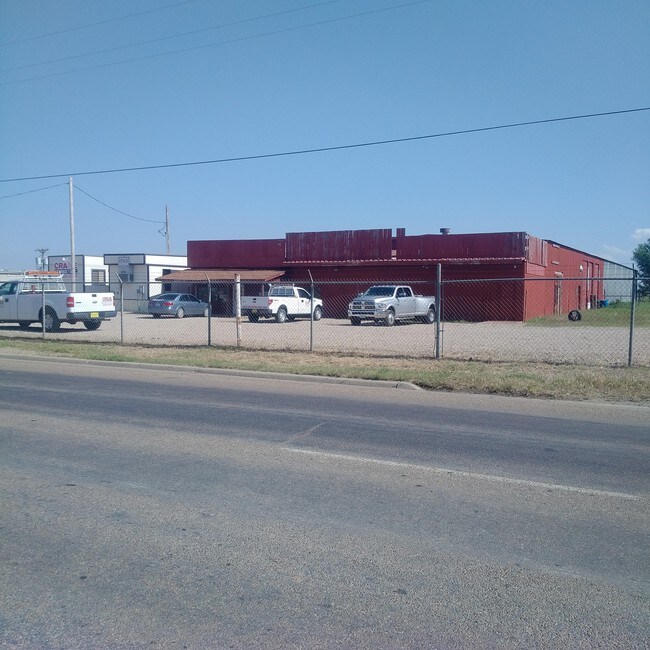


Property Detail
7600 E Interstate 40
R-200-0900-1200-0
SECT 90 A B & M BLK 0002, 3 AC HOMESITE IN N/2 OF SECT, 3.0000 ACRES
Commercialnec
Potter
LC
Texas
B and X Area of moderate flood hazard, usually the area between the limits of the 100-year and 500-year floods.
3 AC
2024
Amarillo
2025
Other Market Areas
014401
Amarillo, TX
NEARBY LISTINGS FOR SALE OR LEASE
DEMOGRAPHICS near 7600 E Interstate 40
1 mile
3 mile
5 mile
2024 Total Population
17
16,115
55,175
2029 Population
16
15,860
54,678
Pop Growth 2024-2029
(5.88%)
(1.58%)
(0.90%)
Average Age
37
35
35
2024 Total Households
5
5,307
17,268
HH Growth 2024-2029
0.00%
(1.71%)
(0.98%)
Median Household Inc
$87,500
$51,135
$42,572
Avg Household Size
2.40
2.90
2.90
2024 Avg HH Vehicles
2.00
2.00
2.00
Median Home Value
$99,999
$78,422
$80,812
Median Year Built
1964
1962
1962
Nearby Places
Map Layers
Map Styles
 Street
 Aerial
Transit
 Traffic
 Biking
Places
Listings with unknown addresses are not visible on the map
- Restaurants
- Banks
- Shops
- Fitness
- Groceries
PUBLIC TRANSPORTATION
AIRPORT
Rick Husband Amarillo International
Drive
Walk
Distance
Rick Husband Amarillo International
8 min
4.2 mi
Freight Ports
Tulsa Port Of Catoosa
Drive
Walk
Distance
Tulsa Port Of Catoosa
390 min
372.2 mi
SALE & LEASE HISTORY
LISTING DATE
SALE/LEASE

Sep 25, 2016
For Lease
Nearby Properties
Address
Land Use
TOTAL SIZE
Lot Size
Zoning
Address
Land Use
TOTAL SIZE
Lot Size
Zoning
1,079,953 SF
106.07 AC
Address
Land Use
TOTAL SIZE
Lot Size
Zoning
414,471 SF
104.16 AC
LC
Address
Land Use
TOTAL SIZE
Lot Size
Zoning
572,685 SF
34.93 AC
Address
Land Use
TOTAL SIZE
Lot Size
Zoning
325,220 SF
26.22 AC
PD
Address
Land Use
TOTAL SIZE
Lot Size
Zoning
89,206 SF
17.98 AC
Address
Land Use
TOTAL SIZE
Lot Size
Zoning
152,702 SF
46.34 AC
Address
Land Use
TOTAL SIZE
Lot Size
Zoning
69,116 SF
4.05 AC
Address
Land Use
TOTAL SIZE
Lot Size
Zoning
257,520 SF
19.81 AC
PD
Address
Land Use
TOTAL SIZE
Lot Size
Zoning
136,639 SF
18.07 AC
R2
Address
Land Use
TOTAL SIZE
Lot Size
Zoning
1,604 SF
419.88 AC
A
Address
Land Use
TOTAL SIZE
Lot Size
Zoning
190,035 SF
13.26 AC
Address
Land Use
TOTAL SIZE
Lot Size
Zoning
209,957 SF
24.24 AC
LC
Address
Land Use
TOTAL SIZE
Lot Size
Zoning
136,844 SF
38.77 AC
Address
Land Use
TOTAL SIZE
Lot Size
Zoning
89,740 SF
2.71 AC
Address
Land Use
TOTAL SIZE
Lot Size
Zoning
92,341 SF
9.91 AC
R3
Address
Land Use
TOTAL SIZE
Lot Size
Zoning
23.39 AC
Address
Land Use
TOTAL SIZE
Lot Size
Zoning
87,936 SF
2.89 AC
Address
Land Use
TOTAL SIZE
Lot Size
Zoning
4,984 SF
39.98 AC
Address
Land Use
TOTAL SIZE
Lot Size
Zoning
74,509 SF
2.49 AC
Address
Land Use
TOTAL SIZE
Lot Size
Zoning
66,756 SF
6.21 AC
Address
Land Use
TOTAL SIZE
Lot Size
Zoning
79,521 SF
Address
Land Use
TOTAL SIZE
Lot Size
Zoning
52,318 SF
1.78 AC
Address
Land Use
TOTAL SIZE
Lot Size
Zoning
15,448 SF
16.10 AC
Address
Land Use
TOTAL SIZE
Lot Size
Zoning
74,897 SF
7.33 AC
LC
Address
Land Use
TOTAL SIZE
Lot Size
Zoning
89,982 SF
9.75 AC
Address
Land Use
TOTAL SIZE
Lot Size
Zoning
53,855 SF
1.88 AC
HC
Address
Land Use
TOTAL SIZE
Lot Size
Zoning
65,730 SF
9.09 AC
A
Address
Land Use
TOTAL SIZE
Lot Size
Zoning
84,352 SF
21.76 AC
HC
Address
Land Use
TOTAL SIZE
Lot Size
Zoning
73,196 SF
Address
Land Use
TOTAL SIZE
Lot Size
Zoning
91,134 SF
7.33 AC
LC
The World's #1 Commercial Real Estate Marketplace
Connect with us
© 2026 CoStar Group
The information above has been obtained from sources believed reliable. While we do not doubt its accuracy we have not verified it and make no guarantee, warranty or representation about it. It is your responsibility to independently confirm its accuracy and completeness. Any projections, opinions, assumptions, or estimates used are for example only and do not represent the current or future performance of the property. The value of this transaction to you depends on tax and other factors which should be evaluated by your tax, financial, and legal advisors. You and your advisors should conduct a careful, independent investigation of the property to determine to your satisfaction the suitability of the property for your needs.