Property Record
7600 N Bryant Ave, Oklahoma City, OK 73121


NEARBY LISTINGS FOR SALE OR LEASE
Property Detail
7600 N Bryant Ave
141705017
Unpltd Pt Sec 06 12N 2W
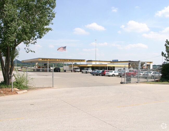
Autorepair
UNPLTD PT SEC 06 12N 2W 000 000 PT NW4 SEC 6 12N 2W BEG 779.42FT S OF NW/C NW4 TH S742.24FT E313.42FT TO R/W OF HWY NELY ALONG R/W 601.01FT N146.77FT W437.64FT TO BEG SUBJ TO EASEMENTS OF RECORD
X
Oklahoma
40109C0190H
Oklahoma
2023
6.29 AC
2024
Northeast
106100
Oklahoma City
15,900 SF
Oklahoma City, OK
DEMOGRAPHICS near 7600 N Bryant Ave
1 Mile
3 Mile
5 Mile
2024 Total Population
224
10,252
75,782
2029 Population
227
10,446
78,264
Pop Growth 2024-2029
+ 1.34%
+ 1.89%
+ 3.28%
Average Age
46
43
39
2024 Total Households
87
4,057
32,497
HH Growth 2024-2029
+ 1.15%
+ 1.97%
+ 3.45%
Median Household Inc
$89,204
$53,743
$49,524
Avg Household Size
2.30
2.40
2.20
2024 Avg HH Vehicles
2.00
2.00
2.00
Median Home Value
$250,000
$210,280
$204,226
Median Year Built
1960
1964
1969
Nearby Places
Map Layers
Map Styles
 Street
 Aerial
- Restaurants
- Banks
- Shops
- Fitness
- Groceries
PUBLIC TRANSPORTATION
COMMUTER RAIL
DRIVE
WALK
Distance
12 min
8.6 mi
AIRPORT
Will Rogers World
DRIVE
WALK
Distance
Will Rogers World
24 min
17.8 mi
Nearby Properties
Address
Land Use
TOTAL SIZE
Lot Size
Zoning
Address
Land Use
TOTAL SIZE
Lot Size
Zoning
93,244 SF
7.54 AC
PUD
Address
Land Use
TOTAL SIZE
Lot Size
Zoning
241,874 SF
36.89 AC
PUD
Address
Land Use
TOTAL SIZE
Lot Size
Zoning
21,000 SF
2.64 AC
I-1
Address
Land Use
TOTAL SIZE
Lot Size
Zoning
280,970 SF
24.32 AC
Address
Land Use
TOTAL SIZE
Lot Size
Zoning
145,124 SF
55 AC
PUD
Address
Land Use
TOTAL SIZE
Lot Size
Zoning
39,800 SF
4.10 AC
PUD
Address
Land Use
TOTAL SIZE
Lot Size
Zoning
316,358 SF
39.39 AC
PUD
Address
Land Use
TOTAL SIZE
Lot Size
Zoning
198,422 SF
4.17 AC
O-2
Address
Land Use
TOTAL SIZE
Lot Size
Zoning
160,816 SF
16.14 AC
Address
Land Use
TOTAL SIZE
Lot Size
Zoning
39,883 SF
2.35 AC
PUD
Address
Land Use
TOTAL SIZE
Lot Size
Zoning
36,251 SF
6.21 AC
Address
Land Use
TOTAL SIZE
Lot Size
Zoning
220,800 SF
14.55 AC
PUD
Address
Land Use
TOTAL SIZE
Lot Size
Zoning
58,293 SF
10.88 AC
C-4
Address
Land Use
TOTAL SIZE
Lot Size
Zoning
32,252 SF
3.33 AC
PUD
Address
Land Use
TOTAL SIZE
Lot Size
Zoning
46,390 SF
14.13 AC
Address
Land Use
TOTAL SIZE
Lot Size
Zoning
214,478 SF
22 AC
PUD
Address
Land Use
TOTAL SIZE
Lot Size
Zoning
131,180 SF
12.90 AC
I-2
Address
Land Use
TOTAL SIZE
Lot Size
Zoning
110,172 SF
33.65 AC
PUD
Address
Land Use
TOTAL SIZE
Lot Size
Zoning
145,600 SF
16.38 AC
PUD
Address
Land Use
TOTAL SIZE
Lot Size
Zoning
92,712 SF
54.28 AC
PUD
Address
Land Use
TOTAL SIZE
Lot Size
Zoning
6,286 SF
1.03 AC
C-3
Address
Land Use
TOTAL SIZE
Lot Size
Zoning
4,041 SF
0.38 AC
PUD
Address
Land Use
TOTAL SIZE
Lot Size
Zoning
125,440 SF
10.92 AC
PUD
Address
Land Use
TOTAL SIZE
Lot Size
Zoning
48,768 SF
5.47 AC
PUD
Address
Land Use
TOTAL SIZE
Lot Size
Zoning
7,360 SF
4.69 AC
SPUD
Address
Land Use
TOTAL SIZE
Lot Size
Zoning
104,186 SF
21.32 AC
R-4
Address
Land Use
TOTAL SIZE
Lot Size
Zoning
4,479 SF
0.18 AC
PUD
Address
Land Use
TOTAL SIZE
Lot Size
Zoning
88,116 SF
38.22 AC
C-3
Address
Land Use
TOTAL SIZE
Lot Size
Zoning
147,511 SF
2.84 AC
The World's #1 Commercial Real Estate Marketplace
Connect with us
© 2026 CoStar Group
The information above has been obtained from sources believed reliable. While we do not doubt its accuracy we have not verified it and make no guarantee, warranty or representation about it. It is your responsibility to independently confirm its accuracy and completeness. Any projections, opinions, assumptions, or estimates used are for example only and do not represent the current or future performance of the property. The value of this transaction to you depends on tax and other factors which should be evaluated by your tax, financial, and legal advisors. You and your advisors should conduct a careful, independent investigation of the property to determine to your satisfaction the suitability of the property for your needs.