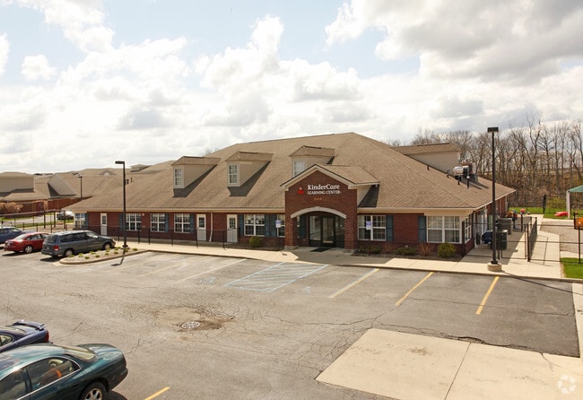
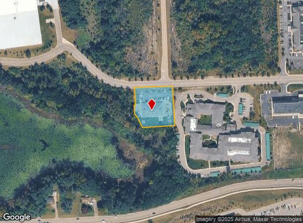
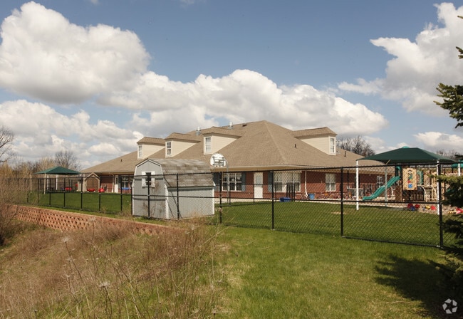
Property Record
7600 Nemco Way, Brighton, MI 48116
NEARBY LISTINGS FOR SALE OR LEASE
Property Detail
7600 Nemco Way
18-24-400-038
A PARCEL OF LAND BEING PART OF THE SOUTHEAST 1/4 OF SECTION 24, TOWN 02 NORTH - RANGE 05 EAST, CITY OF BRIGHTON, LIVINGSTON
Commercialnec
Livingston
X
Michigan
26093C0345D
1.18 AC
2025
Livingston County
2025
Detroit
741100
Detroit-Warren-Dearborn, MI
8,968 SF
DEMOGRAPHICS near 7600 Nemco Way
1 Mile
3 Mile
5 Mile
2024 Total Population
1,593
27,947
53,759
2029 Population
1,644
28,743
55,287
Pop Growth 2024-2029
+ 3.20%
+ 2.85%
+ 2.84%
Average Age
47
45
44
2024 Total Households
736
11,695
21,481
HH Growth 2024-2029
+ 3.40%
+ 2.93%
+ 2.90%
Median Household Inc
$67,976
$92,317
$98,378
Avg Household Size
2.10
2.40
2.50
2024 Avg HH Vehicles
2.00
2.00
2.00
Median Home Value
$305,454
$333,208
$341,579
Median Year Built
1989
1987
1986
Nearby Places
Map Layers
Map Styles
 Street
 Aerial
- Restaurants
- Banks
- Shops
- Fitness
- Groceries
PUBLIC TRANSPORTATION
AIRPORT
Bishop International
DRIVE
WALK
Distance
Bishop International
52 min
37.4 mi
Freight Ports
Port of Toledo
DRIVE
WALK
Distance
Port of Toledo
100 min
80.6 mi
Nearby Properties
Address
Land Use
TOTAL SIZE
Lot Size
Zoning
Address
Land Use
TOTAL SIZE
Lot Size
Zoning
222,504 SF
25.60 AC
C1
Address
Land Use
TOTAL SIZE
Lot Size
Zoning
4.30 AC
R5
Address
Land Use
TOTAL SIZE
Lot Size
Zoning
304,566 SF
27.31 AC
C1
Address
Land Use
TOTAL SIZE
Lot Size
Zoning
172,817 SF
7.87 AC
OS
Address
Land Use
TOTAL SIZE
Lot Size
Zoning
97,544 SF
12.13 AC
R4
Address
Land Use
TOTAL SIZE
Lot Size
Zoning
90,399 SF
13.90 AC
B-1
Address
Land Use
TOTAL SIZE
Lot Size
Zoning
142,190 SF
23.24 AC
R4
Address
Land Use
TOTAL SIZE
Lot Size
Zoning
114,371 SF
9.88 AC
R4
Address
Land Use
TOTAL SIZE
Lot Size
Zoning
173,509 SF
18.06 AC
R-M
Address
Land Use
TOTAL SIZE
Lot Size
Zoning
240,114 SF
18.91 AC
R-M
Address
Land Use
TOTAL SIZE
Lot Size
Zoning
85,147 SF
12.67 AC
C1
Address
Land Use
TOTAL SIZE
Lot Size
Zoning
134,148 SF
11.43 AC
IA
Address
Land Use
TOTAL SIZE
Lot Size
Zoning
53,494 SF
10 AC
MUPUD
Address
Land Use
TOTAL SIZE
Lot Size
Zoning
124,157 SF
13.27 AC
OR
Address
Land Use
TOTAL SIZE
Lot Size
Zoning
100,728 SF
14.30 AC
B-2
Address
Land Use
TOTAL SIZE
Lot Size
Zoning
110,602 SF
18.63 AC
R-M
Address
Land Use
TOTAL SIZE
Lot Size
Zoning
113,038 SF
9.73 AC
OR
Address
Land Use
TOTAL SIZE
Lot Size
Zoning
5,947 SF
104.68 AC
MHP
Address
Land Use
TOTAL SIZE
Lot Size
Zoning
80,573 SF
13.72 AC
OR
Address
Land Use
TOTAL SIZE
Lot Size
Zoning
19.60 AC
OR
Address
Land Use
TOTAL SIZE
Lot Size
Zoning
100,326 SF
8.61 AC
R4
Address
Land Use
TOTAL SIZE
Lot Size
Zoning
57,169 SF
3.70 AC
OS
Address
Land Use
TOTAL SIZE
Lot Size
Zoning
6 AC
R4
Address
Land Use
TOTAL SIZE
Lot Size
Zoning
131,020 SF
11 AC
LI
Address
Land Use
TOTAL SIZE
Lot Size
Zoning
41,261 SF
1.72 AC
OS
Address
Land Use
TOTAL SIZE
Lot Size
Zoning
5 AC
R4
Address
Land Use
TOTAL SIZE
Lot Size
Zoning
27,605 SF
3.82 AC
R-M
Address
Land Use
TOTAL SIZE
Lot Size
Zoning
51,408 SF
5.40 AC
OR
Address
Land Use
TOTAL SIZE
Lot Size
Zoning
173,345 SF
10.98 AC
LI
Address
Land Use
TOTAL SIZE
Lot Size
Zoning
25,337 SF
6.53 AC
OR
The World's #1 Commercial Real Estate Marketplace
Connect with us
© 2025 CoStar Group
The information above has been obtained from sources believed reliable. While we do not doubt its accuracy we have not verified it and make no guarantee, warranty or representation about it. It is your responsibility to independently confirm its accuracy and completeness. Any projections, opinions, assumptions, or estimates used are for example only and do not represent the current or future performance of the property. The value of this transaction to you depends on tax and other factors which should be evaluated by your tax, financial, and legal advisors. You and your advisors should conduct a careful, independent investigation of the property to determine to your satisfaction the suitability of the property for your needs.