Property Record
7601 Ganser Way, Madison, WI 53719


Property Detail
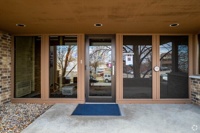
7601 Ganser Way
0708-262-0203-1
HIGHPOINT COMMERCIAL, LOT 9 AND E 63 FT LOT 8
Commercialnec
Dane
RMX
Wisconsin
B and X Area of moderate flood hazard, usually the area between the limits of the 100-year and 500-year floods.
9,8
2025
0.98 AC
2025
Southwest Madison
000410
Milwaukee/Madison
20,108 SF
Madison, WI
NEARBY LISTINGS FOR SALE OR LEASE
DEMOGRAPHICS near 7601 Ganser Way
1 mile
3 mile
5 mile
2025 Total Population
10,803
78,490
155,352
2030 Population
11,363
82,048
161,834
Pop Growth 2025-2030
+ 5.18%
+ 4.53%
+ 4.17%
Average Age
39
40
39
2025 Total Households
5,637
36,291
69,151
HH Growth 2025-2030
+ 5.29%
+ 4.92%
+ 4.50%
Median Household Inc
$71,509
$91,292
$95,103
Avg Household Size
1.90
2.10
2.20
2025 Avg HH Vehicles
1.00
2.00
2.00
Median Home Value
$415,490
$435,285
$454,064
Median Year Built
1990
1989
1987
Nearby Places
Map Layers
Map Styles
 Street
 Aerial
Layers
 Traffic
 Biking
Places
Listings with unknown addresses are not visible on the map
- Restaurants
- Banks
- Shops
- Fitness
- Groceries
PUBLIC TRANSPORTATION
AIRPORT
Dane County Regional/Truax Field
Drive
Walk
Distance
Dane County Regional/Truax Field
27 min
16.7 mi
SALE & LEASE HISTORY
LISTING DATE
SALE/LEASE

Oct 27, 2020
For Lease
May 21, 2020
For Lease
Jun 30, 2017
For Lease
Jul 11, 2018
For Lease
Nearby Properties
Address
Land Use
TOTAL SIZE
Lot Size
Zoning
Address
Land Use
TOTAL SIZE
Lot Size
Zoning
408,311 SF
9.26 AC
SE
Address
Land Use
TOTAL SIZE
Lot Size
Zoning
501,997 SF
26.90 AC
SE
Address
Land Use
TOTAL SIZE
Lot Size
Zoning
530,774 SF
37.40 AC
RMX
Address
Land Use
TOTAL SIZE
Lot Size
Zoning
526,685 SF
23.94 AC
SR-V2
Address
Land Use
TOTAL SIZE
Lot Size
Zoning
156,908 SF
23.87 AC
SE
Address
Land Use
TOTAL SIZE
Lot Size
Zoning
143,360 SF
10.27 AC
SEC
Address
Land Use
TOTAL SIZE
Lot Size
Zoning
235,052 SF
7.34 AC
WP-28
Address
Land Use
TOTAL SIZE
Lot Size
Zoning
262,260 SF
6.28 AC
TR-U2
Address
Land Use
TOTAL SIZE
Lot Size
Zoning
317,128 SF
10.14 AC
PD
Address
Land Use
TOTAL SIZE
Lot Size
Zoning
217,664 SF
1.43 AC
TE
Address
Land Use
TOTAL SIZE
Lot Size
Zoning
217,544 SF
7.65 AC
TR-U2
Address
Land Use
TOTAL SIZE
Lot Size
Zoning
350,550 SF
6.17 AC
TR-U2
Address
Land Use
TOTAL SIZE
Lot Size
Zoning
175,209 SF
12.60 AC
SEC
Address
Land Use
TOTAL SIZE
Lot Size
Zoning
169,563 SF
19.82 AC
SEC
Address
Land Use
TOTAL SIZE
Lot Size
Zoning
51,205 SF
9.32 AC
SE
Address
Land Use
TOTAL SIZE
Lot Size
Zoning
15.61 AC
Address
Land Use
TOTAL SIZE
Lot Size
Zoning
201,601 SF
10.08 AC
TR-U2
Address
Land Use
TOTAL SIZE
Lot Size
Zoning
5.95 AC
Address
Land Use
TOTAL SIZE
Lot Size
Zoning
222,210 SF
11.25 AC
PD
Address
Land Use
TOTAL SIZE
Lot Size
Zoning
169,975 SF
4.05 AC
CC-T
Address
Land Use
TOTAL SIZE
Lot Size
Zoning
167,555 SF
2.98 AC
TR-U2
Address
Land Use
TOTAL SIZE
Lot Size
Zoning
181,269 SF
4.58 AC
CC-T
Address
Land Use
TOTAL SIZE
Lot Size
Zoning
2.91 AC
CC-T
Address
Land Use
TOTAL SIZE
Lot Size
Zoning
204,228 SF
4.23 AC
PD
Address
Land Use
TOTAL SIZE
Lot Size
Zoning
237,562 SF
4.59 AC
PD
Address
Land Use
TOTAL SIZE
Lot Size
Zoning
248,319 SF
8.47 AC
PD
Address
Land Use
TOTAL SIZE
Lot Size
Zoning
243,290 SF
9.28 AC
SR-V2
Address
Land Use
TOTAL SIZE
Lot Size
Zoning
217,919 SF
11.97 AC
PD
Address
Land Use
TOTAL SIZE
Lot Size
Zoning
295,772 SF
7.35 AC
PD
Address
Land Use
TOTAL SIZE
Lot Size
Zoning
135,964 SF
6.57 AC
SR-V2
The World's #1 Commercial Real Estate Marketplace
Connect with us
© 2026 CoStar Group
The information above has been obtained from sources believed reliable. While we do not doubt its accuracy we have not verified it and make no guarantee, warranty or representation about it. It is your responsibility to independently confirm its accuracy and completeness. Any projections, opinions, assumptions, or estimates used are for example only and do not represent the current or future performance of the property. The value of this transaction to you depends on tax and other factors which should be evaluated by your tax, financial, and legal advisors. You and your advisors should conduct a careful, independent investigation of the property to determine to your satisfaction the suitability of the property for your needs.