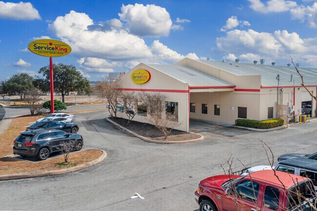
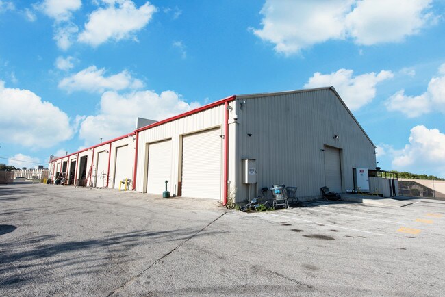
Property Record
7602 Ingram Rd, San Antonio, TX 78251

NEARBY LISTINGS FOR SALE OR LEASE
Property Detail
7602 Ingram Rd
San Antonio-New Braunfels, TX
Crown Meadows Subd
18282-002-0040
NCB 18282 BLK 2 LOT 4 (CROWN MEADOWS SUBD)
Autorepair
Bexar
X
Texas
48029C0360G
4
2024
1.21 AC
2025
Far West
171923
San Antonio
13,984 SF
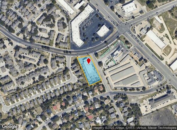
DEMOGRAPHICS near 7602 Ingram Rd
1 Mile
3 Mile
5 Mile
2024 Total Population
15,522
114,330
327,336
2029 Population
16,248
120,844
346,075
Pop Growth 2024-2029
+ 4.68%
+ 5.70%
+ 5.72%
Average Age
34
36
36
2024 Total Households
6,577
42,510
119,304
HH Growth 2024-2029
+ 4.84%
+ 5.92%
+ 5.94%
Median Household Inc
$50,913
$58,470
$57,975
Avg Household Size
2.30
2.60
2.70
2024 Avg HH Vehicles
2.00
2.00
2.00
Median Home Value
$186,611
$178,695
$175,351
Median Year Built
1993
1991
1987
Nearby Places
Map Layers
Map Styles
 Street
 Aerial
- Restaurants
- Banks
- Shops
- Fitness
- Groceries
PUBLIC TRANSPORTATION
AIRPORT
San Antonio International
DRIVE
WALK
Distance
San Antonio International
17 min
12.3 mi
Freight Ports
Calhoun Port
DRIVE
WALK
Distance
Calhoun Port
195 min
157.7 mi
SALE & LEASE HISTORY
LISTING DATE
SALE/LEASE

Apr 16, 2019
For Sale
Nearby Properties
Address
Land Use
TOTAL SIZE
Lot Size
Zoning
Address
Land Use
TOTAL SIZE
Lot Size
Zoning
486,228 SF
50.05 AC
Address
Land Use
TOTAL SIZE
Lot Size
Zoning
339,795 SF
24.27 AC
Address
Land Use
TOTAL SIZE
Lot Size
Zoning
469,808 SF
36 AC
Address
Land Use
TOTAL SIZE
Lot Size
Zoning
593,760 SF
69.28 AC
Address
Land Use
TOTAL SIZE
Lot Size
Zoning
236,594 SF
25.35 AC
Address
Land Use
TOTAL SIZE
Lot Size
Zoning
185,751 SF
21.60 AC
Address
Land Use
TOTAL SIZE
Lot Size
Zoning
171,142 SF
21.60 AC
Address
Land Use
TOTAL SIZE
Lot Size
Zoning
260,384 SF
33.56 AC
Address
Land Use
TOTAL SIZE
Lot Size
Zoning
370,870 SF
27.27 AC
Address
Land Use
TOTAL SIZE
Lot Size
Zoning
541,776 SF
22.15 AC
Address
Land Use
TOTAL SIZE
Lot Size
Zoning
118,393 SF
28.05 AC
Address
Land Use
TOTAL SIZE
Lot Size
Zoning
341,212 SF
15 AC
Address
Land Use
TOTAL SIZE
Lot Size
Zoning
123,595 SF
21.60 AC
Address
Land Use
TOTAL SIZE
Lot Size
Zoning
331,109 SF
14.44 AC
Address
Land Use
TOTAL SIZE
Lot Size
Zoning
369,951 SF
21.42 AC
Address
Land Use
TOTAL SIZE
Lot Size
Zoning
361,708 SF
17.83 AC
Address
Land Use
TOTAL SIZE
Lot Size
Zoning
109,425 SF
30.63 AC
Address
Land Use
TOTAL SIZE
Lot Size
Zoning
532,921 SF
21.80 AC
Address
Land Use
TOTAL SIZE
Lot Size
Zoning
50,135 SF
10.96 AC
Address
Land Use
TOTAL SIZE
Lot Size
Zoning
368,012 SF
22.27 AC
Address
Land Use
TOTAL SIZE
Lot Size
Zoning
336,383 SF
18.71 AC
Address
Land Use
TOTAL SIZE
Lot Size
Zoning
275,270 SF
11.97 AC
Address
Land Use
TOTAL SIZE
Lot Size
Zoning
286,006 SF
13.43 AC
Address
Land Use
TOTAL SIZE
Lot Size
Zoning
202,122 SF
20.56 AC
Address
Land Use
TOTAL SIZE
Lot Size
Zoning
608,644 SF
88.50 AC
Address
Land Use
TOTAL SIZE
Lot Size
Zoning
360,108 SF
24 AC
Address
Land Use
TOTAL SIZE
Lot Size
Zoning
326,820 SF
12.57 AC
Address
Land Use
TOTAL SIZE
Lot Size
Zoning
284,359 SF
21.53 AC
Address
Land Use
TOTAL SIZE
Lot Size
Zoning
337,360 SF
13.33 AC
Address
Land Use
TOTAL SIZE
Lot Size
Zoning
213,968 SF
21.30 AC
The World's #1 Commercial Real Estate Marketplace
Connect with us
© 2025 CoStar Group
The information above has been obtained from sources believed reliable. While we do not doubt its accuracy we have not verified it and make no guarantee, warranty or representation about it. It is your responsibility to independently confirm its accuracy and completeness. Any projections, opinions, assumptions, or estimates used are for example only and do not represent the current or future performance of the property. The value of this transaction to you depends on tax and other factors which should be evaluated by your tax, financial, and legal advisors. You and your advisors should conduct a careful, independent investigation of the property to determine to your satisfaction the suitability of the property for your needs.