Property Record
7604 Ne 5Th Ave, Vancouver, WA 98665


NEARBY LISTINGS FOR SALE OR LEASE
Property Detail
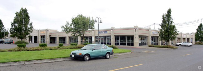
7604 Ne 5Th Ave
Portland-Vancouver-Hillsboro, OR-WA
Hazel Dell Square
148227-000
HAZEL DELL SQUARE LOT 1 SP3-932 FOR ASSESSOR USE ONLY LOT 1 EXC PORTION TO ROAD PER AFN 6179913 (EX 893077)
Regionalshoppingcenterormallwithanchorstore
Clark
X
Washington
53011C0366D
1
2025
3.17 AC
2025
Hazel Dell/Salmon Creek
040810
Portland
30,360 SF
DEMOGRAPHICS near 7604 Ne 5Th Ave
1 Mile
3 Mile
5 Mile
2024 Total Population
14,829
95,858
198,183
2029 Population
15,890
102,781
213,378
Pop Growth 2024-2029
+ 7.15%
+ 7.22%
+ 7.67%
Average Age
40
41
41
2024 Total Households
6,069
37,517
79,369
HH Growth 2024-2029
+ 7.32%
+ 7.36%
+ 7.89%
Median Household Inc
$61,544
$81,106
$77,678
Avg Household Size
2.40
2.50
2.40
2024 Avg HH Vehicles
2.00
2.00
2.00
Median Home Value
$410,034
$432,356
$436,838
Median Year Built
1981
1979
1986
Nearby Places
Map Layers
Map Styles
 Street
 Aerial
- Restaurants
- Banks
- Shops
- Fitness
- Groceries
PUBLIC TRANSPORTATION
COMMUTER RAIL
DRIVE
WALK
Distance
10 min
4.8 mi
AIRPORT
Portland International
DRIVE
WALK
Distance
Portland International
24 min
15.2 mi
Freight Ports
Port of Vancouver
DRIVE
WALK
Distance
Port of Vancouver
11 min
5.1 mi
Nearby Properties
Address
Land Use
TOTAL SIZE
Lot Size
Zoning
Address
Land Use
TOTAL SIZE
Lot Size
Zoning
590,457 SF
53.12 AC
CPX
Address
Land Use
TOTAL SIZE
Lot Size
Zoning
319,958 SF
53.08 AC
CPX
Address
Land Use
TOTAL SIZE
Lot Size
Zoning
281,852 SF
13.14 AC
OR-22
Address
Land Use
TOTAL SIZE
Lot Size
Zoning
335,784 SF
12.93 AC
GC
Address
Land Use
TOTAL SIZE
Lot Size
Zoning
335,004 SF
17.06 AC
IL
Address
Land Use
TOTAL SIZE
Lot Size
Zoning
589,596 SF
9.63 AC
R-22
Address
Land Use
TOTAL SIZE
Lot Size
Zoning
238,150 SF
11.52 AC
R-43
Address
Land Use
TOTAL SIZE
Lot Size
Zoning
211,613 SF
28.21 AC
R1-6
Address
Land Use
TOTAL SIZE
Lot Size
Zoning
204,060 SF
4.36 AC
R-43
Address
Land Use
TOTAL SIZE
Lot Size
Zoning
352,560 SF
18.34 AC
IL
Address
Land Use
TOTAL SIZE
Lot Size
Zoning
280,541 SF
63.94 AC
IL
Address
Land Use
TOTAL SIZE
Lot Size
Zoning
202,980 SF
8.72 AC
R-18
Address
Land Use
TOTAL SIZE
Lot Size
Zoning
258,882 SF
15.50 AC
IL
Address
Land Use
TOTAL SIZE
Lot Size
Zoning
294,955 SF
14.10 AC
IL
Address
Land Use
TOTAL SIZE
Lot Size
Zoning
169,980 SF
15.98 AC
R-18
Address
Land Use
TOTAL SIZE
Lot Size
Zoning
185,080 SF
14.49 AC
R-30
Address
Land Use
TOTAL SIZE
Lot Size
Zoning
118,879 SF
35.19 AC
R-22
Address
Land Use
TOTAL SIZE
Lot Size
Zoning
140,325 SF
2.93 AC
R-18
Address
Land Use
TOTAL SIZE
Lot Size
Zoning
197,650 SF
35.36 AC
R1-7.5
Address
Land Use
TOTAL SIZE
Lot Size
Zoning
192,958 SF
10.28 AC
IL
Address
Land Use
TOTAL SIZE
Lot Size
Zoning
145,493 SF
6.79 AC
R-18
Address
Land Use
TOTAL SIZE
Lot Size
Zoning
277,402 SF
5.57 AC
R-43
Address
Land Use
TOTAL SIZE
Lot Size
Zoning
170,736 SF
1.83 AC
R-18
Address
Land Use
TOTAL SIZE
Lot Size
Zoning
113,469 SF
6.81 AC
R-18
Address
Land Use
TOTAL SIZE
Lot Size
Zoning
138,850 SF
7.09 AC
R-43
Address
Land Use
TOTAL SIZE
Lot Size
Zoning
283,259 SF
16.93 AC
IL
Address
Land Use
TOTAL SIZE
Lot Size
Zoning
103,200 SF
5.50 AC
R-30
Address
Land Use
TOTAL SIZE
Lot Size
Zoning
115,600 SF
2.94 AC
R-43
Address
Land Use
TOTAL SIZE
Lot Size
Zoning
175,528 SF
10.12 AC
BP
Address
Land Use
TOTAL SIZE
Lot Size
Zoning
111,296 SF
7.23 AC
R-30
The World's #1 Commercial Real Estate Marketplace
Connect with us
© 2025 CoStar Group
The information above has been obtained from sources believed reliable. While we do not doubt its accuracy we have not verified it and make no guarantee, warranty or representation about it. It is your responsibility to independently confirm its accuracy and completeness. Any projections, opinions, assumptions, or estimates used are for example only and do not represent the current or future performance of the property. The value of this transaction to you depends on tax and other factors which should be evaluated by your tax, financial, and legal advisors. You and your advisors should conduct a careful, independent investigation of the property to determine to your satisfaction the suitability of the property for your needs.