Property Record
761 E Anamosa St, Rapid City, SD 57701
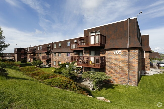


Property Detail
761 E Anamosa St
2131201005
LACROSSE ESTATES P R D, TRACT 1R
Recreationalentertainmentgeneral
PENNINGTON
B and X Area of moderate flood hazard, usually the area between the limits of the 100-year and 500-year floods.
South Dakota
2025
11.58 AC
2025
Rapid City
010400
Other Market Areas
6,480 SF
Rapid City, SD
NEARBY LISTINGS FOR SALE OR LEASE
-
-
View all Rapid City listings for sale on LoopNet.com
DEMOGRAPHICS near 761 E Anamosa St
1 mile
3 mile
5 mile
2025 Total Population
7,328
41,613
79,507
2030 Population
7,629
43,495
82,906
Pop Growth 2025-2030
+ 4.11%
+ 4.52%
+ 4.28%
Average Age
38
39
40
2025 Total Households
3,129
17,281
33,174
HH Growth 2025-2030
+ 4.28%
+ 4.79%
+ 4.51%
Median Household Inc
$47,907
$56,704
$68,740
Avg Household Size
2.20
2.20
2.20
2025 Avg HH Vehicles
2.00
2.00
2.00
Median Home Value
$187,064
$262,079
$280,946
Median Year Built
1974
1977
1982
Nearby Places
Map Layers
Map Styles
 Street
 Aerial
Transit
 Traffic
 Biking
Places
Listings with unknown addresses are not visible on the map
- Restaurants
- Banks
- Shops
- Fitness
- Groceries
PUBLIC TRANSPORTATION
AIRPORT
Rapid City Regional
Drive
Walk
Distance
Rapid City Regional
18 min
10.3 mi
Freight Ports
Tulsa Port Of Catoosa
Drive
Walk
Distance
Tulsa Port Of Catoosa
965 min
887.6 mi
SALE & LEASE HISTORY
LISTING DATE
SALE/LEASE

Apr 01, 2020
For Sale
Nearby Properties
Address
Land Use
TOTAL SIZE
Lot Size
Zoning
Address
Land Use
TOTAL SIZE
Lot Size
Zoning
5,244 SF
17.53 AC
Address
Land Use
TOTAL SIZE
Lot Size
Zoning
5,448 SF
8 AC
Address
Land Use
TOTAL SIZE
Lot Size
Zoning
2,632 SF
8.11 AC
Address
Land Use
TOTAL SIZE
Lot Size
Zoning
14,484 SF
5.20 AC
Address
Land Use
TOTAL SIZE
Lot Size
Zoning
55,442 SF
23.96 AC
Address
Land Use
TOTAL SIZE
Lot Size
Zoning
4,005 SF
12.09 AC
Address
Land Use
TOTAL SIZE
Lot Size
Zoning
48,204 SF
15.19 AC
Address
Land Use
TOTAL SIZE
Lot Size
Zoning
6,820 SF
10.60 AC
Address
Land Use
TOTAL SIZE
Lot Size
Zoning
38,030 SF
13.47 AC
Address
Land Use
TOTAL SIZE
Lot Size
Zoning
188,360 SF
37.53 AC
Address
Land Use
TOTAL SIZE
Lot Size
Zoning
2,018 SF
5.66 AC
Address
Land Use
TOTAL SIZE
Lot Size
Zoning
26,807 SF
0.58 AC
Address
Land Use
TOTAL SIZE
Lot Size
Zoning
46,644 SF
11.89 AC
Address
Land Use
TOTAL SIZE
Lot Size
Zoning
29,226 SF
1.38 AC
Address
Land Use
TOTAL SIZE
Lot Size
Zoning
14,360 SF
2.07 AC
Address
Land Use
TOTAL SIZE
Lot Size
Zoning
28,584 SF
5.62 AC
Address
Land Use
TOTAL SIZE
Lot Size
Zoning
62,209 SF
14.15 AC
Address
Land Use
TOTAL SIZE
Lot Size
Zoning
10,608 SF
10.90 AC
Address
Land Use
TOTAL SIZE
Lot Size
Zoning
50,656 SF
9.17 AC
Address
Land Use
TOTAL SIZE
Lot Size
Zoning
28,894 SF
2.17 AC
Address
Land Use
TOTAL SIZE
Lot Size
Zoning
29,196 SF
3.89 AC
Address
Land Use
TOTAL SIZE
Lot Size
Zoning
147,325 SF
11.93 AC
Address
Land Use
TOTAL SIZE
Lot Size
Zoning
4,576 SF
4.85 AC
Address
Land Use
TOTAL SIZE
Lot Size
Zoning
162,960 SF
22.56 AC
Address
Land Use
TOTAL SIZE
Lot Size
Zoning
26,845 SF
3.49 AC
Address
Land Use
TOTAL SIZE
Lot Size
Zoning
227,112 SF
21.01 AC
Address
Land Use
TOTAL SIZE
Lot Size
Zoning
45,485 SF
9.84 AC
Address
Land Use
TOTAL SIZE
Lot Size
Zoning
118,800 SF
40.85 AC
Address
Land Use
TOTAL SIZE
Lot Size
Zoning
21,735 SF
11.60 AC
The World's #1 Commercial Real Estate Marketplace
Connect with us
© 2026 CoStar Group
The information above has been obtained from sources believed reliable. While we do not doubt its accuracy we have not verified it and make no guarantee, warranty or representation about it. It is your responsibility to independently confirm its accuracy and completeness. Any projections, opinions, assumptions, or estimates used are for example only and do not represent the current or future performance of the property. The value of this transaction to you depends on tax and other factors which should be evaluated by your tax, financial, and legal advisors. You and your advisors should conduct a careful, independent investigation of the property to determine to your satisfaction the suitability of the property for your needs.