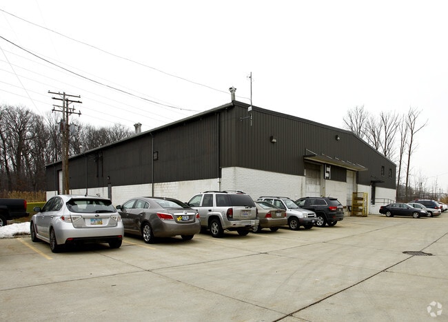
Property Record
761 Sharon Dr, Westlake, OH 44145


NEARBY LISTINGS FOR SALE OR LEASE
Property Detail
761 Sharon Dr
Cleveland-Elyria, OH
Industrial Park
214-02-015
79 INDUSTRIAL PARK 007A ALL
Lightindustrial
Cuyahoga
X
Ohio
39035C0132F
7a
2024
2.08 AC
2024
Westlake/Rocky River
189108
Cleveland
21,620 SF
DEMOGRAPHICS near 761 Sharon Dr
1 mile
3 mile
5 mile
2024 Total Population
6,206
59,926
156,837
2029 Population
6,012
58,196
152,722
Pop Growth 2024-2029
(3.13%)
(2.89%)
(2.62%)
Average Age
44
44
43
2024 Total Households
2,685
25,919
69,410
HH Growth 2024-2029
(3.31%)
(3.09%)
(2.85%)
Median Household Inc
$97,075
$88,802
$79,702
Avg Household Size
2.30
2.20
2.20
2024 Avg HH Vehicles
2.00
2.00
2.00
Median Home Value
$268,825
$256,624
$237,542
Median Year Built
1957
1961
1959
Nearby Places
Map Layers
Map Styles
 Street
 Aerial
Transit
 Traffic
 Biking
Places
Listings with unknown addresses are not visible on the map
- Restaurants
- Banks
- Shops
- Fitness
- Groceries
PUBLIC TRANSPORTATION
AIRPORT
Cleveland-Hopkins International
Drive
Walk
Distance
Cleveland-Hopkins International
15 min
6.5 mi
Nearby Properties
Address
Land Use
TOTAL SIZE
Lot Size
Zoning
Address
Land Use
TOTAL SIZE
Lot Size
Zoning
263,090 SF
33.53 AC
GB-A
Address
Land Use
TOTAL SIZE
Lot Size
Zoning
318,724 SF
41.71 AC
EI
Address
Land Use
TOTAL SIZE
Lot Size
Zoning
354,041 SF
6.16 AC
F-1F80
Address
Land Use
TOTAL SIZE
Lot Size
Zoning
89,195 SF
1.58 AC
1F-R1
Address
Land Use
TOTAL SIZE
Lot Size
Zoning
154,058 SF
29.97 AC
Address
Land Use
TOTAL SIZE
Lot Size
Zoning
53,718 SF
2.19 AC
PF
Address
Land Use
TOTAL SIZE
Lot Size
Zoning
63,139 SF
1.52 AC
PF
Address
Land Use
TOTAL SIZE
Lot Size
Zoning
243,118 SF
15.01 AC
PF
Address
Land Use
TOTAL SIZE
Lot Size
Zoning
217,747 SF
29.07 AC
GB-A
Address
Land Use
TOTAL SIZE
Lot Size
Zoning
117,673 SF
7.35 AC
1F-5
Address
Land Use
TOTAL SIZE
Lot Size
Zoning
326,357 SF
6.40 AC
GB
Address
Land Use
TOTAL SIZE
Lot Size
Zoning
144,000 SF
10.79 AC
1F5
Address
Land Use
TOTAL SIZE
Lot Size
Zoning
230,687 SF
15.98 AC
Address
Land Use
TOTAL SIZE
Lot Size
Zoning
36,844 SF
13.44 AC
EOP
Address
Land Use
TOTAL SIZE
Lot Size
Zoning
162,449 SF
23.90 AC
PF
Address
Land Use
TOTAL SIZE
Lot Size
Zoning
235,984 SF
18.10 AC
GB
Address
Land Use
TOTAL SIZE
Lot Size
Zoning
153,082 SF
13.93 AC
R-MF24
Address
Land Use
TOTAL SIZE
Lot Size
Zoning
78,879 SF
16.63 AC
R-MF24
Address
Land Use
TOTAL SIZE
Lot Size
Zoning
102,512 SF
5.17 AC
CR
Address
Land Use
TOTAL SIZE
Lot Size
Zoning
251,049 SF
13.95 AC
R-MF24
Address
Land Use
TOTAL SIZE
Lot Size
Zoning
123,093 SF
7.31 AC
MFS
Address
Land Use
TOTAL SIZE
Lot Size
Zoning
107,866 SF
11.22 AC
PF
Address
Land Use
TOTAL SIZE
Lot Size
Zoning
103,795 SF
19.39 AC
F-1F80
Address
Land Use
TOTAL SIZE
Lot Size
Zoning
244,602 SF
10.31 AC
CR
Address
Land Use
TOTAL SIZE
Lot Size
Zoning
129,089 SF
19.21 AC
OB
Address
Land Use
TOTAL SIZE
Lot Size
Zoning
211,719 SF
18.82 AC
PF
Address
Land Use
TOTAL SIZE
Lot Size
Zoning
240,506 SF
18.95 AC
Address
Land Use
TOTAL SIZE
Lot Size
Zoning
184,174 SF
24.39 AC
RB
Address
Land Use
TOTAL SIZE
Lot Size
Zoning
154,906 SF
5.99 AC
GB
Address
Land Use
TOTAL SIZE
Lot Size
Zoning
129,775 SF
10.05 AC
IS
The World's #1 Commercial Real Estate Marketplace
Connect with us
© 2026 CoStar Group
The information above has been obtained from sources believed reliable. While we do not doubt its accuracy we have not verified it and make no guarantee, warranty or representation about it. It is your responsibility to independently confirm its accuracy and completeness. Any projections, opinions, assumptions, or estimates used are for example only and do not represent the current or future performance of the property. The value of this transaction to you depends on tax and other factors which should be evaluated by your tax, financial, and legal advisors. You and your advisors should conduct a careful, independent investigation of the property to determine to your satisfaction the suitability of the property for your needs.